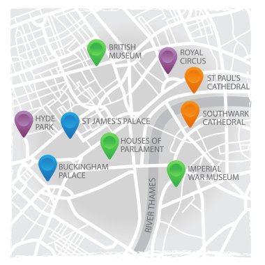
Vector eps10 illustration of London's map with pins and places

Moscow administrative map grey version.

Map of the central and immediate geographic regions of Rio de Janeiro, Brazil

Sehore District Map Highlighted on Madhya Pradesh State Map

Prayagraj District Highlighted in Uttar Pradesh State Map of India

Republic of singapore road map

Jhabua District Map Highlighted on Madhya Pradesh State Map
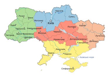
Regional map of Ukraine. Vector

Detailed vector maps of the United Kingdom regions and administrative areas in grey color

Map of administrative divisions of Italy

Colored administrative and political vector map of the Spanish provinces and regions

Ratlam District Map Highlighted on Madhya Pradesh State Map

Ukraine road and highway map. Vector illustration.

Kannauj District Highlighted in Uttar Pradesh State Map of India

Poland administrative and political vector map

France map with flag and navigation icons isolated on white.
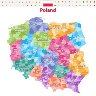
Vector map of Poland provinces(known as voivodeships) with administrative divisions. Polish names gives in parentheses, where they differ from the English ones.

Administrative divisions of Ukraine, map illustration, isolated on white background

Detailed Chile administrative map with country flag and location on a blue globe. Vector illustration

Outline Netherlands map with regions and main cities

Three detailed vector maps of German states, governmental districts and municipalities in white color

Shravasti District Highlighted in Uttar Pradesh State Map of India

Detailed vector maps of Mexico municipalities (regions and administrative areas) in white color
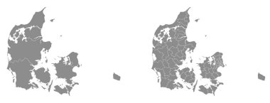
Two detailed vector maps of Danish administrative regions and areas in grey color

Administrative divisions of Ukraine, Ukraine map illustration
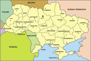
Map of Ukraine (subdivisions of Ukraine), vector

Catalonia administrative and political vector map with flag.

The detailed map of Poland with regions or states and cities, capitals. Administrative division

Five detailed vector maps of Belgium administrative regions and areas in white color

Administrative and political vector map of Ukraine in Ukrainian language with flag
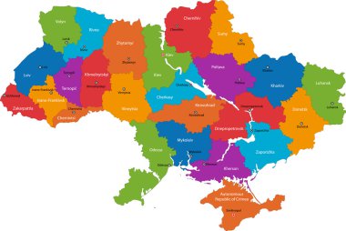
Administrative divisions of Ukraine

Vector administrative and political map of the Federal Republic of Nigeria

Illustration of detailed map of India, Asia with all states and country boundary

Pastel vector map of the Republic of Kenya with black borders and names of its counties

Vector administrative and political map of the Republic of Kenya

Saharanpur Division Highlighted in Uttar Pradesh State Map of India

Set of the political France maps, markers and symbols for infographic

Vector map with Nandurbar district highlighted in Maharashtra, India

Administrative and political vector map of Ukraine with flag

Aerial view Ireland Administrative divisions

Detailed Slovakia administrative map with country flag and location on a blue globe. Vector illustration

Jaunpur District green Map of Uttar Pradesh, India

USA map with flag and navigation icons isolated on white.

Road and administrative map of Germany
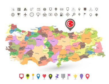
Turkey map with flag and navigation icons isolated on white.

Road and administrative map of Denmark

Nigeria Map with states and modern round shapes
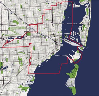
Vector map of the city of Miami, USA

China higt detailed map with subdivisions. Administrative map of China with districts and cities name, colored by states and administrative districts. Vector illustration.
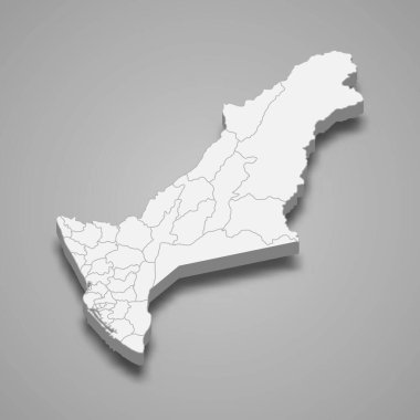
3d isometric map of Kaohsiung City is a region of Taiwan, vector illustration
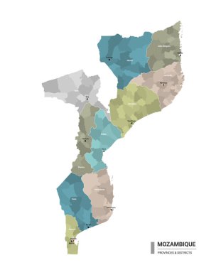
Mozambique higt detailed map with subdivisions. Administrative map of Mozambique with districts and cities name, colored by states and administrative districts. Vector illustration with editable and labelled layers.

Armenia higt detailed map with subdivisions. Administrative map of Armenia with districts and cities name, colored by states and administrative districts. Vector illustration.
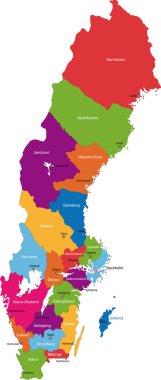
Vector color map of administrative divisions of Sweden

Japan administrative map. Vector flat

3d isometric map of Hsinchu County is a region of Taiwan, vector illustration

3d isometric map of Taoyuan City is a region of Taiwan, vector illustration

Moscow administrative map - puzzle version

Vector color Macau administrative map

Detailed Switzerland administrative map with country flag and location on a blue globe. Vector illustration

Split administrative map with coat of arms
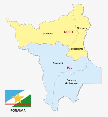
Roraima administrative and political map with flag

3d isometric map of Miaoli County is a region of Taiwan, vector illustration

Baghpat District Map of Uttar Pradesh, India

3d isometric map of Hsinchu City is a region of Taiwan, vector illustration

High quality colorful labeled map of Ukraine with borders of the regions

Chitrakoot Division map of Uttar Pradesh State India

Outline Republic of Ireland map with regions

Administrative map of the new french region Bourgogne-Franche-Comte

Bareilly District Highlighted in Uttar Pradesh State Map of India

Hamirpur District Highlighted in Uttar Pradesh State Map of India

Sonbhadra dist Highlighted in Uttar Pradesh State Map of India

Meerut Division map of Uttar Pradesh State India

Kanpur Division map of Uttar Pradesh State India

Basti Division Highlighted in Uttar Pradesh State Map of India

Kasganj (Kanshiram Nagar) District Vector Map with Bold Black Outline

Ayodhya District orange color Map of Uttar Pradesh, India

Amethi District green Map of Uttar Pradesh, India

Agra District Vector Map with Bold blue Outline of Uttar Pradesh, India

Ambedkar District Map of Uttar Pradesh, India

Kanpur Dehat District Vector Map with Bold Black Outline of Uttar Pradesh, India

Jhansi District Map of Uttar Pradesh, India

Firozabad District Highlighted in Uttar Pradesh State Map of India

Gautam Buddh Nagar (Noida) District Highlighted in Uttar Pradesh State Map of India

Kanpur Dehat District Highlighted in Uttar Pradesh State Map of India

Amroha District Highlighted in Uttar Pradesh State Map of India

Amethi District Highlighted in Uttar Pradesh State Map of India

Bareilly Division Highlighted in Uttar Pradesh State Map of India

Azamgarh Division Highlighted in Uttar Pradesh State Map of India

Agra Division Highlighted in Uttar Pradesh State Map of India

Lucknow Division Highlighted in Uttar Pradesh State Map of India

Kanpur Division Highlighted in Uttar Pradesh State Map of India

Mirzapur Division map of Uttar Pradesh State India

Meerut District Map of Uttar Pradesh, India

Kaushambi District Vector Map with Bold Black Outline

Balrampur District Vector Map with Bold red Outline of Uttar Pradesh, India

Ballia District green color Map of Uttar Pradesh, India

Pratapgarh District Highlighted in Uttar Pradesh State Map of India

Lucknow District Highlighted in Uttar Pradesh State Map of India

Aligarh Division Highlighted in Uttar Pradesh State Map of India

Balrampur District Map of Uttar Pradesh, India