
Brazil political map divide by state colorful outline simplicity style.

Blank political map of Brazil. Administrative divisions - states. Simple black outline map.

Brazil - Highly detailed editable political map.

Brazil - Highly detailed editable political map with separated layers.

A white map with the Brazilian hydrographic regions

Brazil - Highly detailed editable political map with separated layers.

Brazil - Highly detailed editable political map with separated layers.

Brazil - Highly detailed editable political map with separated layers.
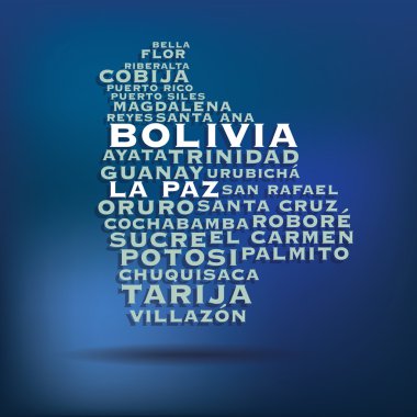
Bolivia map made with name of cities - vector illustration
Flat simple Brazil map, vector background illustration

Flat simple Brazil map, vector background illustration

Colorful political map of Brazil. Administrative divisions - states. Simple flat vector map with labels.

French Guiana flag and coat or arms, France, vector file, illustration

Brazil - Highly detailed editable political map with separated layers.
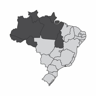
Illustration of a map of Brazil with the north region highlighted

Brazil map An old grunge flag of Brazil state vector art

Map of the Brazil in gray on a white background

Orange political map of Brazil. Administrative divisions - states. Simple flat vector map with labels.

Doodle sketch of Brazil map - vector illustration

Colorful Brazil political map with clearly labeled, separated layers. Vector illustration.
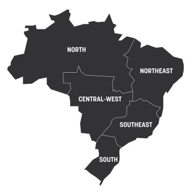
Political map of Brazil. States divide by color into 5 regions. Simple vector map with labels.

Administrative divisions map of Brazil with flat icons. Vector illustration.

Map of Brazil icon for web computer

Brazil 3D map. Stylized neon isometric striped vector Map of Brazil is in violet colors on black background. Educational banner

Brazil map An old grunge flag of Brazil state vector art

High detailed Brazil road map with labeling.

Flag of Brazil - vector illustration
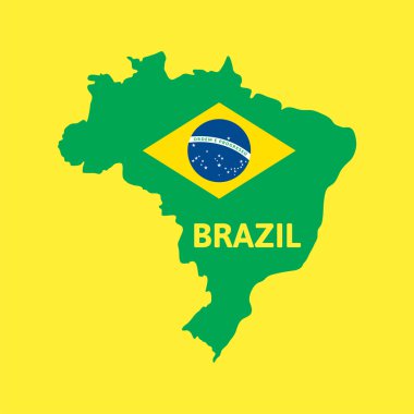
Flat simple Brazil map, vector background illustration

Flag of Brazil. Vector illustration on white background. Beautiful brush strokes. Abstract concept. Elements for design.

Detailed Venezuela Map Collection with Outline, Silhouette, States, and Flag Overlay Variations

Detailed Colombia Map Collection with Outline, Silhouette, Departments, and Flag Overlay Variations

Administrative divisions blue map of Brazil. Vector illustration.
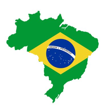
Green Brazil map flag vector silhouette illustration isolated on white background. South America country. Brazil flag.

Brazil map illustration vector detailed Brazil map with all states
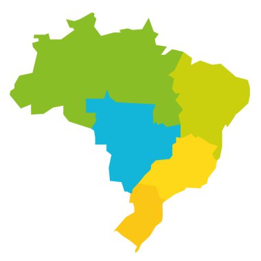
Colorful political map of Brazil. States divide by color into 5 regions . Simple flat blank vector map

Shield with Flag of Brazil - vector illustration

Colorful political map of Brazil. Administrative divisions - states. Simple flat vector map with labels.

Map of Brazil with flag - vector illustration

Blue political map of Brazil. Administrative divisions - states. Simple flat vector map with labels.

Stylized neon isometric striped vector Brazil map with 3d effect. Map of Brazil is in green and mint colors on the dark blue background

The Colombia region map in South America

Gray political map of Brazil. Administrative divisions - states. Simple flat vector map with labels.

Road map of Brazil and colored map pointers. Vector illustration.

Vector map of Colombia Watercolor paint

Republic of Colombia - vector map

Silhouette map of Brazil isolated on green background

Brazil outline map on a black background. Vector illustration

Welcome to Brazil. America. Flag and map of the country of Brazil from brush strokes

Brazil map with Brazil flag inside and ribbon

Hand drawn watercolor map of Bolivia isolated. Vector version
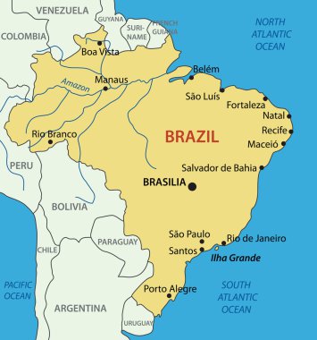
Federative Republic of Brazil - vector map

Brazil map illustration vector detailed Brazil map with all state names

Brazil map country icon isolated vector

Peru-highly detailed physical map

Amazonas map flag line contour vector silhouette illustration isolated on white background. Brazil state Amazonas map symbol. South America territory.

Detailed Peru Map Collection with Outline, Silhouette, Regions, and Flag Overlay Variations
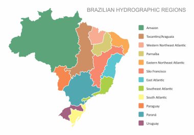
A colorful map with the Brazilian hydrographic regions and legend

The dark silhouette of the Para State map, Brazil

Amazon river map in yellow color on blue background. Vector illustration of amazon map Brazil. text Brazil in the corner of illustration

Colorful blank political map of Brazil. States divide by color into 5 regions . Simple flat vector map.

Colorful political map of Brazil. Administrative divisions - states. Simple flat vector map with labels.

Colombia map made with name of cities - vector illustration

Silhouette map of Brazil isolated

Old vintage color map of Brazil. Vector illustration.

Contour map of Acre with a technological electronics circuit. Brazilian state. Blue background.

A set of 5 wavy 3D flags created using gradient meshes. EPS 8 vector

Colorful political map of Brazil. States divide by color into 5 regions . Simple flat vector map with labels.

Flat simple Brazil map, vector background illustration

Doodle Map of Brazil - vector illustration

Colorful Brazil political map with clearly labeled, separated layers. Vector illustration.

Map of Brazil - vector illustration

Flat simple Brazil map, vector background illustration

Gray political map of Brazil. Administrative divisions - states. Simple flat vector map with labels.

Doodle freehand drawing Brazil political map with major cities. Vector illustration.

Flat simple Brazil map, vector background illustration

Brazil political and administrative vector map set. Regions and states illustration with colors and grayscale. Vector illustration.

Amazonas blank outline map set on white

Administrative divisions map of Brazil with it's states and flat map pointers isolated on white.

Turquoise blue political map of Brazil. Administrative divisions - states. Simple flat vector map with labels.

Stylized vector flat map of Brazil in neon green colors on striped dark blue background. Educational banner, poster about Brazil

Outline map of Brazil vector icon

Vector highly detailed political map of Peru with regions and their capitals. All elements are separated in editable layers clearly labeled.EPS 10

Peru map vector illustration, Peru map silhouette, Peru country, Black and white Peru map

Silhouette map of the Brazil, flag and windrose. All objects are independent and fully editable. Source of map:

Highly detailed road map of Brazil with rivers and navigation icons. Vector illustration.

Green Brazil map flag vector silhouette illustration isolated on black background. South America country. Brazil flag.
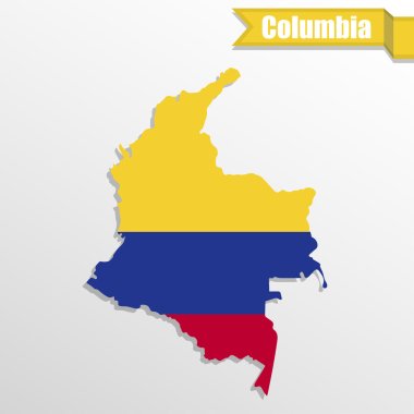
Columbia map with flag inside and ribbon
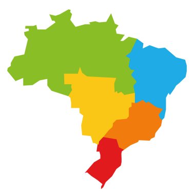
Colorful political map of Brazil divided by color into 5 regions. Simple flat blank vector map

Colorful blank political map of Brazil. States divide by color into 5 regions . Simple flat vector map.

Vector highly detailed political map of Peru with regions and their capitals. All elements are separated in editable layers clearly labeled.EPS 10

Flat simple Brazil map, vector background illustration
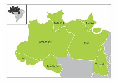
Map of the north region of Brazil with the identified states

Brazilian flag map icon. Editable vector.

Brazil political map divide by state colorful outline simplicity style.

Flag of Brazil - vector illustration

Colorful political map of Brazil. Administrative divisions - states. Simple flat vector map with labels.

Brazil map with labels/In the picture Brazil is a map of Brazilian cities with labels. Map for geography, travel, editable tags.

Contour silhouette map of the Brazil. All objects are independent and fully editable.

Brazil - Highly detailed editable political map with separated layers.

Travel around the world. Bolivia. Watercolor map