Outline map of the Republic India with the borders of the states and Union Territories, includes the new state Telangana

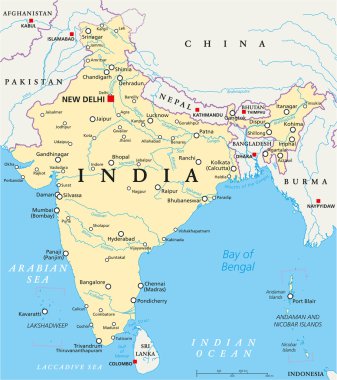
India political map with capital New Delhi, national borders and neighbor countries. Republic and subcontinent in South Asia. Gray illustration, English labeling. Isolated on white background. Vector.

India political map with capital New Delhi, national borders, important cities, rivers and lakes. English labeling and scaling. Illustration.

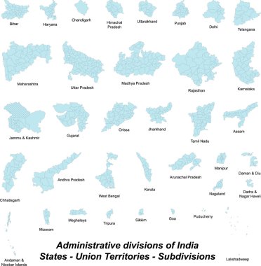
A large and detailed map of India with all subdivisions and islands.

A large and detailed map of India with all subdivisions and islands.

A large and detailed map of all subdivions of India.

Andaman and Nicobar, Andhra Pradesh, Arunachal Pradesh, Assam outline maps

Andaman and Nicobar state blank outline map set