
Highly detailed map of Germany with with administrative divisions(states), cities and pictogram navigation icons. The url of the reference file is : http://www.lib.utexas.edu/maps/europe/germany.jp

Highly detailed political map of Germany with administrative divisions(states), cities and navigation icons collection

Map of Bavaria with borders in gray

Bavaria outline map set - vector version

Baden-Wurttemberg, Bayern, Berlin, Brandenburg outline maps

Highly detailed road map of Germany with GPS pin pointers set. Vector illustration contains: land outlines, states and land names,town names,roads(highways) and railroads

Germany Map - Icons - detailed vector illustration

Germany grey map with regions. Vector illustration.

Map of Germany and flag - highly detailed vector illustration. Image contains land contours, country and land names, city names, water objects, flag, navigation icons, roads, railways.

Highly detailed political map of Germany with its federal states contours, cities and 3D pin pointers collection

Germany infographic map and flag - vector illustration

Map of Germany with its federal states. Highly detailed map of Germany with administrative divisions (states), cities and pictogram navigation icons

High detailed germany map collection, red marked federal states in seperated map silhouettes,

Map Germany

High Quality map of Bavaria is a state of Germany, with borders of the districts

Old retro color map of Germany. Vector illustration.

Black and white map of Germany

Germany and its federal states, Berlin and its boroughs

Illustrated map of Germany with labels. Vector, colorful hand drawn style.

Germany map - high details vector illustration

Map of Germany with separated landers with labels. Vector, colorful hand drawn style.

Stylized map of Germany. Travel illustration with German landmarks.
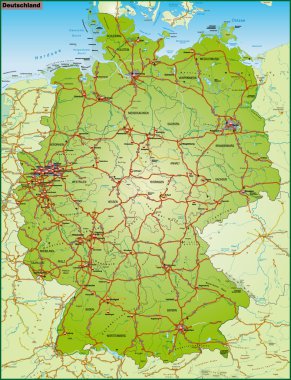
Deuschland mit Nachbarländern als Umgebungskarte in bunt
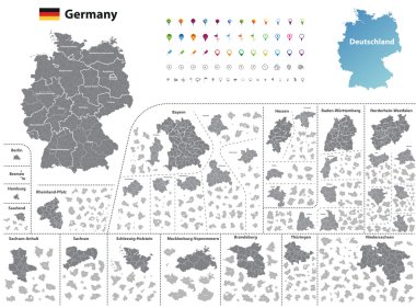
Federal states of Germany map with administrative districts and subdivisions

Map of Germany - high details vector illustration

Germany map (colored by states and administrative districts) with subdivisions
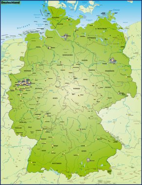
Deuschland mit Nachbarländern als Umgebungskarte Uebersicht

This vector map of the German State of Bavaria includes 6 editable layers for each of the 5 administrative levels (municipalities, municipalities associations, subdistricts, districts, state) and the background

Regensburg (Bayern) blank outline map set

The detailed map of the Germany with regions or states and cities, capitals.
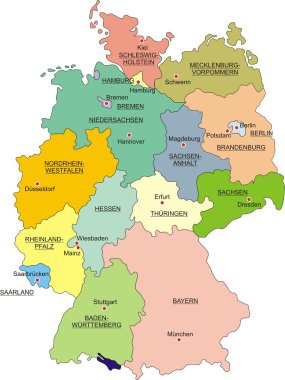
Map of Germany with national boundaries and national capitals

Stylized map of Germany. Travel illustration with German landmarks.

Illustrated map of Germany with labels. Vector, colorful hand drawn style.

Map of Bavaria with main cities in green

Map of Germany - high details vector illustration
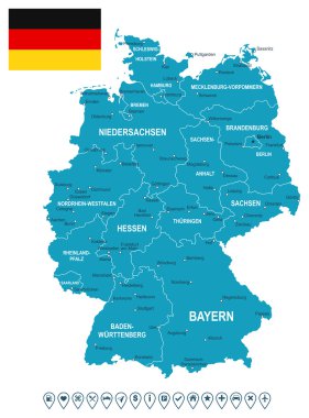
Map of Germany and flag - highly detailed vector illustration. Image contains land contours, country and land names, city names, flag, navigation icons.

Vector map of Germany with federated states or regions and administrative divisions. Editable and clearly labeled layers.
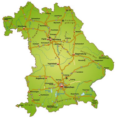
Bundesland Bayern mit Autobahnen bunt

Germany Map - White and Grid - detailed vector illustration

Berchtesgadener Land (Bayern) blank outline map set

Germany Map - Color Grid - detailed vector illustration

Germany Map - Blue Green Gray Isolated on White - detailed vector illustration

Germany map and flag - vector illustration

Germany Map - Blue Orange Gray - detailed vector illustration

The detailed map of the Germany with regions or states and cities, capitals

Germany Map - Yellow - detailed vector illustration

Germany map - high details vector illustration

Germany map and flag - vector illustration

Illustrated map of Germany with labels. Isolated vector, hand drawn style. Blue color

Vector illustration of Germany map and navigation icons.

The detailed map of the Germany with regions

Germany map and flag of Germany. City names - land contours. Vector illustration.

Old vintage color map of Germany. Vector illustration.
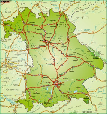
Bundesland Bayern als Umgebungskarte in bunt

Map of Germany with it's states and flat map pointers isolated on white.

Vector map of Germany and infographic elements collection. Vector illustration

Political map of Germany with all states

Danger warning terrorism background

Map of Germany - 3D illustration.

Beer with foam silhouette German map. Brandenburg Gate and flag of Germany. Vector illustration

Bundesland Bayern mit Autobahnen in blau

Silhouette and colored map of Germany regions

Bavaria split in administrative districts

Map of Bavaria is a state Germany with flag. Vector Illustration

Map of Germany and flag - highly detailed vector illustration. Image contains land contours, country and land names, city names, water object names, flag, navigation icons.

Map of Bavaria, oktoberfest symbols, black and white vector illustration
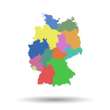
Germany map with federal states icon. Flat vector illustration. Germany sign symbol with shadow on white background.

Map of Germany with markers. Highly detailed map of Germany with administrative divisions (states), cities and pictogram navigation icons
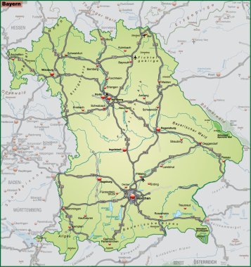
Bundesland Bayern als Umgebungskarte in gruen

Outline map of Germany with regions and cities

Germany map with federal states. Flat vector

Road map of Germany and colored map pointers. Vector illustration.

Map of Germany and flag - highly detailed vector illustration. Image contains land contours, country and land names, city names, water object names, flag, navigation icons, roads, railways.

Germany map with flag

Shiny vector stickers in form of Germany

Germany map
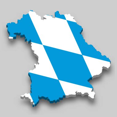
3d isometric Map of Bavaria is a state of Germany with national flag
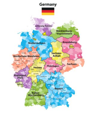
Germany states and districts colored vector map

Map of Germany and flag - highly detailed vector illustration. Image contains land contours, country and land names, city names, water object names, flag.

Map of Germany and flag - highly detailed vector illustration. Image contains land contours, country and land names, city names, water object names, flag.

Highly detailed blank and outline map set of Germany with administrative divisions(states) and pictogram navigation icons

Vector illustration in form of map of Bavaria in low poly design

Germany vintage map and flag - vector illustration

The detailed map of the Germany with regions or states and cities, capitals, national flag

Map of Germany and flag - highly detailed vector illustration. Image contains land contours, country and land names, city names, water object names, flag, navigation icons, roads, railways, rivers.
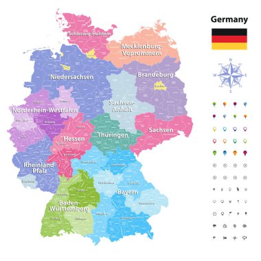
Germany vector map (colored by states and administrative districts) with subdivisions.

Highly detailed map of Germany coloured by national flag and location on world map with a 3D flag pin pointers of the neighbour states.

Vector illustration of a vintage sticker in form of Germany

Map of Germany and flag - highly detailed vector illustration. Image contains land contours, country and land names, city names, water object names, flag, navigation icons.

Germany map with federal states. Flat vector

Bavaria state map, Germany, vector map silhouette illustration isolated on Germany map. Editable blank vector map. Province in Germany.

Germany clear map

High Quality map of Bavaria is a state of Germany, with borders of the districts

Shiny icon in form of Germany - vector illustration

Germany map with flag and name

Detailed map of the Germany with cities

Germany map and flag - vector illustration

Map of Germany and flag - highly detailed vector illustration. Image contains land contours, country and land names, city names, water object names, flag, navigation icons.

Illustrated map of Germany with labels. Isolated vector, hand drawn style. Blue color

Germany country map collection with seperated federal state silhouettes, high detailed,