
Vector Old Light Paper
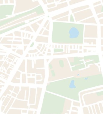
Abstract city map vector illustration with white streets, beige buildings, green parks and blue pond. Simply town plan

Abstract city map vector illustration with streets, parks, and ponds

Grunge map on wall. Vector illustration.

Beige map of the world.

Folded map featuring location pins that highlight navigation routes and destinations for travel and exploration in a clean vector style. Informative and clear.

Abstract city map vector illustration with streets, parks and ponds

Abstract city map vector illustration with streets, parks and ponds

Town streets with a stadium on the plan - vector - eps 8

Abstract topographic patterned background vector

Vintage World Map - Detailed Vector Illustration

United States - Highly Detailed Vector Map of the USA. Ideally for the Print Posters

City streets on the map - vector

The Minas Gerais State map with some cities labels

World Map Vintage Political - Vector Detailed Illustration

Detailed hand-drawn navigational urban street roads map of the United Kingdom city township of BURNLEY, ENGLAND with vivid road lines and name tag on solid background

Map of the World. Vintage Style. Large Detailed World Map vector illustration.

World Map - Highly Detailed Vector Map of the World. Ideally for the Print Posters

Honduras - detailed map with administrative divisions country. Vector illustration

Vintage Political World Map Pacific Centered - vector

World Map and Flags - borders, countries and cities - vintage vector illustration

Topographic map background concept with space for your copy.

World Map - Highly Detailed Vector Map of the World. Ideally for the Print Posters

Map of Europe - Terracotta Brown Beige Colors - vector colored illustration with layers

World Map - Highly Detailed Vector Map of the World. Ideally for the Print Posters

World Map - Highly Detailed Vector Map of the World. Ideally for the Print Posters

World Map Vintage Political - Vector Detailed Illustration

Europe - Highly Detailed Vector Map of the Europe. Ideally for the Print Posters

Vintage World Map - Detailed Vector Illustration

Europe - Highly Detailed Vector Map of the Europe. Ideally for the Print Posters

World Map Vintage Political - Vector Detailed Illustration

World Map - Highly Detailed Vector Map of the World. Ideally for the Print Posters

Vintage World Map and Markers - Detailed Vector Illustration

Retro fashioned treasure map vector illustration

The illustration of South America map with country borders. Vector Image.

Vintage World Map and Markers - Detailed Vector Illustration

Round vector map with river - streets and parks

World Map and Flags - borders, countries and cities - vintage vector illustration

Vintage Travel Paper With Map and Compass

Retro Color World Map and Round Flat Icons. Detailed World Map vector illustration.

Rectangular map of Slovenia with pin icon of Slovenia

World Map - Highly Detailed Vector Map of the World. Ideally for the Print Posters

Map of Europe - Retro Vintage Ancient - vector colored illustration with layers

Map of Europe - vector colored illustration with layers

Vintage World Map and Markers - Detailed Vector Illustration

World Map - Highly Detailed Vector Map of the World. Ideally for the Print Posters

United States - Highly Detailed Vector Map of the USA. Ideally for the Print Posters

Vintage World Map and Markers - Detailed Vector Illustration

White World Map - Detailed Vector Illustration

World Map - Pacific View - Asia China Center - Political Topographic - Vector Detailed
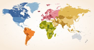
A Vintage colors High Detail vector Map illustration of the whole world map.

World Map Retro Color Pacific Centred. Detailed Vector Illustration of Pacific Centered Political World Map Retro Color.

World Map Vintage Political - Vector Detailed Illustration

Vintage World Map and Markers - Detailed Vector Illustration

World Map - Highly Detailed Vector Map of the World. Ideally for the Print Posters

Vintage World Map and Markers - Detailed Vector Illustration

Detailed Vintage Ancient Cartoon World Map - vector illustration with layers

United States - Highly Detailed Vector Map of the USA. Ideally for the Print Posters

Vintage World Map - Detailed Vector Illustration

World Map Vintage Political - Vector Detailed Illustration

World Map - Highly Detailed Vector Map of the World. Ideally for the Print Posters

A red location pin stands on a simplified street grid map with beige roads and green blocks, illustrating navigation and direction concepts.

United Kingdom - detailed map with administrative divisions country. Vector illustration

Sepia Parchment. Yellow Worn Splatter.

World Map - Highly Detailed Vector Map of the World. Ideally for the Print Posters

World Map - Highly Detailed Vector Map of the World. Ideally for the Print Posters

World Map - Highly Detailed Vector Map of the World. Ideally for the Print Posters

World Map and Flags - borders, countries and cities - vintage vector illustration
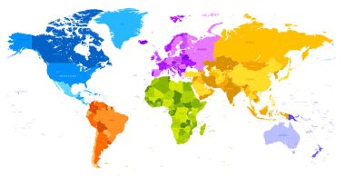
Vector hi quality world map in vibrant colors

Map of Europe - Green Yellow Golden Colors - vector colored illustration with layers
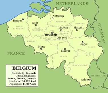
Map of Belgium with administrative division into provinces and country information data table.

Vector of old vintage yellowed paper background

Old vintage or retro style map of World. Political map in shades of brown ang beige. Simple flat vector illustration.

World Map Vintage Vector. High detailed illustration of worldmap

Vintage World Map - Detailed Vector Illustration

Vintage World Map - Detailed Vector Illustration

World Map Vintage Old Retro - Asia in Center- vector

Map of Europe - Retro Pastel Vintage Ancient - vector colored illustration with layers

Sepia Parchment. Cream Old Paper.

Town streets on the plan - vector

World Map and Flags - borders, countries and cities - vintage vector illustration

United States Map Vector Vintage Dark Blue Beige - Customizable layered political map of United States with administrative divisions for website, education, reports, news, politics, print, poster

Vintage World Map and Markers - Detailed Vector Illustration

World Map - Highly Detailed Vector Map of the World. Ideally for the Print Posters

World Map - Highly Detailed Vector Map of the World. Ideally for the Print Posters

World Map and Flags - borders, countries and cities - vintage vector illustration

World Map Vintage Vector. Detailed illustration of worldmap

Vintage World Map and Markers - Detailed Vector Illustration

World Map and Flags - borders, countries and cities - vintage vector illustration

World Map - Highly Detailed Vector Map of the World. Ideally for the Print Posters

World Map Vector Vintage. High detailed illustration of worldmap

World Map. Vintage color style. Large Detailed World Map vector illustration.

Cyprus Map Old Color. Detail vector map of Cyprus.

Simplified schematic map of World. Political map of countries with name labels. Generalized and smoothed borders. Simple flat vector illustration

Marine theme, old map, this illustration may be useful as designer work

World Map and Flags - borders, countries and cities - vintage vector illustration

Vector illustration design of town streets on plan

World Map Vintage Political - Vector Detailed Illustration

World map paper. Political map of the world on a grey background. Countries. Vector illustration.

World Map Vector Vintage. High detailed illustration of worldmap