
Belarus Country four color glass button icon

Minsk Belarus Vector Map Monochrome Artprint, Outline Version for Infographic Background, Black Streets and Waterways

Belarus Country golden line premium logo or icon

Belarus vector map with infographic elements, pointer marks. Editable template with regions, cities and capital Minsk.

Belarus Country Green and yellow modern 3d vector icon logo
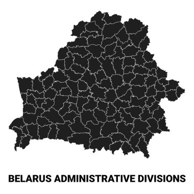
Belarus map elections vector with administrative borders, regions, municipalities, departments in black white colors

Belarus Country blue gradient vector icon

Belarus map outline - country shape sharp polygonal geometric style vector.

Belarus Country four color glowing neon vector icon
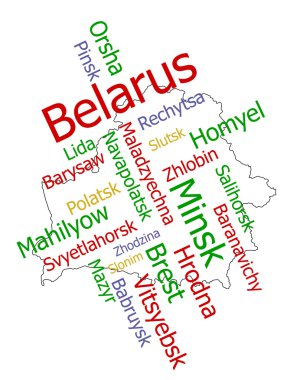
Belarus map and words cloud with larger cities

Belarus Country blue and red four color minimal icon set

Belarus map card paper 3D natural vector

Belarus Country Flat four color minimal icon set
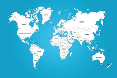
The world map with the frontiers and country names. The vector image has the grouped layers for each country. All of the countries groups ordered by the alphabet.

Belarus Country yellow glowing neon icon
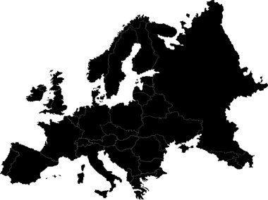
Abstract europe vector map on white

Belarus Country gold plated metalic icon or logo vector

Europe with parts of Asia classic color detailed map, individual states and islands and sea with names vector

Belarus Country minimal bright yellow material icon

Vector map of the city of Minsk, Belarus

Europa-highly detailed map. Vector illustration

Layered editable vector illustration country map of Belarus,which contains colorful country flag version,black silhouette version and defferent pixel versions,can be used as background or material.
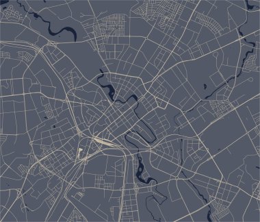
Vector map of the city of Minsk, Belarus

Vector map of the city of Minsk, Belarus

Isometric 3D Belarus map. Stylized vector map illustration with cities, borders, capital, administrative divisions and pointer marks; gradient background with grid.

Vector map of the city of Minsk, Belarus

Vector map of the city of Minsk, Belarus

Abstract mash line and point scales on dark background with Map of belarus. Wire frame 3D mesh polygonal network line, design sphere, dot and structure. communications map of belarus. Vector illustration.

Vector map of the city of Minsk, Belarus

Vector road and national park map of the Republic of Belarus.

Minsk, Belarus, Colorful Artmap, Vector Map, Local Urban Travel Landmark. Infographic Design Template

Belarus map flag glass card paper 3D vector

Illustration of europe chart, blue countries shape

Vector map of the city of Brest, Belarus

Creative Abstract Decor Design of Vector Map Design

Latvia administrative and political vector map with flag

Map of administrative divisions of Republic of Belarus

Vector map of Belarus with world map infographic style.

Isometric map and flag of Belarus. 3D isometric shape of Belarus. Vector Illustration.

Simple vector map of Belarus in Belarusian

Map of Belarus - vector illustration

Vector map of Belarus regions colored by administrative districts with neighbouring countries and territories

Black abstract map of Hungary

Geometric polygonal design map of Belarus. Geometric vector Belarus flag colors.

Detailed vector map of Belarus and capital city Minsk

Map of administrative divisions of Republic of Belarus

Map of administrative divisions of Republic of Belarus

Shiny icon in form of Belarus - vector illustration

High detailed vector map of Belarus with navigation pins.

Belarus map with shadow effect

Monochrome vector Belarus map

Monochrome contour map with city names

Belarus vector set. Detailed country shape with region borders, flags and icons isolated on white background.

Flag of Belarus - vector illustration

Grunge rubber stamp with the name and map of Belarus, vector illustration
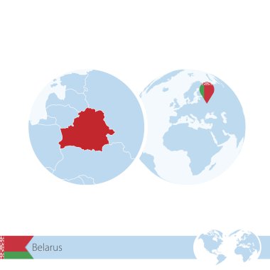
Belarus on world globe with flag and regional map of Belarus. Vector Illustration.

Map of Belarus

Colorful flag, map pointer and map of Belarus in the colors of the belarusian flag. High detail. Vector illustration

Belarus administrative and political vector map with flag

Belarus car license plate, European country, letters, numbers and symbols, vector illustration

Abstract map of Belarus - vector illustration

Printable map of Zhlobin, Belarus with main and secondary roads and larger railways. This map is carefully designed for routing and placing individual data.

Vintage label cards of Belarus flag. Vector

Printable map of Maladzyechna, Belarus with main and secondary roads and larger railways. This map is carefully designed for routing and placing individual data.

Minsk Belarus Colorful Landmark Banner. Beautiful hand drawn vector sketch. Travel illustration for social media marketing and print advertising.

Vector line art Doodle set of cartoon characters and objects on Belarus. Coloring Book

Belarus flag, map and glossy button, vector illustration set.

Travel Belarus Symbol - vector illustration

Doodle Map of Belarus - vector illustration

Europe with highlighted Belarus map and flag

Set of different symbols in national colours of Belarus

Map pins with flag of Belarus - vector illustration

Map of Belarus in Europe

Estonia road and National Park map

Ukraine map with individual regions and capital city, with individual neighboring states with names, classic color map vector
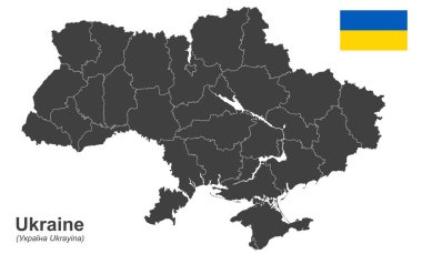
Eps vector illustration with country ukraine and administrative divisions, oblasts, autonomous republics and special cities
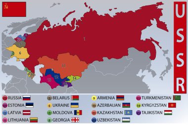
Illustration of the Map and Flags of the Republics of the Former USSR
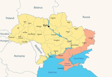
Ukraine, administrative map with occupied territories by Russia, as of January 2024. Vector illustration

Map of Eastern Europe. Handdrawn doodle style. Vector illustration.

Belarus map | Vector detailed color Belarus map

Administrative map of Ukraine with colored ukrainian areas and borders. Vector illustration

High quality map of Belarus with borders of the regions on white background

Russia on map of europe

Ukraine and Russia military conflict. Map of Ukraine with military hotspots. War and aggression concepts. Geopolitical crisis. Independence and sovereignty of country. Cartoon flat vector illustration

Map of the Ukraine in the colors of the flag with individual regions and capital city, with neighboring states with names vector

Poland administrative and political vector map

High detailed vector political Europe map with capitals, cities, towns, rivers and lakes.
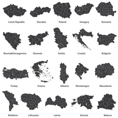
Vector maps of european countries
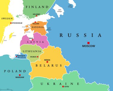
Baltic States, colored countries, political map. From Finland to Estonia, Latvia and Lithuania to Poland, and from the Russian exclave Kaliningrad Oblast, to Belarus and the European Part of Russia.

Illustration of a Political Map of USSR with Names

Latvia road and National Park map

Baltic States and Kaliningrad Oblast, gray political map. From Finland to Estonia, Latvia and Lithuania to Poland, and from the Russian exclave Kaliningrad, to Belarus and the European Part of Russia.

Map of the railroad tracks in the three Baltic states
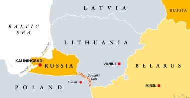
Suwalki Gap, political map. Also known as the Suwalki Corridor, the border starting from the Russian exclave Kaliningrad Oblast to Belarus, between Lithuania and Poland, near the Polish town Suwalki.
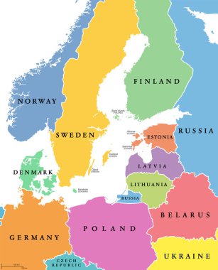
Baltic Sea area, colored countries, political map, with national borders and English names. Countries along the coast of the Baltic Sea, with surrounding countries in Europe. Isolated illustration.

Lithuania road and national park map

Republic of Belarus - vector map
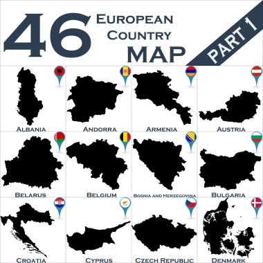
European country set with map pointers

Political map of Ukraine with borders of the regions. Administrative detailed map of Ukraine with cities, and regions.Vector illustration

Ukraine. Map of the territory of the Ukrainian state with the image of the bordering states and the seas washing the southern borders. Flat graphic vector illustrations.