
Denmark travel infographics with map traditional cuisine landmarks road and rating of using transport vector illustration
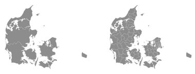
Two detailed vector maps of Danish administrative regions and areas in grey color

Denmark blank detailed outline map set

DENMARK Position Inside the World with Flag in Map
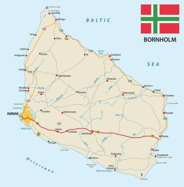
Vector road map of the Danish island bornholm in the Baltic sea with flag

Denmark map with shapes of regions. Blank vector map of the Country with regions. Borders of the country for your infographic. Vector illustration.

Denmark Map - Detailed Vector Illustration

Abstract Denmark map isolated on a white background. Triangular mesh model in black color of Denmark map. Polygonal geographic scheme designed for political illustrations.

High detailed Denmark physical map with labeling.

Highly detailed editable political map with separated layers. Denmark.

Stylized map of Denmark. Travel illustration with danish landmarks, architecture, national flag, and other symbols in flat style. Vector illustration

Denmark vintage map and flag - vector illustration

Hand-drawn map of Denmark. Colorful country shape. Sketchy Denmark maps collection. Vector illustration.

Outline silhouette map of Denmark with inset flag isolated over a white background

Low Poly map of Denmark. Denmark geometric polygonal, mosaic style map.

Highly detailed editable political map with separated layers. Denmark.

Denmark map - high details vector illustration

Rainbow gradiented star collage map of Denmark. Vector vibrant map of Denmark with rainbow gradients. Mosaic map of Denmark collage is constructed with scattered color star parts.

Denmark network map. Abstract polygonal map design. Internet connections vector illustration.

Denmark region map: grey outline on white background. Detailed map of Denmark regions. Vector illustration.

Denmark Map - Vintage Detailed Vector Illustration

Danish island Bornholm and Germanys largest island Ruegen, gray political map. Both islands are located in southern Baltic Sea, a marginal sea of the Atlantic Ocean. Illustration on white background.

High detailed Denmark physical map with labeling.

Vector illustration outline drawing of Greenland country map isolated on white background
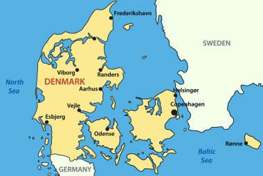
Vector map of Denmark

Set of vector polygonal Denmark maps. Bright gradient map of country in low poly style. Multicolored Denmark map in geometric style for your infographics.

Black outline of Denmark map- vector illustration

Stylized map of Denmark. Travel illustration with danish landmarks, architecture, national flag, and other symbols in flat style. Vector illustration

Road map of the Faroe Islands North Atlantic Archipelago with flag, Denmark

Map flag of Denmark

Denmark network map. Abstract polygonal map design. Network connections vector illustration.

Silhouette map of the Greenland.
Map pin icons of national flags: Norway, Denmark, Finland, Sweden. White background.

Danish low poly regions. Polygonal map of Denmark with regions. Geometric maps for your design. Attractive vector illustration.

Denmark map outline - smooth country shape map vector.

Denmark flag symbols set, national flag icons of Kingdom of Denmark

Vector illustration black silhouette of Greenland country map isolated on white background
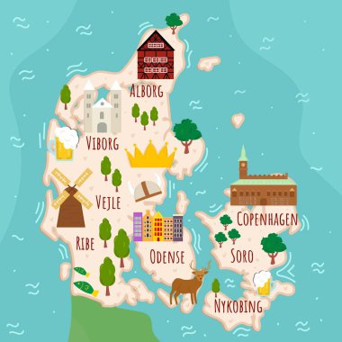
Stylized map of Denmark. Cartoon map with travel illustration. Famous landmarks, buildings, food and plants. Funny tourist infographics. National symbols. attractions. Vector illustration.

Denmark map. Map of the country with beautiful geometric waves in red blue colors. Vivid Denmark shape. Vector illustration.
High detailed flag of Denmark. National Denmark flag. Europe. 3D illustration.

3d isometric Map of Denmark with national flag. Vector Illustration.

Isomatric 3d design of Denmark wildlife. Animals, birds and plants constructor elements isolated on white set. Build your own geography infographics collection. Vector illustration

Denmark flag pin map icon, isolated vector illustration eps 10
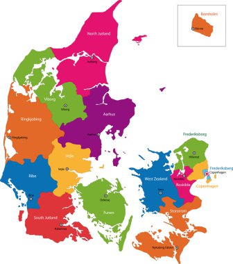
Map of administrative divisions of Denmark

Denmark round sign. Futuristic satelite view of the world centered to Denmark. Country badge with map, round text and binary background. Trendy vector illustration.

Vintage Amazing Denmark travel stamp with map outline. Denmark travel grunge round sticker.

Nordic Council countries and territories flags. Finland, Iceland, Norway, Faroe Islands, Sweden, Denmark, Aland Islands, and Greenland. Vector icon set.
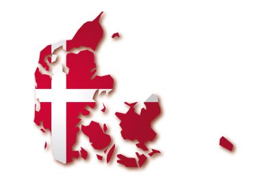
Map flag of Denmark

Set of vector icons with Denmark flag

Denmark in heart and words cloud with larger cities

Cityscape with modern buildings of Copenhagen

Denmark heart flag logo. Country name text around Denmark flag in a shape of heart. Neat vector illustration.

Copenhagen city silhouette skyline. Denmark - Copenhagen city vector city, danish linear architecture, buildings. Copenhagen city line travel illustration, landmarks. Denmark flat icon, danish outline

Greenland map vector illustration, scribble sketch Greenland
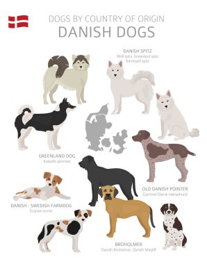
Dogs by country of origin. Danish dog breeds. Shepherds, hunting, herding, toy, working and service dogs set. Vector illustration

World map with a magnifying glass pointing at Denmark. Map of Denmark with the flag in the loop.

Urban vector city map of Copenhagen, Germany
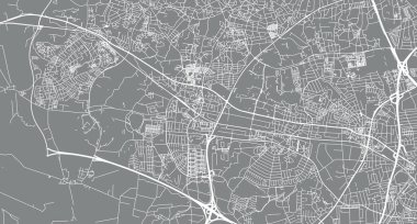
Urban vector city map of Ballerup, Denmark.

Map of Randers, Denmark. Detailed city vector map, municipality area. Black and white streetmap with buildings.

Urban vector city map of Kolding, Germany

World map, labeled oceans, seas, isthmus and strait

Vector Hand Drawn Denmark Label. Travel Skandinavian Illustration. Hand Writen Lettering Illustration. Danish Symbol Logo
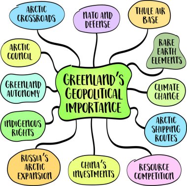
Greenland geopolitical importance is multifaceted, shaped by its strategic location, military significance, and abundant resources. Mind map infographics sketch.

Urban vector city map of Randers, Germany

Urban vector city map of Aalborg, Denmark

Urban vector city map of Aalborg, Denmark.

Bornholm, East, West and South Zealand Denmark plates. Danish island, Denmark territories vector tin signs, grunge plates or old travel stickers with country flag colors, Coat of Arms dragon and map

Vector set of world flags on white background

Greenland, the world's largest island, a unique place on the globe due to its geographic, historical, and political significance. Mind map infographics sketch.

Urban vector city map of Horsen, Germany

Urban vector city map of Randers, Germany
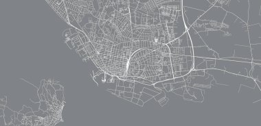
Urban vector city map of Esbjerg, Germany

Vector Canada Map card paper on blue background, high detailed

Urban vector city map of Aalborg, Denmark

Urban vector city map of Esbjerg, Germany

Urban vector city map of Copenhagen, Germany

The Kingdom of Denmark is a Scandinavian country in Europe

Denmark detailed map highlighted on blue rounded World Map. Map of Denmark in circle.

Urban vector city map of Herning, Germany

High detailed vector map - Denmark

Denmark - highly detailed map. Vector illustration

Denmark Map - Detailed Vector Illustration

Map pointers with flag and 3D effect on grey background - Denmark

Denmark map flag glass water card paper 3D vector

Denmark - highly detailed map. Vector illustration

Low Poly Map of Denmark isolated

Location of Denmark on the Europa continent

Black map of Denmark
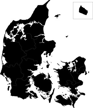
Map of administrative divisions of Denmark

Vector map of Denmark with regions

Map of Denmark with location on european map

Illustrated map of Denmark with nature and landmarks. Editable vector illustration

Vector dotted map of Denmark isolated on white background . Travel vector illustration

Isometric map and flag of Denmark. 3D isometric shape of Denmark. Vector Illustration.

Flat treasure map of Denmark. Colorful cartoon with icons of ship, jolly roger, treasure chest and banner ribbon. Flat design vector illustration.

Administrative and political vector outline map of the Kingdom of Denmark

Map of administrative divisions of Denmark

Denmark map and flag - vector illustration

Isometric map of Denmark country vector illustration. Football 2020 tournament final stage infographic and country info. Official championship colors and style

Denmark-highly detailed map. Vector illustration