Delhi blank detailed outline map set - vector version

Delhi blank detailed vector outline map set

India isolated blank outline map set

Delhi India City Map in Retro Style. Outline Map. Vector Illustration.

Vector map of India

India map. hand drawn illustration.

Illustration of detailed map of India, Asia with all states and country boundary

Detail Map of India Vector Icon Illustration Indian Map Independence

Vector Map of the combined catchment areas of the Ganges, Brahmaputra and Meghna rivers.

High detailed India physical map.

High detailed India physical map with labeling.

India country detailed editable map with regions cities and towns, roads and railways, geographic sites. Vector EPS-10 file

High detailed India physical map with labeling.

India - Highly detailed editable political map with labeling.

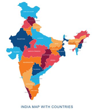
Abstract multicolor vector political india map with countries name,border.Detailed modern illustration can be use for presentation,report,t-shirt,poster,geographical templates.Simplified isolated administrative map.Hand drawn print map.

India - Highly detailed editable political map with labeling.

India road map with the main cities

Illustration of detailed map of India, Asia with all states and country boundary

A set of detailed accurate vector maps of India. Detailed map, with regional borders, a map of round points and a map in the colors of the flag.

Globe centered to India. Country highlighted with green color on world map. Satellite world projection. Attractive vector illustration.

India - Highly detailed editable political map with labeling.

High detailed India physical map with labeling.

Colored Hand drawn doodle India map. India city names lettering and cartoon landmarks, tourist attractions cliparts. travel, trip comic infographic poster, banner concept design.

Map of India with the biggest cities and rivers

Illustration of detailed map of India, Asia with all states and country boundary

Vector illustration of administrative division map of India.

Illustration of detailed map of India, Asia with all states and country boundary

Map of India silhouette, India map dotted, Flag of India. Vector illustration flat

Andaman Islands map. Island silhouette icon. Isolated Andaman Islands black map outline. Vector illustration.

Vintage map of India. Grunge sunburst around the country. Black India shape with sun rays on white background. Vector illustration.

India travel stamps set, postage stamps with symbols and cities of of Republic of India, vector

India map. Country poster with colored regions. Old grunge texture. Vector illustration of India with country name.

Blue india national map vector image on white background

Map of the United States by population

Flat India Map Set Vector Illustration

India vector map with infographic elements, pointer marks. Editable template with regions, cities and capital Delhi.

India political isometric map divide by state colorful outline simplicity style. Vector illustration.

India polygonal mosaic dot grey vector map

Illustration of detailed map of India, Asia with all states and country boundary

Location of India on the Asia continent

Hand drawn doodle India map. India city names lettering and cartoon landmarks, tourist attractions cliparts. travel, trip comic infographic poster, banner concept design.

Detailed railway map of the main routes of India

Highly detailed editable political map with separated layers. India.

Highly detailed editable political map with separated layers. India.

India Map background Vector illustration

Illustration of detailed 3d map of India, Asia with all states and country boundary

Illustration of detailed 3d map of India, Asia with all states and country boundary

Colorful political map of India. Administrative divisions - states and union territories. Simple flat vector map with labels.

Map of india. map concept

Illustration of detailed map of India, Asia with all states and country boundary

Republic of India isolated map and official flag icons. vector Indian political map thin line style illustration. South Asia country geographic banner template. travel and business concept map

India map graphic, travel geography icon, nation country indian atlas region, vector illustration .

Map of india. map concept

Abstract India map of radial dots, halftone concept. Vector

India country silhouette. High detailed map. Solid grey vector illustration isolated on white background.

3D map of India (Republic of India) - white, yellow, blue and gold - vector illustration

Isolated vector Illustration. Black on White background. EPS 10 Illustration

Illustration of detailed map of India on colored back

Illustration of detailed map of India, Asia with all states and country boundary

India map. Outline illustration country map with state names and their capital cities.

Republic of India vector map

Vector map India. Isolated vector Illustration. Black on White background. EPS 10 Illustration.

Travel India conceptual poster in flat style design. Summer vacation in exotic countries illustration. Journey to India vector template. Maps and navigation in a foreign country concept.

Vector Map of the combined catchment areas of the Ganges, Brahmaputra and Meghna rivers.

Map of India. Outline illustration country map with major cities (state capitals).

India country outline theme symbols set eps10

India vector set. Detailed country shape with region borders, flags and icons isolated on white background.

India map, black and white detailed outline regions of the country. Vector illustration

Map of India. Outline illustration country map with major cities (state capitals).

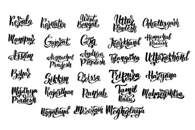
States of India. Handwritten stock lettering set ink typography. Calligraphy for logotype badge icon card postcard logo, banner, tag. Vector illustration EPS10.

Vector flag map of India with gold frame isolated on white background

Isolated vector Illustration. Black on White background. EPS 10 Illustration

Set of India map graphic, travel geography icon, nation country indian atlas region, vector illustration .

India flag map with shadow effect

Delhi (States and union territories of India, Federated states, Republic of India) map vector illustration, scribble sketch National Capital Territory of Delhi (NCT) map

India Outline Map with Green Colour. Modern Simple Line Cartoon Design - EPS 10 Vector

Map of the northern Indian state of Uttar Pradesh

Black line India map icon isolated on grey background. Abstract circle random dots. Vector.

India country simplified map. Thin black outline contour. Simple vector icon

Detailed map of Delhi city administrative area. Royalty free vector illustration. Cityscape panorama. Decorative graphic tourist map of Delhi territory.

Delhi (New York) blank outline map

Minimal New Delhi map silhouette vector, perfect for prints, icons, and design projects. Simple black outline of India's capital city

Silhouette map of India with outlines of major cities including Delhi, Mumbai, Chennai, Hyderabad, Bengaluru, and more. Modern vector-style black city shapes on white background

Republic of India map in line style. Sketch icon of country for cartography, geography, education projects, documents, sites, articles and other design needs

Delhi Hills (Ohio) blank outline map

India map with location pointers

Daman and Diu, Delhi, Goa, Gujarat outline maps

Silhouette map of India with outlines of major cities including Delhi, Mumbai, Chennai, Hyderabad, Bengaluru, and more. Modern vector style black outline city shapes on white background

Delhi state blank outline map set