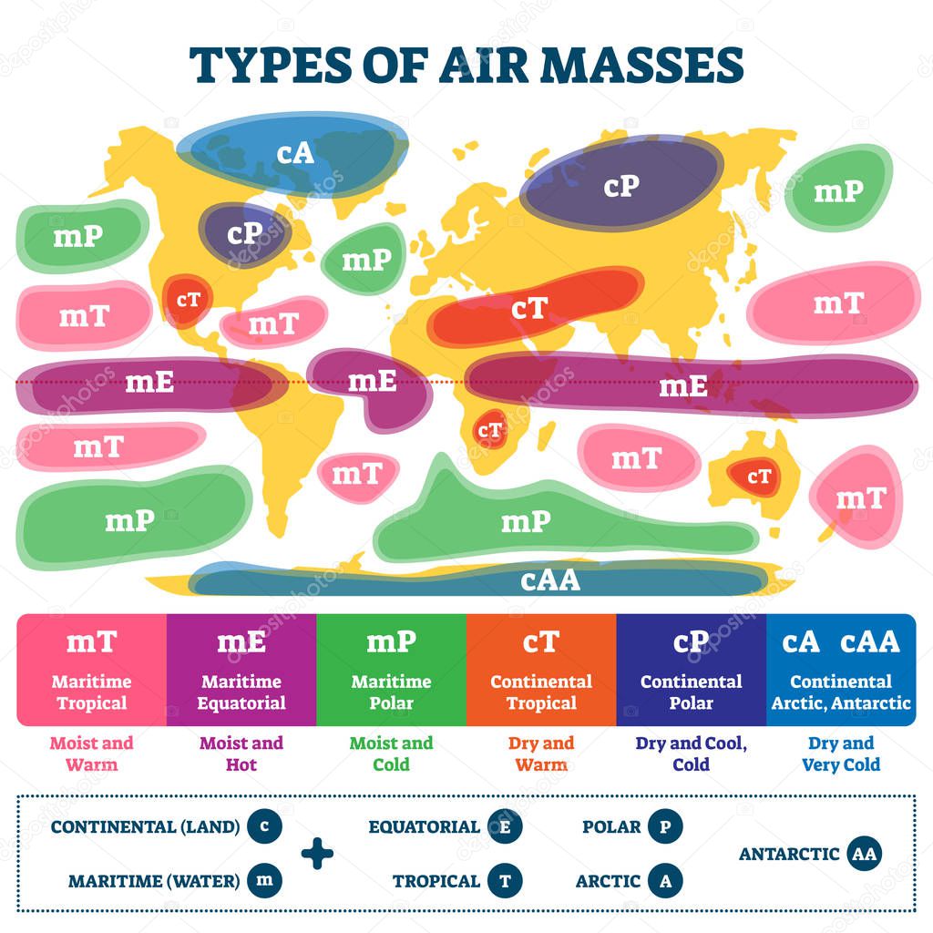
Types of air masses vector illustration. Labeled earth weather causes map scheme. Educational diagram with continental land, maritime water, equatorial, tropical, polar, arctic and antarctic fronts. premium vector by VectorMine

Please buy a commercial licence for commercial use without attribution.
colorful graphic illustration water air weather tropical symbol scale earth temperature movement gradient surface globe meteorology system volume map geography latitude area land superior analysis maritime boundary scheme antarctic arctic polar educational region diagram moist monsoon tags classification explanation types phenomena properties masses equatorial abbreviation labeled fronts characteristics infographic
Categories:Array ( ) 1
tags:
colorful
graphic
illustration
water
air
weather
tropical
symbol
scale
earth
temperature
movement
gradient
surface
globe
meteorology
system
volume
map
geography
latitude
area
land
superior
analysis
maritime
boundary
scheme
antarctic
arctic
polar
educational
region
diagram
moist
monsoon
tags
classification
explanation
types
phenomena
properties
masses
equatorial
abbreviation
labeled
fronts
characteristics
infographic