Europe map illustration. Vector design.
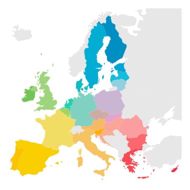
Colorful vector map of EU, European Union, member states.

Europe map polygonal with spot lights places
Europe map cover vector

Europe border map illustration. Vector design.

Europe dotted map illustration. Vector design.

This is a simple, clean and unique set of vectorized Europe countries flags. Full editable and resizable. Good for several projects.

This is a simple, clean and unique set of vectorized Europe countries flags. Full editable and resizable. Good for several projects.
Political blank map of Europe in gray color with white background. Vector illustration

Map of Spain vector

San Marino marked by blue in grey political map of Europe. Vector illustration.

Map of europe. map concept

Colorfully vector hand illustrated map of Europe. Detailed political map.

Simplified map of Europe (vector illustration)

Map of administrative divisions of Republic of Belarus

Map of administrative divisions of Ireland

Poland map outline vector with administrative borders, regions, municipalities, departments in black white colors. Infographic design template map.
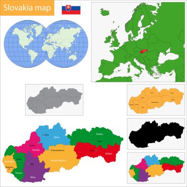
Administrative division of the Slovak Republic

Administrative division of the Portuguese Republic

Colorful Belgium map with provinces and main cities

Administrative division of the Kingdom of Norway

Administrative division of the Kingdom of Sweden

Colorful Austria map with states and main cities

Administrative division of the Kingdom of Spain

Map of Europe with names of sovereign countries, ministates included. Simplified black vector map on white background.

European Union territory blue silhouette. Map of EU. Vector illustration.

Europe mainland cartoon relief map with mountains, climate zones, rivers, seas and island flat vector illustration. Topographic or physical atlas. Geographic concept for children book illustrating
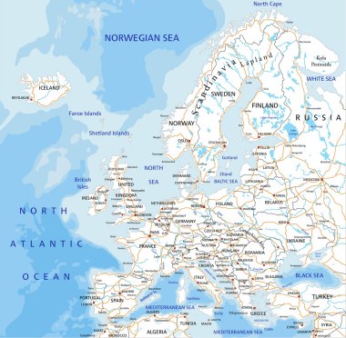
High detailed Europe road map with labeling.

Europe - Highly detailed editable political map with separated layers.

Grayscale silhouette with europe map and latvia in green color vector illustration

Administrative divisions of Ukraine
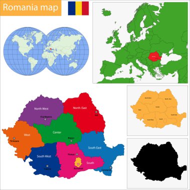
Administrative division of the Romania
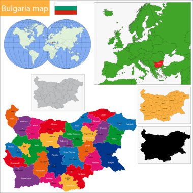
Map of administrative divisions of Bulgaria

Illustration of a Political Map of USSR with Names

High detailed Russia road map with labeling.

The Empire of Alexander the Great an his conquest course from Greece to India to Babylon in 334-323 B.C. with towns, provinces and year dates. German labeling! Isolated vector illustration.

Nazi Germany - Third Reich at its greatest extent in 1942. Map of Europe in Second World War with todays state borders.

Map of the war in Ukraine and the Middle East. Ukraine and Russia military conflict.

The Roman Empire in ancient Europe at its greatest extent in 117 AD at the time of Trajan. Vector illustration.

The Roman Empire at its greatest extent in 117 AD at the time of Trajan, plus principal provinces. German labeling! Vector illustration.

Vector icon Ukraine map. Stock illustration Ukrainian district map in flag colors clipart

Ukraine vector maps with administrative regions, municipalities, departments, borders
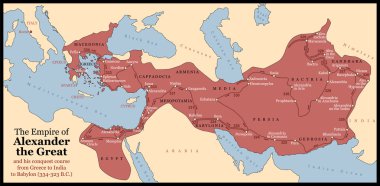
The Empire of Alexander the Great an his conquest course from Greece to India to Babylon in 334-323 B.C. with towns, provinces and year dates. Isolated vector illustration o black background.

World Map - Pacific View - Asia China Center - Political Topographic - Layers - Vector Detailed

World Map Vintage Political - Vector Illustration - Layers

World Map Pacific China Asia View - Vintage Physical Topographic - Vector Detailed Illustration

World Map - Pacific View - Asia China Center - Political Topographic - Vector Detailed

The Roman Empire at its greatest extent in 117 AD at the time of Trajan, plus principal provinces. Vector illustration.
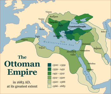
The Ottoman Empire at its greatest extent in 1683. Vector illustration.

Turkish history - The Ottoman Empire at its greatest extent in 1683 - overview map of its territory expansion and military acquisition in Europe, Asia and Africa - vector illustration.

World Map - Pacific View - Asia China Center - Political Topographic - Vector Detailed

Map of Ukraine and the illegally annexed territory before the start of the counteroffensive. Editable schematic map with Eastern Ukraine cities. Vector illustration

Vector Color Illustration of North pole
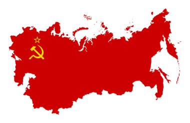
The territory of the Soviet Union. Isolated illustration on a white background.

Highly detailed editable political map with separated layers. Russia.

Ukraine country map icon vectors illustration symbol design

Russian Federation detailed political map with separated layers.

Detailed map of Europe

Ukrainian gas transportation system - vector

World Map Political - Vintage Retro Old Style - Vector Detailed Illustration

High detailed Germany physical map.

Map of administrative divisions of Republic of Iceland
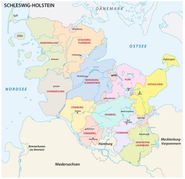
Schleswig-Holstein administrative and political map in german language

Detailed vector map of 5 Europe Region on white

Map of the United Kingdom of Great Britain and Northern Ireland

Russian Federation detailed political map and flat map pointers with separated layers.

American and Russian flags together in correct colors

World Map - Asia China Center - Vintage Physical Topographic - Vector Detailed

Republic of Belarus - vector map

Poland Physical Map. No text. Highly detailed map vector illustration. Image contains layers with shaded contours, water objects.

Map of administrative divisions of Republic of Croatia

The Ottoman Empire at its greatest extent in 1683, and Turkey today. Vector illustration.

World Map - Physical - Vintage Retro Old Style - Vector Detailed Illustration

World Map Vintage Political - Vector Illustration

Europe Political Map and Bathymetry. No text. Detailed vector illustration of Europe Map.

High detailed Germany physical map.
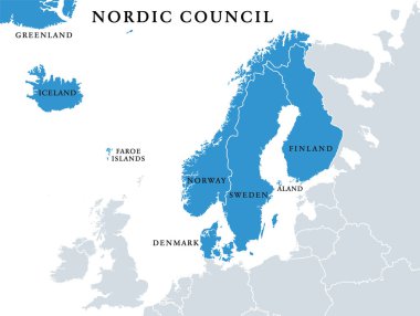
Nordic Council members, political map. Cooperation among the Nordic states Denmark, Finland, Iceland, Norway and Sweden, the autonomous territories Faroe Islands and Greenland, and the region Aland.

High detailed Poland physical map with labeling.

Europe map in the dot on blue background . Vector illustration.

World Map - Pacific View - Asia China Center - Political Topographic - Vector Detailed

Map of European Union with the identication of Ukraine. Map of Ukraine. Political map of Europe in gray color. European Union countries. Vector stock.

World Map Political - Vintage Retro Old Style - Vector Detailed Illustration

World Map Vintage Political - Vector Illustration - Layers
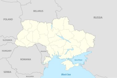
Political map of Ukraine with borders of the regions. Vector illustration
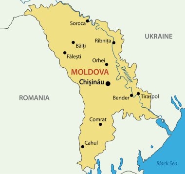
Republic of Moldova - vector map

Russia against Ukraine map

Germany - Highly detailed editable political map with separated layers.

Russia map with location pointers

High detailed Sweden physical map with labeling.

World Map Political - Vintage Retro Old Style - Vector Detailed Illustration

Silhouette maps of European countries.

World Map Political - Vector Detailed Illustration

Vector icon Ukraine map. Stock illustration regions Ukraine district map silhouette

Poland map cover vector

Germany - Highly detailed editable political map with separated layers.

Map of the Ukraine in the colors of the flag, administrative divisions vector
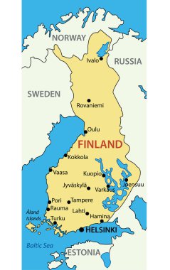
Republic of Finland - vector map

World Map Political - Vector Detailed Illustration

World Map Vintage Dark Political - Vector Illustration - Layers

High detailed Sweden road map with labeling.