Dotted world map on white

India map, vector flat illustration, Elephant, cow sitar palm tree.

Manipur (States and union territories of India, Federated states, Republic of India) map vector illustration, scribble sketch Manipur state map

Rajasthan (States and union territories of India, Federated states, Republic of India) map vector illustration, scribble sketch Rajasthan state map

Dotted world map isolated on white. Vector image.

Black silhouette vector design map of india

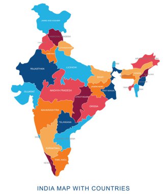
Abstract multicolor vector political india map with countries name,border.Detailed modern illustration can be use for presentation,report,t-shirt,poster,geographical templates.Simplified isolated administrative map.Hand drawn print map.

Black map of India

Map of India silhouette, India map dotted, Flag of India. Vector illustration flat

Map of India with icons. Traditional symbols of culture and architecture of India

Blue map of India

Travel Concept India Landmark Flat Icons Design .Vector Illustratio

India communication network map. Vector low poly image of a global map with lights in the form of cities in or population density consisting of points and shapes in the form of stars and space.

An high quality world map in tones of grey with a cool flat shaded Shadow.

World map with indication of India

Travel and tourism background. Vector flat illustration

Orange map of India

Grey map of India

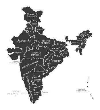
India Map labelled black illustration

Saharanpur Division Highlighted in Uttar Pradesh State Map of India

Flat India Map Set Vector Illustration

Assam map of Indian state. Assam map vector illustration. Assam vector map on white background.

Blue india national map vector image on white background

Chitrakoot Division map of Uttar Pradesh State India

India, Sign and symbol, Vector infographics illustration.

A vector gray line map of the Punjab State of India.

India flag map with shadow effect

Dotted world map vector. Abstract world map with dots.

India communication network map. Vector low poly image of a global map with lights in the form of cities in or population density consisting of points and shapes in the form of stars and space.

Dotted world map. Vector illustration.

Illustration of Detailed 3d map of India showing different monument and famous places

Carcass irregular mesh India map. Abstract lines are combined into India map. Linear carcass 2D network in vector format. Vector model is created for India map using intersected random lines.

Vector map of India. High detailed country map with division, cities and capital New Delhi. Political map, world map, infographic elements.

Map of India with flag. vector illustration of India map with flag

Infographic for India, detailed map of India with flag. Vector Info graphic green map.

India country silhouette. High detailed map. Solid grey vector illustration isolated on white background.

Asia map. Flat simple modern illustration pictogram. Collection concept symbol for infographic project and logo

Vector India map in vintage design. Indian border on grunge background. Letters are not cut and easy to move

Vector Illustration of Engineer's day India. 16th September. Background with construction instruments.

2D polygonal Chandigarh City map and grunge seal stamps. Abstract lines and small circles form Chandigarh City map vector model. Round red stamp with connecting hands.

Colored sketch poly art of M. Visvesvaraya. Birth anniversary on 16th September. Vector Illustration.

White border india map outline png on black background, vector illustration

Large group of people forming India map standing together, flat vector illustration. People crowd gathering. Population demographics.

Vector Illustration of Engineer's day India. 16th September. Background with construction instruments.

15 September Happy Engineer's day vector illustration

India map silhouette png on white background, vector illustration

15 September Happy Engineer's day vector illustration

Vector Illustration of Engineer's day India. 16th September. Background with construction instruments.

Simple contour map of India. Black outline vector map isolated on white background.

15 September Happy Engineer's day vector illustration

Grey map of India with indication of largest cities

Bundle India map and blue Assembled seal stamp, and Minimal Effort distress seal stamp. Colorful vector India map mosaic of puzzle units. Red rounded Minimal Effort rubber.

Vector illustration of India map in tricolor design with Ashoka Chakra. Clean lines and vibrant colors enhance visual appeal

India Outline Map with Green Colour. Modern Simple Line Cartoon Design - EPS 10 Vector

Ayodhya District orange color Map of Uttar Pradesh, India

Amethi District green Map of Uttar Pradesh, India

Agra District Vector Map with Bold blue Outline of Uttar Pradesh, India

Ambedkar District Map of Uttar Pradesh, India

Kanpur Dehat District Vector Map with Bold Black Outline of Uttar Pradesh, India

Jhansi District Map of Uttar Pradesh, India

Meerut Division map of Uttar Pradesh State India

Kanpur Division map of Uttar Pradesh State India

Basti Division Highlighted in Uttar Pradesh State Map of India

Kasganj (Kanshiram Nagar) District Vector Map with Bold Black Outline

Bareilly Division Highlighted in Uttar Pradesh State Map of India

Azamgarh Division Highlighted in Uttar Pradesh State Map of India

Agra Division Highlighted in Uttar Pradesh State Map of India

Lucknow Division Highlighted in Uttar Pradesh State Map of India

Kanpur Division Highlighted in Uttar Pradesh State Map of India

Mirzapur Division map of Uttar Pradesh State India

Meerut District Map of Uttar Pradesh, India

Kaushambi District Vector Map with Bold Black Outline

Balrampur District Vector Map with Bold red Outline of Uttar Pradesh, India

Ballia District green color Map of Uttar Pradesh, India

India country simplified map. Thin black outline contour. Simple vector icon

Aligarh Division Highlighted in Uttar Pradesh State Map of India

Balrampur District Map of Uttar Pradesh, India

Ambedkar District Vector Map with yellow Outline of Uttar Pradesh, India

Kasganj (Kanshiram Nagar) District Map of Uttar Pradesh, India

Mainpuri District Map of Uttar Pradesh, India

Prayagraj Division map of Uttar Pradesh State India

Bareilly Division map of Uttar Pradesh State India

Jhansi Division map of Uttar Pradesh State India

Uttar Pradesh state map Uttar Pradesh state map illustration with all dist, India

Lalitpur District Vector Map with Bold Black Outline

Lakhimpur Kheri District Map of Uttar Pradesh, India

Bareilly District green Map of Uttar Pradesh, India

Jalaun District Vector Map of Uttar Pradesh state, India

Kannauj District Vector Map of Uttar Pradesh, India

Amroha District green Map of Uttar Pradesh, India

Aligarh District Map of Uttar Pradesh, India

Varanasi Division map of Uttar Pradesh State India

Basti Division map of Uttar Pradesh State India

Lucknow Division map of Uttar Pradesh State India

Devipatan Division map of Uttar Pradesh State India

Chitrakoot Division Highlighted in Uttar Pradesh State Map of India

Moradabad Division Highlighted in Uttar Pradesh State Map of India

Lucknow District Map of Uttar Pradesh, India

Bahraich District blue Map of Uttar Pradesh, India

Hathras (Mahamaya Nagar) District Vector Map with Bold blue Outline of Uttar Pradesh, India