Pack Of Maps And Navigation Flat Icons

Here is a useful Business and Finance Vector Icons pack. Hope you can find a great use for them in finance, money, banking, and statistics visuals.

Tennesy state detailed editable map with cities and towns, geographic sites, roads, railways, interstates and U.S. highways. Vector EPS-10 file, trending color scheme

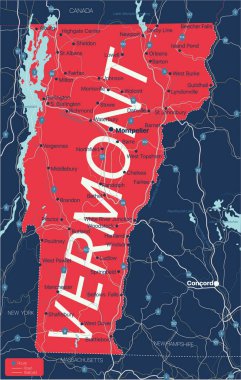
Vermont state detailed editable map with cities and towns, geographic sites, roads, railways, interstates and U.S. highways. Vector EPS-10 file, trending color scheme

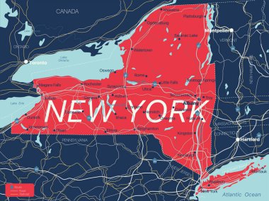
New York state detailed editable map with cities and towns, geographic sites, roads, railways, interstates and U.S. highways. Vector EPS-10 file, trending color scheme

Flag of Vatican City. Glossy Icons Square Shape. This is File from the Collection European Flags

San Marino country detailed editable map with regions cities and towns, roads and railways, geographic sites. Vector EPS-10 file

Flag of Cyprus. Glossy Icons Square Shape. This is File from the Collection European Flags

Flag of Bulgaria. Glossy Icons Square Shape. This is File from the Collection European Flags

Flag of Switzerland. Glossy Icons Square Shape. This is File from the Collection European Flags

South Sudan country detailed editable map with regions cities and towns, roads and railways, geographic sites. Vector EPS-10 file

Flag of Spain. Glossy Icons Square Shape. This is File from the Collection European Flags

Flag of Romania. Glossy Icons Square Shape. This is File from the Collection European Flags

Rhode Island state detailed editable map with cities and towns, geographic sites, roads, railways, interstates and U.S. highways. Vector EPS-10 file, trending color scheme

Ghana country detailed editable map with regions cities and towns, roads and railways, geographic sites. Vector EPS-10 file

Flag of Italy. Glossy Icons Square Shape. This is File from the Collection European Flags

Travel - Kingdom of THAILAND. Pictures of Life. Hand drawn vector pack, freehand sketching. Editable in layers and groups. Background is isolated. All things are named inside the vector file.

Sultanpur District Vector Map with Bold Outline

Jhansi District Map of Uttar Pradesh, India

Kasganj (Kanshiram Nagar) District Vector Map with Bold Black Outline

Ayodhya District orange color Map of Uttar Pradesh, India

Amethi District green Map of Uttar Pradesh, India

Agra District Vector Map with Bold blue Outline of Uttar Pradesh, India

Ambedkar District Map of Uttar Pradesh, India

Meerut Division map of Uttar Pradesh State India

Kanpur Division map of Uttar Pradesh State India

Saharanpur Division Highlighted in Uttar Pradesh State Map of India

Basti Division Highlighted in Uttar Pradesh State Map of India

Chitrakoot Division map of Uttar Pradesh State India

Sehore District Map Highlighted on Madhya Pradesh State Map

Lucknow Division Highlighted in Uttar Pradesh State Map of India

Kanpur Division Highlighted in Uttar Pradesh State Map of India

Mirzapur Division map of Uttar Pradesh State India

Bareilly Division Highlighted in Uttar Pradesh State Map of India

Azamgarh Division Highlighted in Uttar Pradesh State Map of India

Shahjahanpur District Map of Uttar Pradesh, India

Meerut District Map of Uttar Pradesh, India

Rampur District Vector Map with red Outline

Kaushambi District Vector Map with Bold Black Outline

Balrampur District Vector Map with Bold red Outline of Uttar Pradesh, India

Ballia District green color Map of Uttar Pradesh, India

Agra Division Highlighted in Uttar Pradesh State Map of India

Jhabua District Map Highlighted on Madhya Pradesh State Map

Ambedkar District Vector Map with yellow Outline of Uttar Pradesh, India

Kasganj (Kanshiram Nagar) District Map of Uttar Pradesh, India

Balrampur District Map of Uttar Pradesh, India

Jhansi Division map of Uttar Pradesh State India

Uttar Pradesh state map Uttar Pradesh state map illustration with all dist, India

Bareilly Division map of Uttar Pradesh State India

Aligarh Division Highlighted in Uttar Pradesh State Map of India

Prayagraj Division map of Uttar Pradesh State India

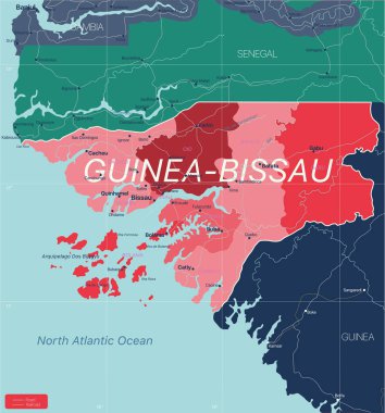
Guinea-Bissau country detailed editable map with regions cities and towns, roads and railways, geographic sites. Vector EPS-10 file

Polish map flag isolated on white vector file. red and white patriotic colours of poland nation. Cartography illustration icon, design. simple design element template for prints. Eps 10 format.

Lucknow Division map of Uttar Pradesh State India

Varanasi Division map of Uttar Pradesh State India

Basti Division map of Uttar Pradesh State India

Shamli District Vector Map with Bold Black Outline

Mau District Vector Map with Bold Black Outline

Jalaun District Vector Map of Uttar Pradesh state, India

Lalitpur District Vector Map with Bold Black Outline

Lakhimpur Kheri District Map of Uttar Pradesh, India

High detail Uttar Pradesh District Map Set Clean Vector Outline with Labels

Aligarh District Map of Uttar Pradesh, India

Amroha District green Map of Uttar Pradesh, India

Bareilly District green Map of Uttar Pradesh, India

Ratlam District Map Highlighted on Madhya Pradesh State Map

Moradabad Division Highlighted in Uttar Pradesh State Map of India

Devipatan Division map of Uttar Pradesh State India

Shravasti District Vector Map with pink Outline

Sambhal District Vector Map with pink Outline

Hathras (Mahamaya Nagar) District Vector Map with Bold blue Outline of Uttar Pradesh, India

Lucknow District Map of Uttar Pradesh, India

Bahraich District blue Map of Uttar Pradesh, India

Chitrakoot Division Highlighted in Uttar Pradesh State Map of India

KMZ Icon, Simple Vector Illustration For Web Use

Devipatan Division Highlighted in Uttar Pradesh State Map of India

Azamgarh Division map of Uttar Pradesh State India

Saharanpur District Vector Map with green Outline

Aligarh District Vector Map with Bold Black Outline of Uttar Pradesh, India

Lakhimpur District Vector Map with yellow Black Outline

Aligarh District Vector Map with Bold Black Outline of Uttar Pradesh, India

KML Icon, Simple Vector Illustration For Web Use

Jhansi Division Highlighted in Uttar Pradesh State Map of India

Moradabad Division map of Uttar Pradesh State India

SAHARANPUR Division map of Uttar Pradesh State India

Devipatan Division map of Uttar Pradesh State India

Ayodhya Division map of Uttar Pradesh State India

Prayagraj Division Highlighted in Uttar Pradesh State Map of India

Maharajganj District Map of Uttar Pradesh, India

Pilibhit District Vector Map with Bold Black Outline

Kannauj District Map of Uttar Pradesh, India

Baghpat District Vector Map with Bold colorful Outline of Uttar Pradesh, India

Ballia District Vector Map with Bold blue Outline of Uttar Pradesh, India

Sambhal, Bhimnagar District Vector Map with Bold Black Outline

Rae Bareli District Vector Map with yellow Outline

Agra District Map of Uttar Pradesh, India

Varanasi District Vector Map with Bold Black Outline

Mainpuri District Vector Map with Bold Black Outline

Barabanki District Vector Map with Bold Black Outline of Uttar Pradesh, India

Azamgarh District blue Map of Uttar Pradesh, India