10 FREE IMAGES of ShutterstockTry Shutterstock and Get 10 Free Images

geography mapping SVG, Vector And Clipart Images

() geography mapping SVG Vectors and Transparent background geography mapping ClipArts. All Download the royalty free graphic in the form of SVG, PNG, EPS, AI or PSD.

Description:

Usage ideas:

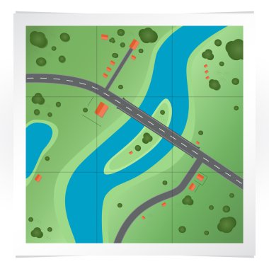
Vector illustration of road map. clipart svg vector

Vector illustration of road map.

Globe with blue location markers, upward graph indicating growth, and a smiling face. Ideal for global reach, tracking, growth, success, navigation, teamwork simple landing page clipart svg vector

Globe with blue location markers, upward graph indicating growth, and a smiling face. Ideal for global reach, tracking, growth, success, navigation, teamwork simple landing page

Landscape Background. Futuristic Landscape with Shiny Grid. Low Poly Terrain. 3D Wireframe Terrain. Network Abstract Background. Cyberspace Grid. Technology Vector Illustration of Low-Poly Landscape clipart svg vector

Landscape Background. Futuristic Landscape with Shiny Grid. Low Poly Terrain. 3D Wireframe Terrain. Network Abstract Background. Cyberspace Grid. Technology Vector Illustration of Low-Poly Landscape

Illustration of GPS in mobile phone showing route map clipart svg vector

Illustration of GPS in mobile phone showing route map

Abstract Landscape Background. Mosaic. 3d Vector Illustration. clipart svg vector

Abstract Landscape Background. Mosaic. 3d Vector Illustration.

Abstract Landscape Background. Mosaic. 3d Technology Vector Illustration. Can Be Used For Banner, Flyer, Book Cover, Poster clipart svg vector

Abstract Landscape Background. Mosaic. 3d Technology Vector Illustration. Can Be Used For Banner, Flyer, Book Cover, Poster

Abstract landscape background. Mosaic. 3d technology vector illustration. Can be used for banner, flyer, book cover, poster, web banners. clipart svg vector

Abstract landscape background. Mosaic. 3d technology vector illustration. Can be used for banner, flyer, book cover, poster, web banners.

Color map of Southeastern Asia divided by the countries clipart svg vector

Color map of Southeastern Asia divided by the countries

Globe flat mapping pin icon, vector illustration eps 10 clipart svg vector

Globe flat mapping pin icon, vector illustration eps 10

Color map of Central Asia divided by the countries clipart svg vector

Color map of Central Asia divided by the countries

Map Pointer with flag glossy buttons clipart svg vector

Map Pointer with flag glossy buttons

Regions of Oceania, political map. Colored geographic regions, southeast of the Asia-Pacific region including Australasia, Melanesia, Micronesia and Polynesia. English. Illustration over white. Vector clipart svg vector

Regions of Oceania, political map. Colored geographic regions, southeast of the Asia-Pacific region including Australasia, Melanesia, Micronesia and Polynesia. English. Illustration over white. Vector

Forecast weather isobar night map of Europe, wind fronts and temperature vector diagram. Meteorology climate and weather forecast isobar of Europe, cold and warm cyclone or atmospheric pressure chart clipart svg vector

Forecast weather isobar night map of Europe, wind fronts and temperature vector diagram. Meteorology climate and weather forecast isobar of Europe, cold and warm cyclone or atmospheric pressure chart

Turkey map designed in illustration with regions colored in bright colors clipart svg vector

Turkey map designed in illustration with regions colored in bright colors

Turkey map designed in illustration with regions colored in bright colors clipart svg vector

Turkey map designed in illustration with regions colored in bright colors

Political map of Europe with different colors for each country. Vector illustration. clipart svg vector

Political map of Europe with different colors for each country. Vector illustration.

Pin map with Andorra flag on world map. Vector illustration. clipart svg vector

Pin map with Andorra flag on world map. Vector illustration.

Locator map showing the location of the country British Indian Ocean Territory in Seven seas. The country is highlighted with a red polygon. No labels at all. Made with Natural Earth. clipart svg vector

Locator map showing the location of the country British Indian Ocean Territory in Seven seas. The country is highlighted with a red polygon. No labels at all. Made with Natural Earth.
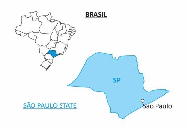
Map of the State of Sao Paulo and its location in the Brazilian territory clipart svg vector
Map of the State of Sao Paulo and its location in the Brazilian territory

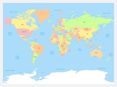
World map atlas. Colored political map with blue seas and oceans. Vector illustration. clipart svg vector

World map atlas. Colored political map with blue seas and oceans. Vector illustration.

Political color map of Asia with borders of the states. clipart svg vector

Political color map of Asia with borders of the states.

Detailed vector a large color map of the USA clipart svg vector
Detailed vector a large color map of the USA

Abstract landscape background. Mosaic. 3d technology vector illustration. Can be used for banner, flyer, book cover and poster clipart svg vector

Abstract landscape background. Mosaic. 3d technology vector illustration. Can be used for banner, flyer, book cover and poster
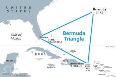
The Bermuda Triangle or Devils Triangle, gray political map. Region in North Atlantic Ocean between Bermuda, Miami and Puerto Rico where aircrafts and ships disappeared under mysterious circumstances. clipart svg vector

The Bermuda Triangle or Devils Triangle, gray political map. Region in North Atlantic Ocean between Bermuda, Miami and Puerto Rico where aircrafts and ships disappeared under mysterious circumstances.

Detailed road vector map of Turkey and colorful map pointers with separated layers. clipart svg vector

Detailed road vector map of Turkey and colorful map pointers with separated layers.

Pin map with Albania flag on world map.Vector illustration. clipart svg vector

Pin map with Albania flag on world map.Vector illustration.

Pin map with Albania flag on world map.Vector illustration. clipart svg vector

Pin map with Albania flag on world map.Vector illustration.

Liechtenstein vector set. Isolated. clipart svg vector

Liechtenstein vector set. Isolated.

Seamless abstract topographical map, vector, illustration clipart svg vector

Seamless abstract topographical map, vector, illustration

Dotted World map - blue world map silhoeutte isolated on white, World Map of blue dots background, vector illustration, template, concept, icon social media, wallpaper. Modern design map world cartography social media icon, symbol, travel, education. clipart svg vector

Dotted World map - blue world map silhoeutte isolated on white, World Map of blue dots background, vector illustration, template, concept, icon social media, wallpaper. Modern design map world cartography social media icon, symbol, travel, education.

Vector map of Malaysia with names of cities and with borders city clipart svg vector

Vector map of Malaysia with names of cities and with borders city

Map of administrative divisions of Republic of Belarus clipart svg vector

Map of administrative divisions of Republic of Belarus

Detailed white world map on black background. Vector illustration. clipart svg vector

Detailed white world map on black background. Vector illustration.

Map of administrative divisions of France clipart svg vector

Map of administrative divisions of France

Brazil Regions Map Set with World Location. clipart svg vector

Brazil Regions Map Set with World Location.

A colorful map of Santa Catarina State divided into regions, Brazil clipart svg vector

A colorful map of Santa Catarina State divided into regions, Brazil

Geographic coordinates diagram shows Earth with longitude and latitude lines, demonstrating global position measurement. Outline diagram clipart svg vector

Geographic coordinates diagram shows Earth with longitude and latitude lines, demonstrating global position measurement. Outline diagram

High detailed Greece road map with labeling. clipart svg vector
High detailed Greece road map with labeling.

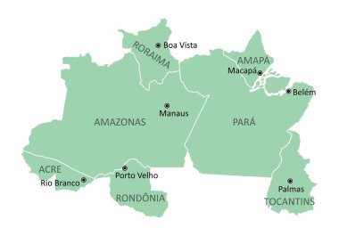
Map of the Brazil north region isolated on white background clipart svg vector

Map of the Brazil north region isolated on white background

Highly detailed Myanmar physical map with labeling. clipart svg vector

Highly detailed Myanmar physical map with labeling.

Vector physical map of Kazakhstan. Color map, mountains and plains, rivers and lakes. Major cities, roads and regional boundaries clipart svg vector

Vector physical map of Kazakhstan. Color map, mountains and plains, rivers and lakes. Major cities, roads and regional boundaries

Political map of Europe with colors and borders for each country and names in Spanish. Vector illustration. clipart svg vector

Political map of Europe with colors and borders for each country and names in Spanish. Vector illustration.

Pin map with Afghanistan flag on world map.Vector illustration. clipart svg vector

Pin map with Afghanistan flag on world map.Vector illustration.

Vector map of the Indonesian islands of Java and Bali clipart svg vector

Vector map of the Indonesian islands of Java and Bali

Map of Andalusia autonomous community of Spain and location on Spanish map clipart svg vector

Map of Andalusia autonomous community of Spain and location on Spanish map

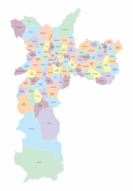
The Sao Paulo city colorful map divided into districts and regions with labels, Brazil clipart svg vector

The Sao Paulo city colorful map divided into districts and regions with labels, Brazil

The Sao Paulo city colorful map divided into districts and regions with labels, Brazil. Center, North, South, West and East Zones. clipart svg vector

The Sao Paulo city colorful map divided into districts and regions with labels, Brazil. Center, North, South, West and East Zones.

Slovenia is a country located in Europe at the crossroads of main European cultural and trade routes clipart svg vector

Slovenia is a country located in Europe at the crossroads of main European cultural and trade routes

Color map of Eastern Asia divided by the countries clipart svg vector

Color map of Eastern Asia divided by the countries

Map of China with regions. All elements are separated in editable layers clearly labeled. clipart svg vector

Map of China with regions. All elements are separated in editable layers clearly labeled.

Blank outline map of Europe. Simplified vector map made of black outline on white background. clipart svg vector

Blank outline map of Europe. Simplified vector map made of black outline on white background.

Pin map with India flag on world map.Vector illustration. clipart svg vector

Pin map with India flag on world map.Vector illustration.

Pin map with Albania flag on world map.Vector illustration. clipart svg vector

Pin map with Albania flag on world map.Vector illustration.

Political map of Europe with colors and borders for each country and names in English. Vector illustration. clipart svg vector

Political map of Europe with colors and borders for each country and names in English. Vector illustration.

Blank outline map of Europe with Caucasian region. Simplified wireframe map of black lined borders. Vector illustration. clipart svg vector

Blank outline map of Europe with Caucasian region. Simplified wireframe map of black lined borders. Vector illustration.

High detailed Italy road map with labeling. clipart svg vector

High detailed Italy road map with labeling.

Political map of Europe with different colors for each country and names in English. Vector illustration. clipart svg vector

Political map of Europe with different colors for each country and names in English. Vector illustration.

Nation of Brunei vector map with flag clipart svg vector

Nation of Brunei vector map with flag

Pin map with Algeria flag on world map. Vector illustration. clipart svg vector

Pin map with Algeria flag on world map. Vector illustration.

Locator map showing the location of the country Albania in Europe. The country is highlighted with a red polygon. No labels at all. Made with Natural Earth. clipart svg vector

Locator map showing the location of the country Albania in Europe. The country is highlighted with a red polygon. No labels at all. Made with Natural Earth.

INSTC, International NorthSouth Transport Corridor, political map. Network for moving freight, with Moscow as north end and Mumbai as south end, replacing the standard route across Mediterranean Sea. clipart svg vector

INSTC, International NorthSouth Transport Corridor, political map. Network for moving freight, with Moscow as north end and Mumbai as south end, replacing the standard route across Mediterranean Sea.

Political map of Europe with different colors for each country and names in Spanish. Vector illustration. clipart svg vector

Political map of Europe with different colors for each country and names in Spanish. Vector illustration.

Vector a large color map of the USA clipart svg vector

Vector a large color map of the USA

Highly detailed Argentina physical map with labeling. clipart svg vector

Highly detailed Argentina physical map with labeling.

Argentina - Highly detailed editable political map with labeling. clipart svg vector
Argentina - Highly detailed editable political map with labeling.

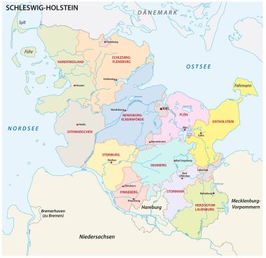
Schleswig-Holstein administrative and political map in german language clipart svg vector
Schleswig-Holstein administrative and political map in german language

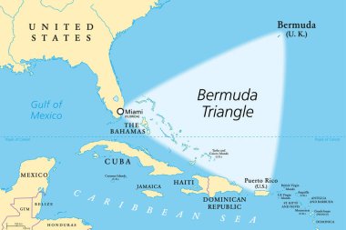
The Bermuda Triangle or Devils Triangle, political map. Region in the North Atlantic Ocean between Bermuda, Miami and Puerto Rico, where aircrafts and ships disappeared under mysterious circumstances. clipart svg vector

The Bermuda Triangle or Devils Triangle, political map. Region in the North Atlantic Ocean between Bermuda, Miami and Puerto Rico, where aircrafts and ships disappeared under mysterious circumstances.

Locator map showing the location of the country Andorra in Europe. The country is highlighted with a red polygon. No labels at all. Made with Natural Earth. clipart svg vector

Locator map showing the location of the country Andorra in Europe. The country is highlighted with a red polygon. No labels at all. Made with Natural Earth.

Colorful United Kingdom political map with clearly labeled, separated layers. Vector illustration. clipart svg vector

Colorful United Kingdom political map with clearly labeled, separated layers. Vector illustration.

Political Map of USA and Flat Map Pointers with water objects, cities and capitals. clipart svg vector

Political Map of USA and Flat Map Pointers with water objects, cities and capitals.

Principal tectonic plates of the Earth, world map. The sixteen major pieces of crust and uppermost mantle of the Earth, called the lithosphere, and consisting of oceanic and continental crust. Vector clipart svg vector

Principal tectonic plates of the Earth, world map. The sixteen major pieces of crust and uppermost mantle of the Earth, called the lithosphere, and consisting of oceanic and continental crust. Vector

Map with flag of USA states collection. clipart svg vector

Map with flag of USA states collection.

Colorful Japan political map with clearly labeled, separated layers. Vector illustration. clipart svg vector

Colorful Japan political map with clearly labeled, separated layers. Vector illustration.

Locator map showing the location of the country Afghanistan in Asia. The country is highlighted with a red polygon. No labels at all. Made with Natural Earth. clipart svg vector

Locator map showing the location of the country Afghanistan in Asia. The country is highlighted with a red polygon. No labels at all. Made with Natural Earth.

Melanesia, Micronesia and Polynesia, political map. Colored geographic regions of Oceania, southeast of the Asia-Pacific region. English labeling. Illustration on white background. Vector. clipart svg vector

Melanesia, Micronesia and Polynesia, political map. Colored geographic regions of Oceania, southeast of the Asia-Pacific region. English labeling. Illustration on white background. Vector.

A colorful map of the Minas Gerais State divided into regions, Brazil clipart svg vector
A colorful map of the Minas Gerais State divided into regions, Brazil

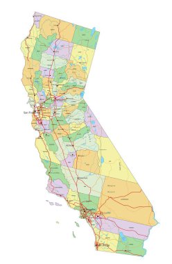
California - Highly detailed editable political map with labeling. clipart svg vector

California - Highly detailed editable political map with labeling.

Highly detailed Taiwan physical map. clipart svg vector

Highly detailed Taiwan physical map.

Locator map showing the location of the country Algeria in Africa. The country is highlighted with a red polygon. No labels at all. Made with Natural Earth. clipart svg vector

Locator map showing the location of the country Algeria in Africa. The country is highlighted with a red polygon. No labels at all. Made with Natural Earth.

Brazil regions map with no states limits clipart svg vector

Brazil regions map with no states limits

Colorful Greece political map with clearly labeled, separated layers. Vector illustration. clipart svg vector
Colorful Greece political map with clearly labeled, separated layers. Vector illustration.

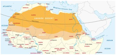
Vector map of the Sahara desert and Sahel zone clipart svg vector

Vector map of the Sahara desert and Sahel zone

Colorful map of the Brazil south region isolated on white background clipart svg vector

Colorful map of the Brazil south region isolated on white background

Pin map with Algeria flag on world map. Vector illustration. clipart svg vector

Pin map with Algeria flag on world map. Vector illustration.

High detailed Europe physical map. clipart svg vector

High detailed Europe physical map.

Los Angeles Vector Map, Artprint. Black Landmass, White Water and Roads. clipart svg vector

Los Angeles Vector Map, Artprint. Black Landmass, White Water and Roads.

Black gps pointer icon showing location tracking for global positioning system navigation clipart svg vector

Black gps pointer icon showing location tracking for global positioning system navigation

Administrative and political vector map of the Spanish Mediterranean Sea Eivissa with flag clipart svg vector

Administrative and political vector map of the Spanish Mediterranean Sea Eivissa with flag

Bogota administrative and political map with flag clipart svg vector

Bogota administrative and political map with flag

Pin map with Afghanistan flag on world map.Vector illustration. clipart svg vector

Pin map with Afghanistan flag on world map.Vector illustration.

Highly detailed Egypt physical map with labeling. clipart svg vector

Highly detailed Egypt physical map with labeling.

Indonesia map, administrative division with names regions, colors map isolated on white background vector clipart svg vector

Indonesia map, administrative division with names regions, colors map isolated on white background vector

Pirate treasure map. Vector illustration. clipart svg vector

Pirate treasure map. Vector illustration.

High detailed Ukraine physical map. clipart svg vector

High detailed Ukraine physical map.

Locator map showing the location of the country Andorra in Europe. The country is highlighted with a red polygon. Small countries are also marked with a red circle. The map shows yellow land areas, blue sea, state borders and a blue grid lines. clipart svg vector

Locator map showing the location of the country Andorra in Europe. The country is highlighted with a red polygon. Small countries are also marked with a red circle. The map shows yellow land areas, blue sea, state borders and a blue grid lines.
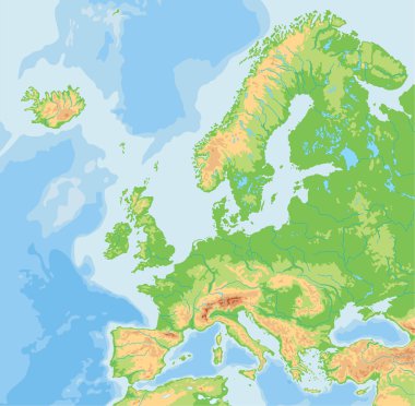
High detailed Europe physical map. clipart svg vector

High detailed Europe physical map.

High detailed Japan physical map with labeling. clipart svg vector

High detailed Japan physical map with labeling.

Pin map with Central African Republic flag on world map. Vector illustration. clipart svg vector

Pin map with Central African Republic flag on world map. Vector illustration.

Colorful Italy political map with clearly labeled, separated layers. Vector illustration. clipart svg vector
Colorful Italy political map with clearly labeled, separated layers. Vector illustration.

The Sao Paulo city colorful map divided into districts with labels, Brazil clipart svg vector

The Sao Paulo city colorful map divided into districts with labels, Brazil