Berchtesgadener Land (Bayern) blank outline map set

Germany outline map set

Niedersachsen state (Germany) outline map set

Berlin state (Germany) outline map set

Sachsen-Anhalt state (Germany) outline map set

Boundary of Schengen Area, Europe with countries silhouettes. Eps file contains separate layers

Blank Map of Germany. Thin line Germany map on a transparent background. Stock vector. Flat design.

Vector detailed color Europe map

Mittelsachsen (Sachsen) blank outline map set

Vector detailed color Germany map

Vector detailed color Germany map

Political map of European continent. Versatile file, easy editable color and visibility of every state in one click in layers panel

Mecklenburg-Vorpommern state blank outline map set

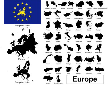
Vectors of european countries, Europe and European Union

Thuringen blank outline map

Monochrome vector Germany map

Highly detailed physical map of Germany,in vector format,with all the relief forms,regions and big cities.

Blue map of Europe, isolated on a white background. Highly detailed vector illustration. Includes Germany, Netherlands, Belgium, Luxembourg, Austria, Switzerland, France, Monaco, and Liechtenstein.

Highly detailed physical map of Europe,in vector format,with all the relief forms,countries and big cities.

Highly detailed physical map of Europe,in vector format,with all the relief forms,countries and big cities.

Germany with red location placeholder on europe map, close up Germany, pinned destination, top view, colorful map with location icon, travel idea, vacation and road trip concept

Administrative and political vector map of switzerland

Political and location map of Germany. Versatile file, every piece is selectable and editable in layers panel. Turn on and off visibility of every province in one click. Vector, eps 10.

Stylized world map, unusual blue color, vector illustration

German polygonal flag on contour of the country map. Low poly style vector illustration eps

Vector of National Flags Symbol Illustrator, EPS 10. Vintage Style.

Germany concept with icon design, vector illustration 10 eps graphic.

Vector detailed color Europe map

World map with pointer flag spain vector illustration eps 10

European Union members and candidates, country silhouettes. Eps file contains separate layers

World flags. Vector illustration.

High detailed national flags of European countries, clipped in round shape glossy metal buttons, vector , part 2

Map of Europe, with EU countries highlighted in blue, and option for other countries to be highlighted in one click, fully and easy editable, vector

The Netherland maps hand drawing.illustration vector EPS 10

Colorful city silhouette, vector graphics, eps 10

Abstract polygonal Germany map with glowing dots and lines, network connections, vector illustration, eps 10

Vector of National Flags Symbol Illustrator, EPS 10. Vintage Style.

Germany pin icon flag. Vector illustration Eps 8.

Western europe - vector maps of territories

World flags. Vector illustration.

Vector of National Flags Symbol Illustrator, EPS 10. Vintage Style.

Vector of National Flags Symbol Illustrator, EPS 10. Vintage Style.

Germany Country Map. Black silhouette and outline isolated on white background. EPS Vector

Nord Stream is gas pipeline from Russia to Germany - vector map

Vector of National Flags Symbol Illustrator, EPS 10. Vintage Style.

Vector of National Flags Symbol Illustrator, EPS 10. Vintage Style.

Thuringen state (Germany) outline map set

Baden-Wurttemberg, Bayern, Berlin, Brandenburg outline maps

Mecklenburg-Vorpommern state (Germany) outline map set

Sachsen, Sachsen-Anhalt, Schleswig-Holstein, Thuringen outline maps

Hamburg state (Germany) outline map set

Bremen, Hamburg, Hessen, Mecklenburg-Vorpommern outline maps

Bremen state (Germany) outline map set