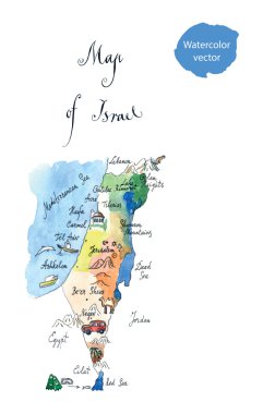
Map Israel attractions, hand drawn, watercolor - vector Illustration

Lebanon political map with capital Beirut, national borders, important cities, rivers and lakes. English labeling and scaling. Illustration.
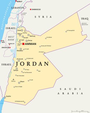
Jordan political map with capital Amman, national borders, important cities, rivers and lakes. English labeling and scaling. Illustration.
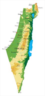
Israel highly detailed physical map,in vector format,with all the relief forms,regions and big cities.

Detailed Israel political map.

Political map of Israel with national borders, cities and rivers

Highly detailed editable political map with separated layers. Israel.

Highly detailed vector map of Israel with main cities, roads and neighbour countries.

Highly detailed editable political map with separated layers. Israel.

Israel political map with capital Jerusalem, national borders, important cities, rivers and lakes. English labeling and scaling. Illustration.

Israel - Highly detailed, editable political map with labeling.

High detailed Israel physical map with labeling.

High detailed Israel road map with labeling.
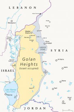
Golan Heights. political map with borders, important places, rivers and Lake Tiberias. A region in the Levant. Area, captured from Syria and occupied by Israel. English labeling. Illustration. Vector.

Vector map of the Israeli Sea of Galilee

High detailed Israel physical map with labeling.

Israel - Highly detailed, editable political map with labeling.

Colorful Israel political map with clearly labeled, separated layers. Vector illustration.

High detailed Israel physical map with labeling.

Highly detailed editable political map with separated layers. Israel.

Israel highly detailed political map with national flag.
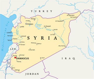
Political map of Syria with capital Damascus, national borders, most important cities, rivers and lakes. Vector illustration.
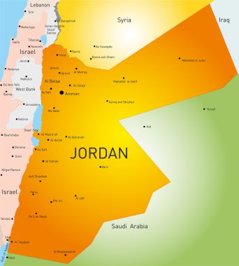
Detailed vector color map of Jordan country

Israel outline map. With the designation of the territory of the Gaza Strip, West Bank and Golan Heights

Israel map outline with stars and lines abstract framework. Communication, connection concept. Modern futuristic low polygonal, wireframe, lines and dots design. Vector illustration.
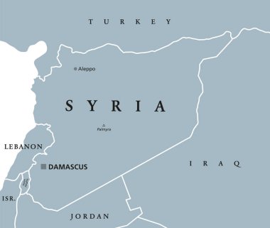
Syria political map with capital Damascus, national borders and neighbor countries. Arab republic in Western Asia. Gray illustration with English labeling on white background. Vector.
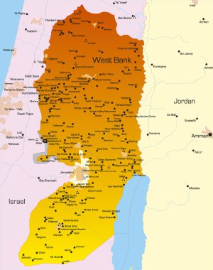
Vector color map of West Bank country

Intersection icon. Intersection warning road sign. Vector illustration of triangular sign for dangerous intersection traffic sign isolated on white background.

Lebanon highly detailed vector map with administrative regions, main cities and roads.
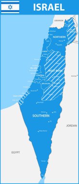
The detailed map of Israel with regions or states and cities, capitals.

Israel political map with capital Jerusalem and neighbors. State of Israel, a country in Middle East with Palestinian territories West Bank and Gaza Strip. Illustration with English labeling. Vector.

Colorful Israel political map with clearly labeled, separated layers. Vector illustration.

Roads vector map of the Lebanese republic with flag

High detailed Israel physical map.

Jordan political map with capital Amman. The Hashemite Kingdom of Jordan, an Arab country in Middle East and Western Asia. Gray illustration isolated on white background. English labeling. Vector.

High detailed Israel physical map.

Eastern Mediterranean countries political map with national borders. Nations to the east of Mediterranean Sea, also called Levant. English labeling and scaling. Gray illustration on white background.

Colorful political map of Israel. Administrative divisions - districts and three special territories - Gaza Strip, West Bank and Golan Heights. Simple flat vector map with labels.

Black and white map of Israel
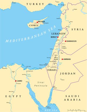
Eastern Mediterranean Political Map with capitals national borders, important cities, rivers and lakes. English labeling and scaling. Illustration.

Israel map collection with location pointers

High detailed Israel physical map with labeling.

The detailed map of the Israel with regions or states and cities, capitals

Map of Israel with red push pin indicating Tel Aviv
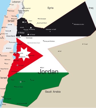
Abstract vector color map of Jordan country colored by national flag

List of cities and towns in Israel, word cloud collage, business and travel concept background

Israel and Palestine map, middle east, vector illustration

The detailed map of the Israel with regions or states and cities, capitals, national flag

The detailed map of the Israel with regions

Japanese cuisine - hot sushi roll

Israel administrative and political vector map

Israel country detailed editable map with regions cities and towns, roads and railways, geographic sites. Vector EPS-10 file