Beautiful design info graphic of india

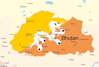
Vector map of Bhutan country colored by national flag

Vector map of Sri Lanka country

Republic of India infographics, statistical data, sights. Vector illustration

Illustrated abstract look at the world in different shades of blue and green circles

Illustrated abstract look at the world in different shades of dark blue tiles

Illustrated abstract look at the world in different shades of light blue tiles

Illustrated abstract look at the world in different shades of light blue tiles

Illustrated abstract look at the world in different shades of blue tiles

A flat picture of cultural, religious and tourist buildings in India. Taj Mahal. Can be used for web banners, marketing and promotional materials, presentation templates

Modern Map - India with federal states

World map technology-style. Vector illustration. Eps10 illustration

Sitapur District Map of Uttar Pradesh, India

Vector : India map with network line and grid blue background

Infographic map of India show population and consumption statistic information.

World earth planet geography map global travel virtual

Traffic information

A set of symbols and icons for the Indian Independence Day.

Vector map of Nepal country colored by national flag

Vector map of Pakistan country colored by national flag

Vector map of Bangladesh country colored by national flag

Vector map of Afganistan country

Republic of India infographics, statistical data, sights. Vector illustration

World map technology with wav eline background

Infographic about harm of alcohol. Body silhouettes and statistic of alcohol harm

Beautiful natural illustration with pink lotuses on a blue background.

Green eco sign of blue earth isolated

Glass blue and green eco earth sign isolated

Eco green and clear blue earth symbol isolated

Mirzapur District Vector Map with Bold red Outline

Mirzapur District Map of Uttar Pradesh, India

Shravasti District Map of Uttar Pradesh, India

Sambhal District Map of Uttar Pradesh, India

Sonbhadra District Map of Uttar Pradesh, India

Muzaffarnagar District Map of Uttar Pradesh, India

Rampur District Map of Uttar Pradesh, India

Rae Bareli District Map of Uttar Pradesh, India

Sambhal, Bhimnagar District Map of Uttar Pradesh, India

Unnao District Map of Uttar Pradesh, India

Airport Location Pin depicting the graphic elements of the airport

Shamli District Map of Uttar Pradesh, India

Sitapur District Map of Uttar Pradesh, India

Indian Youth Raising Flag for independence day

Sultanpur Mathura District Map of Uttar Pradesh, India

Sant Kabir Nagar District green Map of Uttar Pradesh, India

Varanasi District orange Map of Uttar Pradesh, India

Unnao District Vector Map with Bold Outline

Saharanpur District Map of Uttar Pradesh, India

Welcome to India vector travel icons set

Siddharthnagar District Map of Uttar Pradesh, India

Moradabad District Map of Uttar Pradesh, India