Simple contour map of India. Black outline vector map isolated on white background.

Map of India

White States and Union Territories Map of Asian Country of India

Dotted India map on white

Map of the Republic of India with the states colored in bright colors

High quality Outlined vector map of the world with only straight lines

The illustration of south asia map with detailed india map.

India map card paper 3D natural vector

India - highly detailed map. Vector illustration

White border india map outline png on black background, vector illustration

Isolated vector Illustration. Black on White background. EPS 10 Illustration

Punjab blank detailed outline map set

India map outline with country data sheet.

India-highly detailed map. Vector illustration

Andhra Pradesh administrative and political map, India

Black silhouette vector design map of india

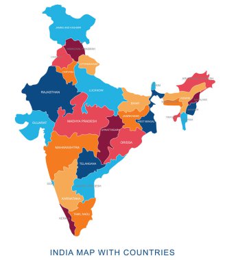
Abstract multicolor vector political india map with countries name,border.Detailed modern illustration can be use for presentation,report,t-shirt,poster,geographical templates.Simplified isolated administrative map.Hand drawn print map.

Map of India silhouette, India map dotted, Flag of India. Vector illustration flat

India map graphic, travel geography icon, nation country indian atlas region, vector illustration .

Gray India map on light grey background. Gray India map - vector illustration.

Vector illustration of administrative division map of India.

India map with states and capital cities

India map. Outline illustration country map with state names and their capital cities.

Hand drawn doodle India map. India city names lettering and cartoon landmarks, tourist attractions cliparts. travel, trip comic infographic poster, banner concept design.

World map with indication of India

India-highly detailed map. Vector illustration

India map. hand drawn illustration.

Kannauj District Highlighted in Uttar Pradesh State Map of India

India Map background Vector illustration

Prayagraj District Highlighted in Uttar Pradesh State Map of India

Shravasti District Highlighted in Uttar Pradesh State Map of India

Detail Map of India Vector Icon Illustration Indian Map Independence

India Map. Black silhouette country map isolated on white background. Black outline on white background. Vector file EPS

South Asia Region. Map of countries in southern Asia. Vector illustration.

India map with borders, cities, capital and administrative divisions. Infographic vector map. Editable layers clearly labeled.

India map, administrative division, separate individual regions with names, new map of division year 2020, color map isolated on white background vector

Saharanpur Division Highlighted in Uttar Pradesh State Map of India

India isolated blank outline map set

Map of India with flight paths. Image with clipping path.

Flat India Map Set Vector Illustration

A vector gray line map of the Punjab State of India.

Assam map of Indian state. Assam map vector illustration. Assam vector map on white background.

India map blue white card paper 3D vector

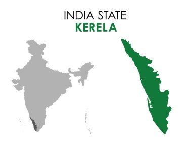
Kerala map of Indian state. Kerala map vector illustration. Kerala vector map on white background.

Ratlam District Map Highlighted on Madhya Pradesh State Map

Blue india national map vector image on white background

Sehore District Map Highlighted on Madhya Pradesh State Map

A fun placemat for kids. Printable the Travel to India activity sheet with a labyrinth, find the differences and find the same ones. 17x11 inch printable vector file

Jhabua District Map Highlighted on Madhya Pradesh State Map

Chitrakoot Division map of Uttar Pradesh State India

World Map Outline Contour Silhouette - Asia in Center

Black India map separated on states

Black Asia map without country borders

World Map Outline Contour Silhouette - Asia in Center

Political Physical Topographic Colored World Map Vector illustration

India flag map with shadow effect

Stylized vector India map. Infographic 3d gold map illustration with cities, borders, capital, administrative divisions and pointer marks, shadow; gradient background.

India map yellow green vector

India vector map with infographic elements, pointer marks. Editable template with regions, cities and capital Delhi.

India polygonal mosaic dot grey vector map

India-highly detailed map. Vector illustration

India map glass card paper 3D vector

India map isolated on a white background.

Map of India with flag. vector illustration of India map with flag

Map of the India in the colors of the flag with administrative divisions vector

Indian map with indian colorful flag vector illustration

Outline map of India over a map and white background

Map of india. map concept

India Border Map, back dots creative design, white background

Map of india. map concept

India country silhouette. High detailed map. Solid grey vector illustration isolated on white background.

India map. Outline illustration country map with state shapes, names and borders.

Vector India map in vintage design. Indian border on grunge background. Letters are not cut and easy to move

Detailed illustration of a ballot box in front of the indian map, eps10 vector

Black map of India with names of regions, design blackboard vector

India map silhouette png on white background, vector illustration

India map, black and white detailed outline regions of the country. Vector illustration

India vector set. Detailed country shape with region borders, flags and icons isolated on white background.

Map time icon outline vector. World zone. Global timezone

India map words cloud with larger cities

Manipur (States and union territories of India, Federated states, Republic of India) map vector illustration, scribble sketch Manipur state map

Jammu and Kashmir map, India, Asia. Filled and outline map designs. Vector illustration

White chalk texture retro stamp with Republic of India map on a green blackboard. Grunge rubber seal with country outlines, vector illustration.

Rajasthan (States and union territories of India, Federated states, Republic of India) map vector illustration, scribble sketch Rajasthan state map

Vector illustration of India map in tricolor design with Ashoka Chakra. Clean lines and vibrant colors enhance visual appeal

India Outline Map with Green Colour. Modern Simple Line Cartoon Design - EPS 10 Vector

Ayodhya District orange color Map of Uttar Pradesh, India

Amethi District green Map of Uttar Pradesh, India

Agra District Vector Map with Bold blue Outline of Uttar Pradesh, India

Ambedkar District Map of Uttar Pradesh, India

Kanpur Dehat District Vector Map with Bold Black Outline of Uttar Pradesh, India

Jhansi District Map of Uttar Pradesh, India

Bareilly District Highlighted in Uttar Pradesh State Map of India

Hamirpur District Highlighted in Uttar Pradesh State Map of India

Sonbhadra dist Highlighted in Uttar Pradesh State Map of India

Meerut Division map of Uttar Pradesh State India

Kanpur Division map of Uttar Pradesh State India

Basti Division Highlighted in Uttar Pradesh State Map of India

Kasganj (Kanshiram Nagar) District Vector Map with Bold Black Outline

Flag Map of India. India Flag Map