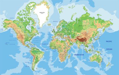
Highly detailed World map with labeling. Vector illustration.

Vector set of India country. Isometric 3d map, India map, Asia map - with region, state names and city names.

Black map of India with names of regions, design blackboard vector

Uttar Pradesh state blank outline map set

Madhya Pradesh state blank outline map set

Karnataka, Kerala, Madhya Pradesh, Maharashtra outline maps

Gujarat state blank outline map set

Assam state blank outline map set

West Bengal state blank outline map set

Arunachal Pradesh state blank outline map set

Sikkim state blank outline map set

Nagaland state blank outline map set

Rajasthan state blank outline map set

Delhi state blank outline map set

Prayagraj District Highlighted in Uttar Pradesh State Map of India

Odisha (Orissa) blank detailed outline map set

Saharanpur Division Highlighted in Uttar Pradesh State Map of India

Kannauj District Highlighted in Uttar Pradesh State Map of India

Bihar blank detailed outline map set

Shravasti District Highlighted in Uttar Pradesh State Map of India

India isolated blank outline map set

Chitrakoot Division map of Uttar Pradesh State India

Jhabua District Map Highlighted on Madhya Pradesh State Map

Ratlam District Map Highlighted on Madhya Pradesh State Map

A vector gray line map of the Punjab State of India.

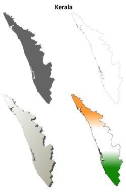
Kerala blank detailed outline map set

Madhya blank detailed outline map set

Karnataka blank detailed outline map set

Gujarat blank detailed outline map set

Chhattisgarh blank detailed outline map set

Tamil Nadu blank detailed outline map set

Maharashtra blank detailed outline map set

Punjab blank detailed outline map set

Manipur (States and union territories of India, Federated states, Republic of India) map vector illustration, scribble sketch Manipur state map

Uttarakhand state blank outline map set

Andhra Pradesh state blank outline map set

Jammu and Kashmir state blank outline map set

Meghalaya state blank outline map set

Ayodhya District orange color Map of Uttar Pradesh, India

Amethi District green Map of Uttar Pradesh, India

Agra District Vector Map with Bold blue Outline of Uttar Pradesh, India

Ambedkar District Map of Uttar Pradesh, India

Kanpur Dehat District Vector Map with Bold Black Outline of Uttar Pradesh, India

Jhansi District Map of Uttar Pradesh, India

Bareilly District Highlighted in Uttar Pradesh State Map of India

Hamirpur District Highlighted in Uttar Pradesh State Map of India

Sonbhadra dist Highlighted in Uttar Pradesh State Map of India

Meerut Division map of Uttar Pradesh State India

Kanpur Division map of Uttar Pradesh State India

Basti Division Highlighted in Uttar Pradesh State Map of India

Kasganj (Kanshiram Nagar) District Vector Map with Bold Black Outline

Bihar state blank outline map set

Manipur state blank outline map set

Firozabad District Highlighted in Uttar Pradesh State Map of India

Gautam Buddh Nagar (Noida) District Highlighted in Uttar Pradesh State Map of India

Kanpur Dehat District Highlighted in Uttar Pradesh State Map of India

Amroha District Highlighted in Uttar Pradesh State Map of India

Amethi District Highlighted in Uttar Pradesh State Map of India

Bareilly Division Highlighted in Uttar Pradesh State Map of India

Azamgarh Division Highlighted in Uttar Pradesh State Map of India

Lucknow Division Highlighted in Uttar Pradesh State Map of India

Kanpur Division Highlighted in Uttar Pradesh State Map of India

Mirzapur Division map of Uttar Pradesh State India

Kaushambi District Vector Map with Bold Black Outline

Balrampur District Vector Map with Bold red Outline of Uttar Pradesh, India

Ballia District green color Map of Uttar Pradesh, India

Pratapgarh District Highlighted in Uttar Pradesh State Map of India

Lucknow District Highlighted in Uttar Pradesh State Map of India

Manipur, Meghalaya, Mizoram, Nagaland outline maps

Jharkhand state blank outline map set

Punjab state blank outline map set

Aligarh Division Highlighted in Uttar Pradesh State Map of India

Balrampur District Map of Uttar Pradesh, India

Ambedkar District Vector Map with yellow Outline of Uttar Pradesh, India

Kasganj (Kanshiram Nagar) District Map of Uttar Pradesh, India

Prayagraj Division map of Uttar Pradesh State India

Bareilly Division map of Uttar Pradesh State India

Jhansi Division map of Uttar Pradesh State India

Uttar Pradesh state map Uttar Pradesh state map illustration with all dist, India

Sitapur Highlighted in Uttar Pradesh State Map of India

Auraiya District Highlighted in Uttar Pradesh State Map of India

Deoria District Highlighted in Uttar Pradesh State Map of India

Chitrakoot District Highlighted in Uttar Pradesh State Map of India

Lakhimpur Kheri District Highlighted in Uttar Pradesh State Map of India

Kushinagar District Highlighted in Uttar Pradesh State Map of India

Goa state blank outline map set

Kerala state blank outline map set

Lalitpur District Vector Map with Bold Black Outline

Lakhimpur Kheri District Map of Uttar Pradesh, India

Bareilly District green Map of Uttar Pradesh, India

Jalaun District Vector Map of Uttar Pradesh state, India

Kannauj District Vector Map of Uttar Pradesh, India

Amroha District green Map of Uttar Pradesh, India

Aligarh District Map of Uttar Pradesh, India

Baghpat District Highlighted in Uttar Pradesh State Map of India

Bijnor District Highlighted in Uttar Pradesh State Map of India

Banda District Highlighted in Uttar Pradesh State Map of India

Bulandshahr District Highlighted in Uttar Pradesh State Map of India

Etawah District Highlighted in Uttar Pradesh State Map of India

Mathura District Highlighted in Uttar Pradesh State Map of India