
Kannauj District Highlighted in Uttar Pradesh State Map of India

Prayagraj District Highlighted in Uttar Pradesh State Map of India

Shravasti District Highlighted in Uttar Pradesh State Map of India

Ratlam District Map Highlighted on Madhya Pradesh State Map

Jhabua District Map Highlighted on Madhya Pradesh State Map

Vector map with Chatrapati Sambhaji Nagar district highlighted in Maharashtra, India

Bareilly District Highlighted in Uttar Pradesh State Map of India

Hamirpur District Highlighted in Uttar Pradesh State Map of India

Sonbhadra dist Highlighted in Uttar Pradesh State Map of India

Firozabad District Highlighted in Uttar Pradesh State Map of India

Gautam Buddh Nagar (Noida) District Highlighted in Uttar Pradesh State Map of India

Kanpur Dehat District Highlighted in Uttar Pradesh State Map of India

Amroha District Highlighted in Uttar Pradesh State Map of India

Amethi District Highlighted in Uttar Pradesh State Map of India

Pratapgarh District Highlighted in Uttar Pradesh State Map of India

Lucknow District Highlighted in Uttar Pradesh State Map of India

Sitapur Highlighted in Uttar Pradesh State Map of India

Auraiya District Highlighted in Uttar Pradesh State Map of India

Deoria District Highlighted in Uttar Pradesh State Map of India

Chitrakoot District Highlighted in Uttar Pradesh State Map of India

Lakhimpur Kheri District Highlighted in Uttar Pradesh State Map of India

Kushinagar District Highlighted in Uttar Pradesh State Map of India

Baghpat District Highlighted in Uttar Pradesh State Map of India

Bijnor District Highlighted in Uttar Pradesh State Map of India

Banda District Highlighted in Uttar Pradesh State Map of India

Bulandshahr District Highlighted in Uttar Pradesh State Map of India

Etawah District Highlighted in Uttar Pradesh State Map of India

Mathura District Highlighted in Uttar Pradesh State Map of India

Maharajganj District Highlighted in Uttar Pradesh State Map of India

Shahjahanpur District Highlighted in Uttar Pradesh State Map of India

Ghaziabad District Highlighted in Uttar Pradesh State Map of India

Gonda District Highlighted in Uttar Pradesh State Map of India

Kasganj (Kanshiram Nagar) District Highlighted in Uttar Pradesh State Map of India

Uttar Pradesh state map with blue color

Agra District Highlighted in Uttar Pradesh State Map of India

Mau District Highlighted in Uttar Pradesh State Map of India

Meerut District Highlighted in Uttar Pradesh State Map of India

Mahoba District Highlighted in Uttar Pradesh State Map of India

Ambedkar Nagar District Highlighted in Uttar Pradesh State Map of India

Jhansi District Highlighted in Uttar Pradesh State Map of India

Jaunpur District Highlighted in Uttar Pradesh State Map of India

Mirzapur District Highlighted in Uttar Pradesh State Map of India

Uttar Pradesh Map with green line illustration

Azamgarh District Highlighted in Uttar Pradesh State Map of India

Chandauli District Highlighted in Uttar Pradesh State Map of India

Basti District Highlighted in Uttar Pradesh State Map of India

Barabanki District Highlighted in Uttar Pradesh State Map of India

Balrampur District Highlighted in Uttar Pradesh State Map of India

Bhadohi (Sant Ravidas Nagar) district Highlighted in Uttar Pradesh State Map of India

Sambhal District Highlighted in Uttar Pradesh State Map of India

Aligarh District Highlighted in Uttar Pradesh State Map of India

You said:pundicheryChatGPT said:Could you please clarify what you'd like to know or do with "Puducherry"? For example, are you: Looking for information about the Union Territory of Puducherry? Wanting keywords or tags for a stock image of Puducherry?

Kannauj District Highlighted in Uttar Pradesh State Map of India

Jalaun District Highlighted in Uttar Pradesh State Map of India

Pilibhit District Highlighted in Uttar Pradesh State Map of India

Rae Bareli District Highlighted in Uttar Pradesh State Map of India

Sambhal (Bhimnagar) District Highlighted in Uttar Pradesh State Map of India

Shamli District Highlighted in Uttar Pradesh State Map of India

Moradabad District Highlighted in Uttar Pradesh State Map of India

Sant Kabir Nagar District Highlighted in Uttar Pradesh State Map of India

Saharanpur District Highlighted in Uttar Pradesh State Map of India

Mainpuri District Highlighted in Uttar Pradesh State Map of India

Lalitpur District Highlighted in Uttar Pradesh State Map of India

Bahraich District Highlighted in Uttar Pradesh State Map of India

Budaun District Highlighted in Uttar Pradesh State Map of India

Gorakhpur District Highlighted in Uttar Pradesh State Map of India

Rampur District Highlighted in Uttar Pradesh State Map of India

Ayodhya District Highlighted in Uttar Pradesh State Map of India

Ballia District Highlighted in Uttar Pradesh State Map of India

Farrukhabad District Highlighted in Uttar Pradesh State Map of India

Hathras (Mahamaya Nagar) District Highlighted in Uttar Pradesh State Map of India

Kaushambi District Highlighted in Uttar Pradesh State Map of India

Jalaun District Map of Uttar Pradesh, India

Muzaffarnagar District Highlighted in Uttar Pradesh State Map of India

Jaunpur District Highlighted in Uttar Pradesh State Map of India

Jhansi District Highlighted in Uttar Pradesh State Map of India

Etah District Highlighted in Uttar Pradesh State Map of India

Uttar Pradesh map design with all districts map border line

Uttar Pradesh Map with green line illustration

Siddharthnagar Highlighted in Uttar Pradesh State Map of India

Fatehpur District Highlighted in Uttar Pradesh State Map of India

Hapur (Panchsheel Nagar) District Highlighted in Uttar Pradesh State Map of India

Hardoi District Highlighted in Uttar Pradesh State Map of India
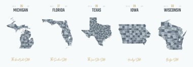
Vector set 6 of 10 Highly detailed silhouettes of US state maps, divided into counties with names and territory nicknames
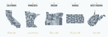
Vector set 7 of 10 Highly detailed silhouettes of US state maps, divided into counties with names and territory nicknames

Satellite map of province of Cremona, towns and roads, buildings and connecting roads of surrounding areas. Lombardy, Italy. Map roads, ring roads

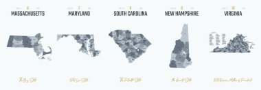
Vector set 10 of 10 Highly detailed silhouettes of US state maps, divided into counties with names and territory nicknames
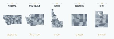
Vector set 9 of 10 Highly detailed silhouettes of US state maps, divided into counties with names and territory nicknames
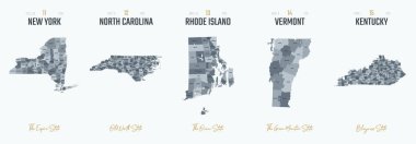
Vector set 3 of 10 Highly detailed silhouettes of US state maps, divided into counties with names and territory nicknames

Dc outline on white background, vector illustration
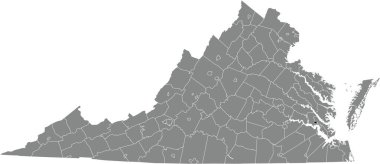
Black highlighted location map of the Williamsburg independent city inside gray administrative map of the Federal State of Virginia, USA

Czech Republic outline map isolated on white background
Vector set 2 of 10 Highly detailed silhouettes of US state maps, divided into counties with names and territory nicknames

Satellite map of Province of Campobasso towns and roads, buildings and connecting roads of surrounding areas. Molise region, Italy. Map roads, ring roads
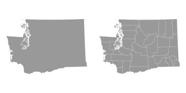
Washington state gray maps. Vector illustration.

Baldwin County, Alabama (Counties in Alabama, United States of America,USA, U.S., US) map vector illustration, scribble sketch Baldwin map

Modern City skyline . city silhouette. vector illustration in flat design
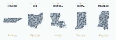
Vector set 4 of 10 Highly detailed silhouettes of US state maps, divided into counties with names and territory nicknames
Construction thin line icon set for web and mobile. Set includes -house, playhouse, house with garage, buildings, shop store. Modern minimalistic flat design. Vector dark grey icon on light grey

Seattle City ( United States cities, United States of America, usa city) map vector illustration, scribble sketch City of Seattle map