10 FREE IMAGES of ShutterstockTry Shutterstock and Get 10 Free Images

isolated editable vector map SVG, Vector And Clipart Images

() isolated editable vector map SVG Vectors and Transparent background isolated editable vector map ClipArts. All Download the royalty free graphic in the form of SVG, PNG, EPS, AI or PSD.

Description:

Usage ideas:

Dotted world map on white clipart svg vector

Dotted world map on white

Saharanpur Division Highlighted in Uttar Pradesh State Map of India clipart svg vector

Saharanpur Division Highlighted in Uttar Pradesh State Map of India

Ayodhya District orange color Map of Uttar Pradesh, India clipart svg vector

Ayodhya District orange color Map of Uttar Pradesh, India

Amethi District green Map of Uttar Pradesh, India clipart svg vector

Amethi District green Map of Uttar Pradesh, India

Agra District Vector Map with Bold blue Outline of Uttar Pradesh, India clipart svg vector

Agra District Vector Map with Bold blue Outline of Uttar Pradesh, India

Ambedkar District Map of Uttar Pradesh, India clipart svg vector

Ambedkar District Map of Uttar Pradesh, India

Kanpur Dehat District Vector Map with Bold Black Outline of Uttar Pradesh, India clipart svg vector

Kanpur Dehat District Vector Map with Bold Black Outline of Uttar Pradesh, India

Jhansi District Map of Uttar Pradesh, India clipart svg vector

Jhansi District Map of Uttar Pradesh, India

Meerut Division map of Uttar Pradesh State India clipart svg vector

Meerut Division map of Uttar Pradesh State India

Kanpur Division map of Uttar Pradesh State India clipart svg vector

Kanpur Division map of Uttar Pradesh State India

Basti Division Highlighted in Uttar Pradesh State Map of India clipart svg vector

Basti Division Highlighted in Uttar Pradesh State Map of India

Kasganj (Kanshiram Nagar) District Vector Map with Bold Black Outline clipart svg vector

Kasganj (Kanshiram Nagar) District Vector Map with Bold Black Outline

Bareilly Division Highlighted in Uttar Pradesh State Map of India clipart svg vector

Bareilly Division Highlighted in Uttar Pradesh State Map of India

Azamgarh Division Highlighted in Uttar Pradesh State Map of India clipart svg vector

Azamgarh Division Highlighted in Uttar Pradesh State Map of India

Agra Division Highlighted in Uttar Pradesh State Map of India clipart svg vector

Agra Division Highlighted in Uttar Pradesh State Map of India

Lucknow Division Highlighted in Uttar Pradesh State Map of India clipart svg vector

Lucknow Division Highlighted in Uttar Pradesh State Map of India

Kanpur Division Highlighted in Uttar Pradesh State Map of India clipart svg vector

Kanpur Division Highlighted in Uttar Pradesh State Map of India

Mirzapur Division map of Uttar Pradesh State India clipart svg vector

Mirzapur Division map of Uttar Pradesh State India

Kaushambi District Vector Map with Bold Black Outline clipart svg vector

Kaushambi District Vector Map with Bold Black Outline

Balrampur District Vector Map with Bold red Outline of Uttar Pradesh, India clipart svg vector

Balrampur District Vector Map with Bold red Outline of Uttar Pradesh, India

Ballia District green color Map of Uttar Pradesh, India clipart svg vector

Ballia District green color Map of Uttar Pradesh, India

Aligarh Division Highlighted in Uttar Pradesh State Map of India clipart svg vector

Aligarh Division Highlighted in Uttar Pradesh State Map of India

Balrampur District Map of Uttar Pradesh, India clipart svg vector

Balrampur District Map of Uttar Pradesh, India

Ambedkar District Vector Map with yellow Outline of Uttar Pradesh, India clipart svg vector

Ambedkar District Vector Map with yellow Outline of Uttar Pradesh, India

Kasganj (Kanshiram Nagar) District Map of Uttar Pradesh, India clipart svg vector

Kasganj (Kanshiram Nagar) District Map of Uttar Pradesh, India

Prayagraj Division map of Uttar Pradesh State India clipart svg vector

Prayagraj Division map of Uttar Pradesh State India

Bareilly Division map of Uttar Pradesh State India clipart svg vector

Bareilly Division map of Uttar Pradesh State India

Jhansi Division map of Uttar Pradesh State India clipart svg vector

Jhansi Division map of Uttar Pradesh State India

Uttar Pradesh state map Uttar Pradesh state map illustration with all dist, India clipart svg vector

Uttar Pradesh state map Uttar Pradesh state map illustration with all dist, India

Clean vector map of New Zealand composed of evenly spaced green dots on a white background. Ideal for use in modern infographics, digital presentations, educational materials, and minimalist design projects. clipart svg vector

Clean vector map of New Zealand composed of evenly spaced green dots on a white background. Ideal for use in modern infographics, digital presentations, educational materials, and minimalist design projects.

Lalitpur District Vector Map with Bold Black Outline clipart svg vector

Lalitpur District Vector Map with Bold Black Outline

Lakhimpur Kheri District Map of Uttar Pradesh, India clipart svg vector

Lakhimpur Kheri District Map of Uttar Pradesh, India

Bareilly District green Map of Uttar Pradesh, India clipart svg vector

Bareilly District green Map of Uttar Pradesh, India

Jalaun District Vector Map of Uttar Pradesh state, India clipart svg vector

Jalaun District Vector Map of Uttar Pradesh state, India

Amroha District green Map of Uttar Pradesh, India clipart svg vector

Amroha District green Map of Uttar Pradesh, India

Aligarh District Map of Uttar Pradesh, India clipart svg vector

Aligarh District Map of Uttar Pradesh, India

Varanasi Division map of Uttar Pradesh State India clipart svg vector

Varanasi Division map of Uttar Pradesh State India

Basti Division map of Uttar Pradesh State India clipart svg vector

Basti Division map of Uttar Pradesh State India

Lucknow Division map of Uttar Pradesh State India clipart svg vector

Lucknow Division map of Uttar Pradesh State India

Devipatan Division map of Uttar Pradesh State India clipart svg vector

Devipatan Division map of Uttar Pradesh State India

Moradabad Division Highlighted in Uttar Pradesh State Map of India clipart svg vector

Moradabad Division Highlighted in Uttar Pradesh State Map of India

Lucknow District Map of Uttar Pradesh, India clipart svg vector

Lucknow District Map of Uttar Pradesh, India

Bahraich District blue Map of Uttar Pradesh, India clipart svg vector

Bahraich District blue Map of Uttar Pradesh, India

Hathras (Mahamaya Nagar) District Vector Map with Bold blue Outline of Uttar Pradesh, India clipart svg vector

Hathras (Mahamaya Nagar) District Vector Map with Bold blue Outline of Uttar Pradesh, India

Lakhimpur District Vector Map with yellow Black Outline clipart svg vector

Lakhimpur District Vector Map with yellow Black Outline

Aligarh District Vector Map with Bold Black Outline of Uttar Pradesh, India clipart svg vector

Aligarh District Vector Map with Bold Black Outline of Uttar Pradesh, India

Aligarh District Vector Map with Bold Black Outline of Uttar Pradesh, India clipart svg vector

Aligarh District Vector Map with Bold Black Outline of Uttar Pradesh, India

Azamgarh Division map of Uttar Pradesh State India clipart svg vector

Azamgarh Division map of Uttar Pradesh State India

Devipatan Division Highlighted in Uttar Pradesh State Map of India clipart svg vector

Devipatan Division Highlighted in Uttar Pradesh State Map of India

Maharajganj District Map of Uttar Pradesh, India clipart svg vector

Maharajganj District Map of Uttar Pradesh, India

Ayodhya Division map of Uttar Pradesh State India clipart svg vector

Ayodhya Division map of Uttar Pradesh State India

Jhansi Division Highlighted in Uttar Pradesh State Map of India clipart svg vector

Jhansi Division Highlighted in Uttar Pradesh State Map of India

Prayagraj Division Highlighted in Uttar Pradesh State Map of India clipart svg vector

Prayagraj Division Highlighted in Uttar Pradesh State Map of India

SAHARANPUR Division map of Uttar Pradesh State India clipart svg vector

SAHARANPUR Division map of Uttar Pradesh State India

Moradabad Division map of Uttar Pradesh State India clipart svg vector

Moradabad Division map of Uttar Pradesh State India

Devipatan Division map of Uttar Pradesh State India clipart svg vector

Devipatan Division map of Uttar Pradesh State India

Baghpat District Vector Map with Bold colorful Outline of Uttar Pradesh, India clipart svg vector

Baghpat District Vector Map with Bold colorful Outline of Uttar Pradesh, India

Ballia District Vector Map with Bold blue Outline of Uttar Pradesh, India clipart svg vector

Ballia District Vector Map with Bold blue Outline of Uttar Pradesh, India

Meerut Division Highlighted in Uttar Pradesh State Map of India clipart svg vector

Meerut Division Highlighted in Uttar Pradesh State Map of India

Varanasi Division Highlighted in Uttar Pradesh State Map of India clipart svg vector

Varanasi Division Highlighted in Uttar Pradesh State Map of India

Barabanki District Vector Map with Bold Black Outline of Uttar Pradesh, India clipart svg vector

Barabanki District Vector Map with Bold Black Outline of Uttar Pradesh, India

Kanpur Dehat District Map of Uttar Pradesh, India clipart svg vector

Kanpur Dehat District Map of Uttar Pradesh, India

Azamgarh District blue Map of Uttar Pradesh, India clipart svg vector

Azamgarh District blue Map of Uttar Pradesh, India

Agra District Map of Uttar Pradesh, India clipart svg vector

Agra District Map of Uttar Pradesh, India

Aligarh Division map of Uttar Pradesh State India clipart svg vector

Aligarh Division map of Uttar Pradesh State India

Gorakhpur Division map of Uttar Pradesh State India clipart svg vector

Gorakhpur Division map of Uttar Pradesh State India

Kushinagar District Map of Uttar Pradesh, India clipart svg vector

Kushinagar District Map of Uttar Pradesh, India

Jhansi District Vector Map with Bold yellow Outline of Uttar Pradesh, India clipart svg vector

Jhansi District Vector Map with Bold yellow Outline of Uttar Pradesh, India

Jaunpur District Vector Map with Bold green Outline of Uttar Pradesh, India clipart svg vector

Jaunpur District Vector Map with Bold green Outline of Uttar Pradesh, India

Jaunpur District green Map of Uttar Pradesh, India clipart svg vector

Jaunpur District green Map of Uttar Pradesh, India

Ayodhya District Vector Map with Bold orange Outline of Uttar Pradesh, India clipart svg vector

Ayodhya District Vector Map with Bold orange Outline of Uttar Pradesh, India

Amethi District Vector Map with Bold Bblue Outline of Uttar Pradesh, India clipart svg vector

Amethi District Vector Map with Bold Bblue Outline of Uttar Pradesh, India

Auraiya District Map of Uttar Pradesh, India clipart svg vector

Auraiya District Map of Uttar Pradesh, India

Amroha District Vector Map with Bold red Outline of Uttar Pradesh, India clipart svg vector

Amroha District Vector Map with Bold red Outline of Uttar Pradesh, India

Kanpur Nagar District Map of Uttar Pradesh, India clipart svg vector

Kanpur Nagar District Map of Uttar Pradesh, India

Azamgarh District Vector Map with Bold blue color Uttar Pradesh, India clipart svg vector

Azamgarh District Vector Map with Bold blue color Uttar Pradesh, India

Baghpat District Map of Uttar Pradesh, India clipart svg vector

Baghpat District Map of Uttar Pradesh, India

Barabanki District blue Map of Uttar Pradesh, India clipart svg vector

Barabanki District blue Map of Uttar Pradesh, India

Moradabad Division Highlighted in Uttar Pradesh State Map of India clipart svg vector

Moradabad Division Highlighted in Uttar Pradesh State Map of India

Gorakhpur Division Highlighted in Uttar Pradesh State Map of India clipart svg vector

Gorakhpur Division Highlighted in Uttar Pradesh State Map of India

Kaushambi District Map of Uttar Pradesh, India clipart svg vector

Kaushambi District Map of Uttar Pradesh, India

Bahraich District Vector Map with Bold blue Outline of Uttar Pradesh, India clipart svg vector

Bahraich District Vector Map with Bold blue Outline of Uttar Pradesh, India

Jalaun District Map of Uttar Pradesh, India clipart svg vector

Jalaun District Map of Uttar Pradesh, India

Ayodhya Division map of Uttar Pradesh State India clipart svg vector

Ayodhya Division map of Uttar Pradesh State India

Kanpur Nagar District Vector Map with Bold pink Outline clipart svg vector
Kanpur Nagar District Vector Map with Bold pink Outline

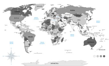
Political world map on white background, with every state labeled and selectable (labeled in Layers panel also). Versatile file, turn on an off visibility and color of each country in one click. clipart svg vector

Political world map on white background, with every state labeled and selectable (labeled in Layers panel also). Versatile file, turn on an off visibility and color of each country in one click.

Outlines World map isolated on white background, editable stroke clipart svg vector
Outlines World map isolated on white background, editable stroke

Isolated black and white map of the word that is editable clipart svg vector

Isolated black and white map of the word that is editable

Netherlands vector map. Editable template with regions, cities, red pins and blue surface on white background. clipart svg vector

Netherlands vector map. Editable template with regions, cities, red pins and blue surface on white background.

Spain vector map. Editable template with regions, cities, red pins and blue surface on white background. clipart svg vector

Spain vector map. Editable template with regions, cities, red pins and blue surface on white background.

Vector map of Montenegro. Country map with division, cities and capital Podgorica. Political map,  world map, infographic elements. clipart svg vector

Vector map of Montenegro. Country map with division, cities and capital Podgorica. Political map, world map, infographic elements.

Sehore District Map Highlighted on Madhya Pradesh State Map clipart svg vector

Sehore District Map Highlighted on Madhya Pradesh State Map

Prayagraj District Highlighted in Uttar Pradesh State Map of India clipart svg vector

Prayagraj District Highlighted in Uttar Pradesh State Map of India

Pakistan vector map. Editable template with regions, cities, red pins and blue surface on white background. clipart svg vector

Pakistan vector map. Editable template with regions, cities, red pins and blue surface on white background.

Argentina vector map. Editable template with regions, cities, red pins and blue surface on white background. clipart svg vector

Argentina vector map. Editable template with regions, cities, red pins and blue surface on white background.

Jhabua District Map Highlighted on Madhya Pradesh State Map clipart svg vector

Jhabua District Map Highlighted on Madhya Pradesh State Map

Ghana Map Vector Illustration - Silhouette, Outline, Ghana Travel and Tourism Map clipart svg vector

Ghana Map Vector Illustration - Silhouette, Outline, Ghana Travel and Tourism Map

Martinique vector map. Editable template with regions, cities, red pins and blue surface on white background. clipart svg vector

Martinique vector map. Editable template with regions, cities, red pins and blue surface on white background.

Taiwan vector map. Editable template with regions, cities, red pins and blue surface on white background. clipart svg vector

Taiwan vector map. Editable template with regions, cities, red pins and blue surface on white background.

Ratlam District Map Highlighted on Madhya Pradesh State Map clipart svg vector

Ratlam District Map Highlighted on Madhya Pradesh State Map