
South Korea map highlighted in South Korea flag colors, gray map with neighboring countries.

Political map of Japan, North Korea and South Korea with the capitals Tokyo, Pyongyang and Seoul, with national borders, some important cities, with rivers and lakes. Vector illustration with english labeling and scale.

Korean map and landmarks for traviling in Korea illustration design

Map of South Korea high quality vector illustration - Hand made line drawing of South Korean borders

South Korea blank detailed outline map set

Coronavirus COVID-19 concept for Korea. Sick Earth in a medical mask with Korean flag fights the virus

Map Of Korea Attractions Vector And Illustration.
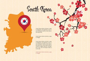
South Korea Map Korean Flag Pointer Beautiful Blossom Of Sakura Branch Decoration Template Banner With Copy Space Vector Illustration
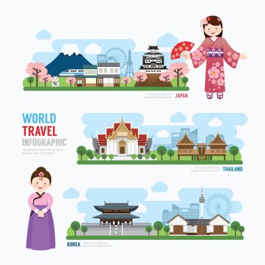
Travel and Building asia Landmarks of Korea, japan, Thailand, Template Design Infographic. Concept Vector Illustration
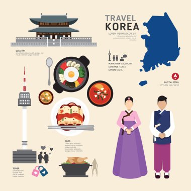
Korea Flat Icons Design Travel Concept.Vector

Gyeonggi-do province map vector illustration

Gyeonggi-do province map vector illustration
Flag of United Korea. Glassy Icon Square Shape. This is File from the Collection Flags of Asia

Korean Peninsula region, political map. Peninsular region Korea in East Asia, divided between the 2 countries North and South Korea, bordered by China and Russia, separated from Japan by Korea Strait.

Gyeonggi-do province map vector illustration

South Korea map abstract geometric mesh polygonal light concept with black and white glowing contour lines countries and dots on dark background. Vector illustration

Map of administrative divisions of South Korea

Map of administrative divisions of North Korea

Gyeonggi-do province map vector illustration

Gyeonggi-do province map vector illustration

Highly detailed editable political map with separated layers. South Korea.

South Korea map and flag - highly detailed vector illustration
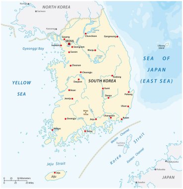
Vector map of the Republic of Korea, South Korea

Political map of Korean and Japanese region, South Korea, North Korea and Japan. Black outline map with black labeling on white background. Vector illustration.

Gyeonggi-do province map vector illustration

Gyeonggi-do province map vector illustration

Gyeonggi-do province map vector illustration

Gyeonggi-do province map vector illustration

Gyeonggi-do province map vector illustration

South Korea - detailed blue country map with cities, regions, location on world map and globe. Infographic icons. Vector illustration

South Korea map and flag - highly detailed vector illustration

Gyeonggi-do province map vector illustration

Gyeonggi-do province map vector illustration

Gyeonggi-do province map vector illustration

Gyeonggi-do province map vector illustration

Korea map illustration in blockchain technology network style isolated on white background. Block chain polygon peer to peer network connected lines technique. Cryptocurrency fintech business concept

Gyeonggi-do province map vector illustration

Gyeonggi-do province map vector illustration

Korea map, north and south administrative division with region names, color map isolated on white background vector

Gyeonggi-do province map vector illustration

Gyeonggi-do province map vector illustration

Gyeonggi-do province map vector illustration

Gyeonggi-do province map vector illustration

Political vector map of Korea. South Korea and North Korea

Administrative map of the South Korean province of Gyeonggi and the capital Seoul

Map of administrative divisions of South Korea

North Korea South Korea Japan China Russia Mongolia Map - Detailed Info Graphic Vector Illustration

Blue map of South Korea administrative divisions with travel infographic icons. Vector illustration

Gyeonggi-do province map vector illustration

Gyeonggi-do province map vector illustration

Gyeonggi-do province map vector illustration

Outline of South Korea map

South Korea map and flag - highly detailed vector illustration

Gyeonggi-do province map vector illustration

Gyeonggi-do province map vector illustration

Gyeonggi-do province map vector illustration

North Korea South Korea Japan China Russia Mongolia Map - Detailed Vector Illustration

Gyeonggi-do province map vector illustration

Gyeonggi-do province map vector illustration

Gyeonggi-do province map vector illustration

Gyeonggi-do province map vector illustration

Gyeonggi-do province map vector illustration

Flag and Map of South Korea symbol isolated on Light blue background. Vector illustration.

South Korea map and flag - highly detailed vector illustration

Korean Peninsula Map - Detailed Vector Illustration

Korean Peninsula region, gray political map. Peninsular region Korea in East Asia, divided between North and South Korea, bordered by China and Russia, and separated from Japan by the Korea Strait.
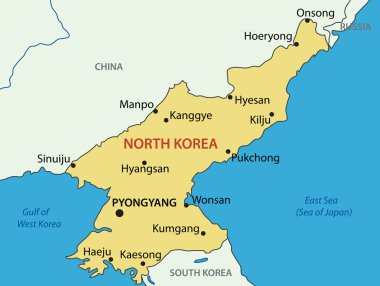
Democratic 's Republic of Korea - vector map

Korean Peninsula, Demilitarized Zone, political map. North and South Korea with Military Demarcation Line, capitals, borders, most important cities and rivers. English labeling. Illustration. Vector.

Korean Peninsula Map - Vintage Detailed Vector Illustration
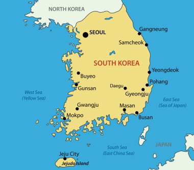
Republic of Korea - vector map

Political map of Korean and Japanese region, South Korea, North Korea and Japan. Turquoise blue map with white labeling on white background. Vector illustration.

World map with magnifying on South Korea. Blue earth globe with South Korea flag pin. Zoom on South Korea map. Vector Illustration

South Korea travel map in flat design - Bulguksa word in Chinese on the temple

Korean peninsula countries political map with North and South Korea and national borders. Gray illustration with English labeling and scaling on white background.

Korean Peninsula Map - Detailed Vector Illustration

South Korea map, Republic of Korea, administrative division with state names, color map isolated on white background vector

Korean Peninsula large detailed physical map retro colors.

Korea map white blue card paper 3D vector

Administrative vector map of the South Korean province of Gangwon-do with flag

Infographic travel and landmark korea map shape template design. country navigator concept vector illustration, graphic or web design layout.

Korea, Republic of network map. Abstract polygonal map design. Internet connections vector illustration.

Map of administrative divisions of North Korea

North and South Korea map separate region names individual card blackboard chalkboard vector

Japan country map and flag, vector illustration.

North Korea Physical Map Isolated on White. Vector illustration.

South Korea 3d map with borders of regions. Vector illustration

Abstract vector color map of Korea countries coloured by national flag

South Korea map and flag - highly detailed vector illustration

North Korea and South Korea country map and flag, vector illustration.

Korea, Democratic People's Republic Of network map. Abstract polygonal map design. Internet connections vector illustration.
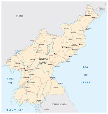
North Korea road vector map

North and South Korea map separate region names individual card paper 3D natural vector

South Korea Physical Map. On White. Vector illustration.

Asia centered world map with magnified glass on North Korea. Focus on map of North Korea on Pacific-centric World Map.

Map Of Korea Attractions Vector And Illustration.

Map of Incheon state of South Korea and location on Korean map

Korea, Republic of label flat sticker design. Patriotic country map round lable. Country sticker vector illustration.

Map of South Korea and flags of South Korea on flag stand.

Political vector map of Korea. South Korea and North Korea

South Korea round sign. Futuristic satelite view of the world centered to South Korea. Country badge with map, round text and binary background. Trendy vector illustration.