
Liechtenstein political map with capital Vaduz, national borders, important cities and rivers. English labeling and scaling. Illustration.

Liechtenstein map icon vector illustration design

Liechtenstein Map Flag. Map of the Principality of Liechtenstein with national flag isolated on white background. Vector Illustration.

America centric world map with magnified Liechtenstein map. Green polygonal world map.

European countries set, maps and flags, part 2

Zoom on Liechtenstein Map and Flag. World Map

Western europe - vector maps of territories

Liechtenstein map with shadow effect

Liechtenstein Flag National Europe Emblem Heart Icon Vector Illustration Abstract Design Element

Liechtenstein Map Pin with National Flag on Open World Map.

Flag of liechtenstein. Flag icon. Standard colors. Standard size. Rectangular flag.

Isometric Map of Liechtenstein. Simple 3D Map. Vector Illustration - EPS 10 Vector

Liechtenstein flag and map set. liechtenstein flag in official colors and proportions. independence day 24 april, map, circle and heart shaped liechtenstein

Liechtenstein Highlighted on Europe Map with Flag Icon.

Liechtensyein flag and map set. liechtensyein flag in official colors and proportions. independence day 24 april, map, circle and heart shaped liechtensyein

Liechtenstein flag and map set. liechtenstein flag in official colors and proportions., map
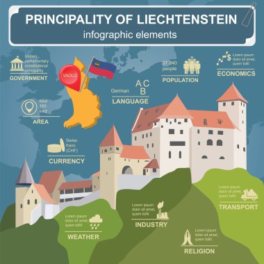
Liechtenstein infographics, statistical data, sights. Vector illustration

Vector detailed map of Liechtenstein country

Liechtenstein vector set. Isolated.

Vector color map of Liechtenstein country

European political map set with map pointers
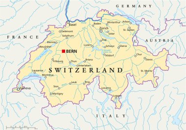
Political map of Switzerland with capital Bern, national borders, most important cities, rivers and lakes with english labeling and scale. Vector illustration using transparencies.
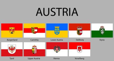
All Flags of regions of Austria. Vector illustraion

Administrative and political vector map of switzerland

Set of grunge rubber stamps with names of Liechtenstein cities, vector illustration

Blank outline map of Europe. Simplified wireframe map of black lined borders. EPS10 vector illustration.

Russia on map of europe

Blank outline map of Europe. Simplified vector map made of black outline on white background.

Blank outline map of Europe. Simplified vector map made of black outline on white background

Map of Europe 1985

Blank map of Europe
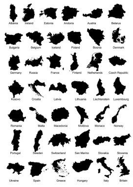
Layered vector illustration of 42 Europe Country Maps.

Political map of Europe with state names - vector illustration
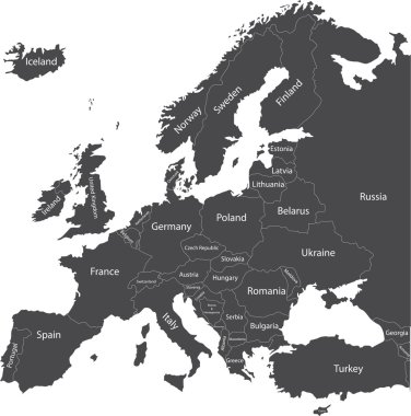
Europe political map with country names

Europe map and flags

Europe map mixed with countries national flags. All european flags vector collection

Map of Europe with sovereign countries, ministates and Kosovo included. Simplified vector map in black color isolated on white background

Outline map of Europe. Simplified wireframe map of black lined borders. Vector illustration.

Green CMYK national map of LIECHTENSTEIN inside detailed gray blank political map of European continent with lakes on transparent background using Mercator projection

Europe map illustration

Administrative map of Europe

Map of Europe in gray on a white background

Simplified map of Liechtenstein outline. Fill and stroke are national colours.

White map markers with flags - Europe. Original colors

Europe countries flags in pointer icons

All flags of Europe. Vector Illustration. flag set

Vector schematic map of the European free trade Association (EFTA).

All European countries flags like pins

Set of wave buttons with European countries flags

All European countries with provinces and different colors for EU, Ex Soviet and Ex Yugoslavia countries

Black map markers with flags - Europe. Original colors

"An old map" of Europe with flags of countries in the form of spots

All European countries pinned with their flags

Forty nine flags of European countries - alphabetical order with name. Set of 2d geolocation signs like national flags of Europre. Forty nine geolocation signs for your web site design, logo, app, UI. EPS10.
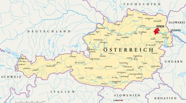
Political map of Austria with the capital Vienna, national borders, most important cities, rivers and lakes. Vector illustration with german labeling and scale.
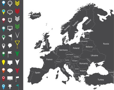
Europe map
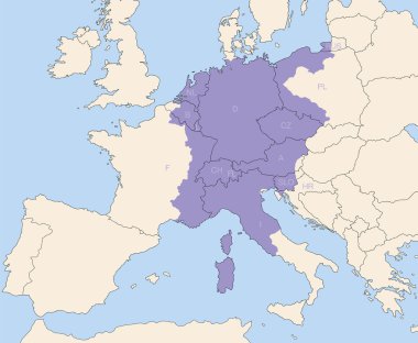
Holy Roman Empire, superpower in europe during the middle ages, at its greatest extent around 1200 AD colored purple - todays states that were partly or wholly included are lettered.

Europe countries flags in pointer icons

World map with magnifying on Liechtenstein. Blue earth globe with Liechtenstein flag pin. Zoom on Liechtenstein map. Vector Illustration

European country set with map pointers

European Icons Round Indicator Flags and Map Set2. EU Europe Map, Zip includes 300 dpi JPG, Illustrator CS, EPS10. Vector with transparency.

Sketch Liechtenstein letter text map, Liechtenstein - in the shape of the continent, Map of Principality of Liechtenstein - brown and black vector illustration

Counties of West Europe, Vector Icon Set in modern style

Liechtenstein infographics, statistical data, sights. Vector illustration

Set of paper map markers for maps and navigators, Vector illustration. Liechtenstein

Austria infographics, statistical data, sights. Vector illustration

3d map of Liechtenstein with borders of regions
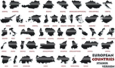
Set of European countries in a nice sticker version.
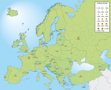
European countries with provinces and capital population

Illustration of europe map with flag of liechtenstein, from 1 july 2013

Liechtenstein Map Flag Vector illustration Eps 10.

All european maps and flags. Vector

Vector map Liechtenstein. Isolated vector Illustration. Black on White background. EPS 10 Illustration.

Austria infographics, statistical data, sights. Vector illustration

European country set with map pointers

Set of All Citizenship Travel Passport of Europe Euro in Vector

Map of Liechtenstein - vector illustration

Europe map with flags, Europe map colored in with their flag. Vector Illustration.

European country set with map pointers

High detailed national flags of European countries, clipped in round shape glossy metal buttons, vector , part 2

European countries flags set on a continent shaped background, vector graphic

Europe with highlighted Liechtenstein map and flag

Set of vector icons with Liechtenstein flag

Set of rectangle buttons with European countries flags

Set of wave buttons with European countries flags

Layered editable vector illustration country map of Liechtenstein,which contains two versions, colorful country flag version and black silhouette version.

Set of vector icons with Liechtenstein flag

Liechtenstein on world globe with flag and regional map of Liechtenstein. Vector Illustration.

Overview map of the Swiss canton of Graubuenden

Vintage European Flags with Worn Texture and Wave Motion

Rectangular Maps of Europe with Flag Pins. Europe Map Collection.

Liechtenstein Map Outline Silhouette, European Microstate Border

Liechtenstein Map Silhouette with National Flag Design

Stylish Vertical Pin Icons Showcasing European Country Flags.

3D Liechtenstein map with flag. Three dimensional map of Liechtenstein with shadow. Flag of Liechtenstein on white background for your design, app, UI. Stock vector. EPS10.

Triesen, Triesenberg, Vaduz outline maps

Detailed Liechtenstein Map Collection with Outline, Silhouette, Municipalities, and Flag Overlay Variations

Planken, Ruggell, Schaan, Schellenberg outline maps

Pennant Flags of European Countries on a Colorful World Map. A vibrant collection of triangular pennant flags

Liechtenstein flag with heart shape in pixel art style