
Blank map Piedmont of Italy. High quality map Region Piedmont with municipalities on transparent background for your web site design, logo, app, UI. EPS10.

Piedmont blank detailed outline map set
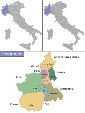
Piedmont is one of the twenty administrative regions of Italy, in the northwest of the country

Piedmont region in northwest Italy, gray political map. Second largest Italian region with capital Turin bordering France, Switzerland, and regions Aosta Valley, Lombardy, Emilia-Romagna, and Liguria.

Silhouettes of european country Italia and the regions

Vector Political Map of Italy with full Region and Provinces Boundaries, completed with Italian and EU flags.

Piedmont administrative and political vector map with flag

Vector illustrated map of Italy with regions and administrative divisions, and neighbouring countries and territories. Editable and clearly labeled layers.

Vector blank map of Italy with regions and administrative divisions. Editable and clearly labeled layers.
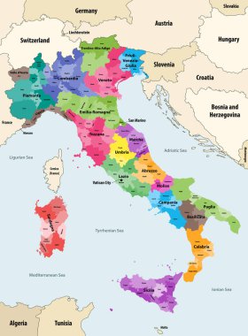
Italy provinces colored by regions vector map with neighbouring countries and territories

Map of Italy divided into 20 administrative regions. White land and black outline borders. Simple flat vector illustration.

Silhouette and colored map of Italy regions

Silhouettes of european country Italy and the regions

Administrative and political map of the metropolitan city of Genoa in the region of Liguria Italy

Vector map of the autonomous Italian region of Aosta Valley, Italy

Vector Political Map of Italy with full Region and Provinces Boundaries, completed with flags and a 3d Globe of Earth centered on Italy.

Map of Italy divided into 20 administrative regions. Grey land, white borders and black labels. Simple flat vector illustration.

Silhouettes of european country Italy and the regions

The detailed map of the Italy with regions or states and cities, capital

Italy map of regions and provinces names in sketch lettering. Vector Italian flag of Sicily peninsula, Sardinia island or Venice Piemonte, Lombardia or Genoa and Alto Adige, Trentino and Toscana

Map of Italy divided into 20 administrative regions in four colors. White labels. Simple flat vector illustration.
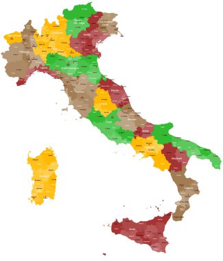
A detailed, colorful map of Italy with all provinces and big cities.

Vector map of Italy with regions and administrative divisions. Editable and clearly labeled layers.

Vector blank map of Italy with regions and administrative divisions. Editable and clearly labeled layers.

Blank map of Italy divided into 20 administrative regions.

Piedmont region in northwest Italy, political map. Second largest Italian region with capital Turin, bordering France, Switzerland, and the regions Aosta Valley, Lombardy, Emilia-Romagna, and Liguria.
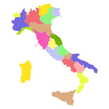
Italy map isolated on a white background. Vector illustration.
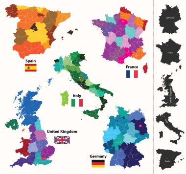
European regions map
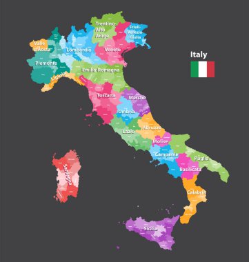
Vector Italy provinces map colored by regions. All layers detachable and labeled.

Regions of Italy. Map of regional country administrative divisions. Colorful vector illustration.

Liguria and the Italian Riviera, the Ligurian Riviera, political map. Region of north-western Italy, with capital Genoa. A narrow coastal strip between Ventimiglia and La Spezia, on the Ligurian Sea.

The detailed map of the Italy with regions

Italian region Piemonte word cloud map silhouette made of local names of foods and wines

Colorful map of Italy vector silhouette illustration isolated on white background. Autonomous communities of Italy. Detailed Italian regions administrative divisions, separated provinces. outline map.

Set Flags of the states of Italy, All Italian regions flag collection
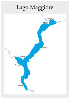
Small outline map of the upper Italian Lake Maggiore, Italy.

Highly detailed physical map of Italy,in vector format,with all the relief forms,regions and big cities.

Sardinia or Sardegna official regional flag and map, Italy, vector illustration

Coat of arms of the state of Italy, All Italian regions emblem collection

South Carolina state map, USA. Set of South Carolina maps with outline border, counties and US states map. Black and white color vector illustration.
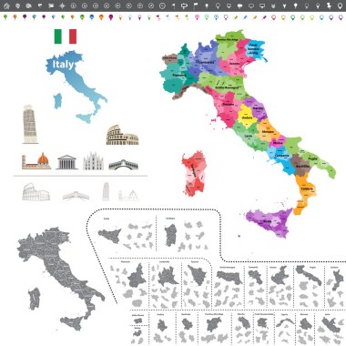
Vector Italy map colored by regions

A large administrative map of Italy with all provinces and communes.

Silhouettes of european country Italy and the regions

Silhouettes of european country Italy and the regions

Italy map isolated on blue background. European country. Vector template for website, design, cover, infographics. Graph illustration.

Countries winemakers - stylized maps from silhouettes of wine bottles, glasses and decanters. Map of Italy.

Travel around the world. Italy. Watercolor map

Vector map of Italy province gray color

Silhouette map of the region of Tuscany in Italy

Vector Political Map of Italy with full Region and Provinces Boundaries, completed with flags and a 3d Globe of Earth centered on Italy.

Map of Italy divided into 20 administrative regions in four shades of grey. White labels. Simple flat vector illustration.

Silhouettes of european country Italia and the regions
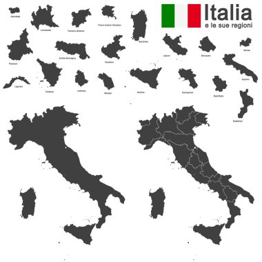
Silhouettes of european country Italia and the regions

Vector illustration of the famous sausages from different regions of Italy

Abstract map of Italy isolated on white

Map of Italy divided into 20 administrative regions in four shades of yellow. White labels. Simple flat vector illustration.

Silhouettes of european country Italy and the regions

Grey Vector Political Map of Italy with full Region and Provinces Boundaries, completed with flags and a 3d Globe of Earth centered on Italy.

Silhouettes of european country Italy and the regions
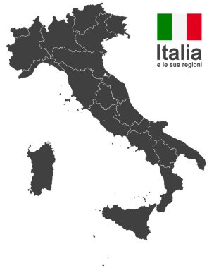
Silhouettes of european country Italy and the regions

The dark silhouette map of Piedmont region on white background

Vector illustration of the famous sausages from different regions of Italy

Vector illustration of the famous sausages from different regions of Italy

Vector illustration of the famous sausages from different regions of Italy

All Flags provinces of Italy. Vector illustraion

Turin silhouette skyline. Italy - Turin vector city, italian linear architecture, buildings. Turin line travel illustration, landmarks. Italy flat icon, italian outline design banner
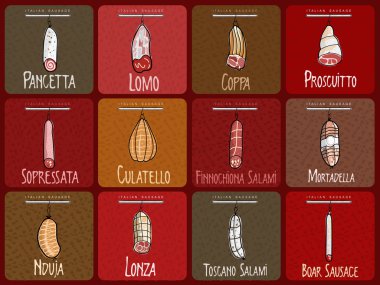
Vector illustration of the famous sausages from different regions of Italy

Vector illustration of the famous sausages from different regions of Italy

Vector illustration of the famous sausages from different regions of Italy

All flags of the Italy regions. vector illustrations

Vector illustration of the famous sausages from different regions of Italy

Vector illustration of the famous sausages from different regions of Italy
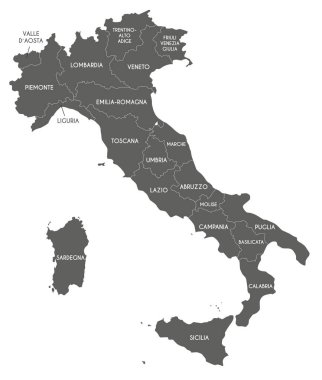
Vector map of Italy with regions and administrative divisions. Editable and clearly labeled layers.

Vector illustration of the famous sausages from different regions of Italy

The gray map of Piedmont region isolated on white background

Vector illustration of the famous sausages from different regions of Italy

High Quality map Northwest region of Italy, with borders of the provinces

Vector illustration of the famous sausages from different regions of Italy

Sardinia or Sardegna official regional flag and coat of arms, Italy, vector illustration

Vector illustration of the famous sausages from different regions of Italy

Turin City (Italian Republic, Italy, Piedmont) map vector illustration, scribble sketch City of Turin map

Piedmont (Autonomous region of Italy) map vector illustration, scribble sketch Piemonte map

The grayscale map of Piedmont region with labels

Piedmont (South Carolina) blank outline map

Molise, Piedmont, Sardinia, Sicily outline maps

Italy, map 3D of the regions of the Italian Republic with regional coats of arms, vector illustration

Italy, round icons of the flags of the regions of the Italian Republic on the map, vector illustration

Piedmont outline map isolated on white background, Italy

Piedmont (Oklahoma) blank outline map

Piedmont region blank outline map set

Piedmont (South Dakota) blank outline map