
Seychelles Political Map with capital Victoria, important cities and islands and an overview map of the whole archipelago. English labeling and scaling. Illustration.

Africa map - highly detailed vector illustration.

Seychelles
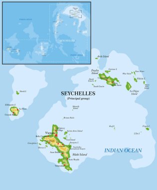
Seychelles islands highly detailed physical map

Seychelles map. Blank vector map of the Island. Borders of Seychelles for your infographic. Vector illustration.

Seychelles map vector, Seychelles flag vector, isolated Seychelles

Praslin and nearby islands, political map. Second largest islands of the Seychelles, a Republic and archipelagic state in the Indian Ocean. La Digue, Curieuse and Felicite Island, and smaller islands.

Seychelles map, islands with names, old paper background vector

Indian Ocean political map. Countries and borders. World's third largest ocean division, bounded by Africa, Asia, Antarctica and Australia. Named after India. Illustration. English labeling. Vector.

East africa administrative map with flags

Highly detailed physical map of Africa,in vector format,with all the relief forms,countries and big cities.

Highly detailed physical map of Africa,in vector format,with all the relief forms,countries and big cities.
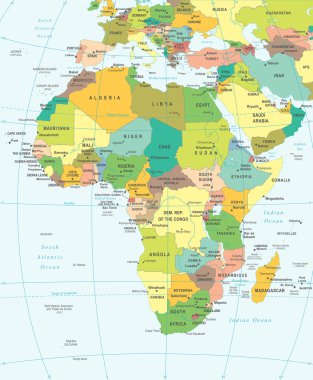
Africa map - highly detailed vector illustration.

Africa map - highly detailed vector illustration.

Praslin island (Republic of Seychelles, Indian Ocean, Inner Islands) map vector illustration, scribble sketch Ile de Palmes and Cousine map

Africa map - highly detailed vector illustration.

Fifty four Flags of African countries - alphabetical order with name. Set of 2d geolocation signs like national flags of Africa. Fifty four geolocation signs for your web site design, logo, app, UI. EPS10.
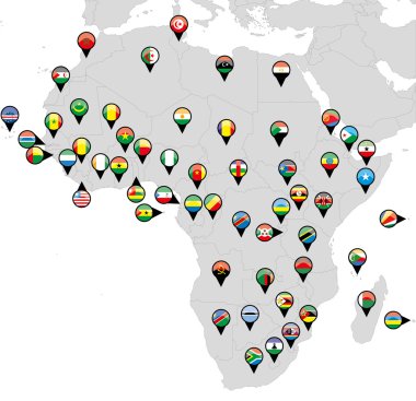
All African countries pinned with their flags
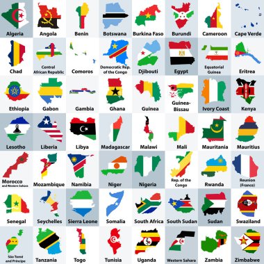
All African countries maps mixed with their national flags and arranged in alphabetical order
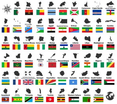
All vector high detailed maps and flags of African countries arranged in alphabetical order

Vector road map of Seychelles island of Mahe
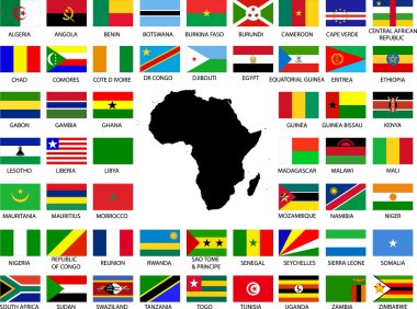
Collection of African flags with continent - vector

Black map collection, black contour maps of World. Map collection Part 19.

Vector Map Icon of the world in Globe form

Vector illustration icon, button set, collection of African Union members flags isolated on white background.
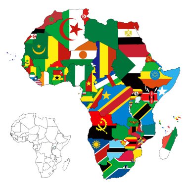
Vector illustration for the continent of Africa. Over 50 countries including several small islands, rivers and lakes not visible unless zoomed in. Very editable

Africa, Arabia Global World

Flags of Africa- complete set of flags in original colors over white background
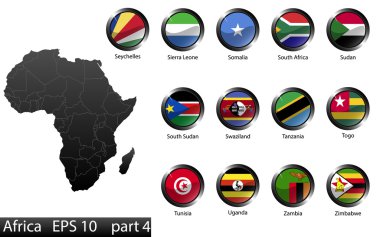
High detailed national flags of African countries, clipped in round shape glossy metal buttons, vector, part 4

Europe, North, South America, Africa Global World

Reunion map vector illustration. Global economy. Famous country. Eastern Africa. Africa.

White map markers with flags - Africa. Original colors. Vector EPS10 illustration
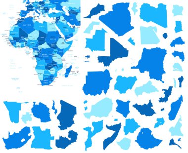
Vector illustration of Africa map.

Seychelles

A High Detail vector Map of the African continent with a classic color set. All countries are named with the respective english name

The flag of the Seychelles, showcasing national colors.

Vector Map Icon of the world in Globe form

Africa map - highly detailed vector illustration. Image contains land contours, country and land names, city names, water object names, navigation icons.

Administrative division of the Republic of Seychelles
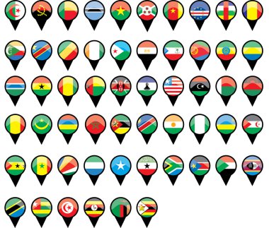
All African countries flags like pins

Vector illustration of Africa map and navigation icons.

Africa map - highly detailed vector illustration. Image contains land contours, country and land names, city names, water object names, navigation icons.

Vector Map Icon of the World Globe

Seychelles Map. Large group of people form to create a shape of Seychelles Map. vector illustration.

Africa, Middle East, Arabia and India Global World eps 10 vector illustration

Africa countries flags in pointer icons

Gray Seychelles map on light grey background. Gray Seychelles map - vector illustration.
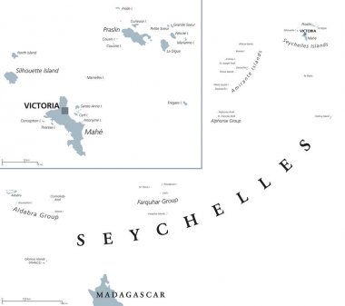
Seychelles political map with capital Victoria on the main island Mahe. Republic, archipelago and country in the Indian Ocean. Gray illustration isolated on white background. English labeling. Vector.

Vector map of Seychelles with high details

Southern africa - vector maps of territories

Background with Globe Icon 3D illustration, Glossy, Shiny Sphere with Global Map in Subtle Blues giving a transparent feel

Africa map - highly detailed vector illustration. Image contains land contours, country and land names, city names, water object names, navigation icons.

Vector Map Icon of the world in Globe form
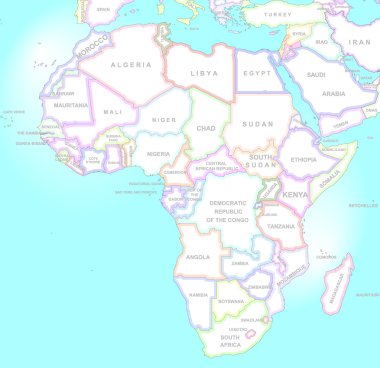
Africa map in vintage style

Africa, Middle East, Arabia and India Global World
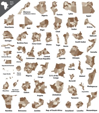
African vector isolated country maps

Vector Map Icon of the World, Globe

Seychelles map with names of Seychelles islands and flag seychelles, design glass card 3D vector

Vector Map Icon of the World Globe

Map marker with flag-set tenth

Folded paper map of Morocco with flag pin of Morocco. Vector Illustration
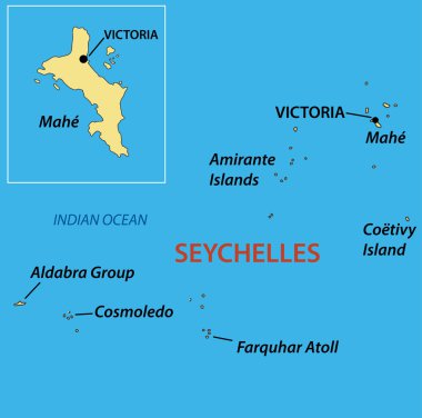
Republic of Seychelles - vector map

Marker from paper with flag for map - set eleventh. Vector illustration

Vector map Seychelles. Isolated vector Illustration. Black on White background. EPS 10 Illustration.

Vector map Seychelles. Isolated vector Illustration. Black on White background. EPS 10 Illustration.

Map marker with flag-set eleventh

Seychelles map with waving flag of country. Vector illustration.

Africa map - highly detailed vector illustration.
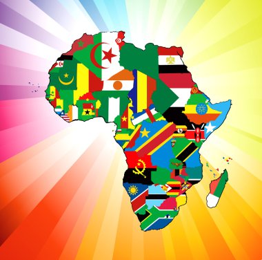
Vector illustration for the continent of Africa. Over 50 countries including several small islands, rivers and lakes not visible unless zoomed in. Very editable

South Africa, Madagascar, South America and Antarctica, South Pole

Black vector map of Seyschelles

African flags - vector

South Africa, Madagascar, South America and Antarctica, South Pole

Abstract rounded World Map with pinned detailed Seychelles map. Vector Illustration.

Vector map Seychelles. Isolated vector Illustration. Black on White background. EPS 10 Illustration.

Africa map - highly detailed vector illustration.

Flag of world. Vector icons

Map flag and symbol of Seychelles on a white background

World map with magnified Seychelles. Seychelles flag and map.

Seychelles National Map with flag illustration. Vector illustration with national flag and map (simplified shape) of Republic of Seychelles. Volume shadow on the map

Postage stamp with Africa flags. Set of 53 African flag. Vector Illustration.

Seychelles map on white background. vector illustration.

Seychelles Independence Day June 29. This is the Seychelles National Day and the day the country was granted independence from Britain in 1976. Design posters, cards, banners.

La Digue Logo. Map of La Digue with island name and flag. Attractive vector illustration.

Nautical Travel Stamp with Seychelles Flag and Anchor. Marine rubber stamp, with round rope border and anchor symbol on flag background. Vector illustration.

Stamp Postal Desroches Island of Seychelles. Map Silhouette rubber Seal. Design Retro Travel. Seal of Map Desroches Island grunge for your design. Seychelles. EPS10

National Flags of the African countries, Postage Flag Set. African Flags with World Map.

La Digue flag badge. Vintage travel stamp with circular text, stars and island flag inside it. Vector illustration.

Flag of seychelles. Flag icon. Standard colors. Standard size. Rectangular flag.

Seychelles Flag Pole Vector Illustration

Seychelles flag and map set. seychellesflag in official colors and proportions., map

Seychelles flags icon set, Seychelles independence day icon set vector sign symbol

Vintage African Flags with Worn Texture and Wave Motion

Seychelles flag badge. Vintage travel stamp with circular text, stars and island flag inside it. Vector illustration.

Seychelles Map Pin with National Flag on Open World Map.

Vector Image - Map on flag button of Republic of Seychelles

Seychelles Flag National Africa Emblem Symbol Icon Vector Illustration Abstract Design Element

Gold and Silver Seychelles Flag Map Pin Icon

Seychelles Location Highlighted on Map with Flag Icon.

Seychelles flag and map set. seychelles flag in official colors and proportions. independence day 29 june, map, circle and heart shaped seychelles