
Map of the U.S. state of Minnesota

United States vintage travel poster series.

Map of the U.S. state of Minnesota

Map of minnesota. map concept

Minnesota postage stamp design. Vector illustration of scenic lake and forest with grunge postmark on separate layer

Minnesota USA state map vector tag cloud illustration

Minnesota, state of USA - solid black silhouette map of country area. Simple flat vector illustration.

Map of Minnesota State on a white background, Vector illustration

Minnesota Forest with Sunset Scenery
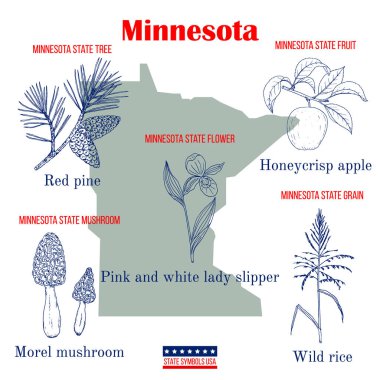
Minnesota. Set of USA official state symbols. Vector hand drawn illustration

USA map with magnified Minnesota State. Minnesota flag and map.

Abstract label with name and map of Minnesota, vector illustration
Minnesota Icons

Vector illustration of the Welcome to Minnesota green and white road sign

Minnesota map shape, united states of america. Flat concept icon symbol vector illustration .

Map of the U.S. state of Minnesota on a white background

Grunge rubber stamp with the name and map of Minnesota, vector illustration

I can't breathe slogan, black lives matter, black fist, vector illustration
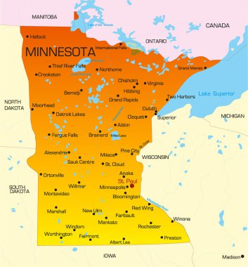
Vector color map of Minnesota state. Usa

Vintage Touristic Greeting Card - Vector

Colorful USA map

Accurate map of Minnesota

Stamp set with the name and map of Minnesota, United States, vector illustration

Red Minnesota. Vector illustration

Illustration of State of Minnesota, USA

Map of Minnesota

Map of the U.S. state of Minnesota on a white background
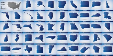
Icons in form of all states of the USA
Shiny vector stickers in form of Minnesota state, USA

Vintage stamp with text Land of 10.000 Lakes written inside and map of Minnesota, vector illustration

USA map vector illustration

Map of the U.S. state of Minnesota on a white backgroun

The seal of the American state of Minnesota

Save Download Previewskyline of urban Mineapolis and saint paul reflected in a spectacle

Accurate map of Minnesota

Minnesota map on heraldic sign

Vector illustration of a vintage sticker in form of Minnesota state, USA
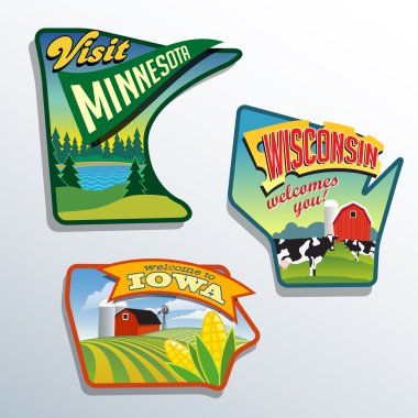
Midwest United States Minnesota Wisconsin Iowa vector illustrations designs
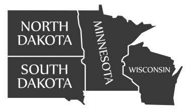
North Dakota - South Dakota - Minnesota - Wisoncsin labelled black illustration

Vintage stamp with map of Minnesota. Stylized badge with the name of the State, year of creation, the contour maps and the names abbreviations . Vector illustration

Minneapolis Minnesota USA Skyline Golden Silhouette. Vector Illustration. Simple Flat Concept for Tourism Presentation, Placard. Business Travel Concept. Minneapolis Cityscape with Landmarks.

Image relative to USA travel. Minnesota state map textured by lines and dots pattern

Cityscape Building Line art Vector Illustration design - Minneapolis city

Minnesota map on a white background. Vector illustration.

Minnesota state detailed editable map with cities and towns, geographic sites, roads, railways, interstates and U.S. highways. Vector EPS-10 file, trending color scheme

An Illustrated Shape of the State of Minnesota

Retro Travel poster Split Rock Lighthouse Minnesota. Vintage vector illustration lighthouse card Lake Superior USA

The Great seal of state of Minnesota, this circle shape seal has an American riding horse with spear, farmer plowing, sunrays, with motto 'L'etoile du nord' in the middle, vintage line drawing or engraving illustration

Realistic sport shirt Minnesota Timberwolves, jersey template for basketball kit. Vector illustration
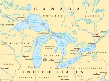
Great Lakes of North America political map. Lakes Superior, Michigan, Huron, Erie and Ontario. Series of large interconnected freshwater lakes on or near the border of Canada and of the United States.
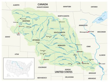
Vector map of the Missouri River Drainage Basin, United States, Canada

Manitoba, a province of Canada, political map with boundaries, and largest cities, rivers and lakes. Located at the longitudinal centre of the country, with capital Winnipeg. Illustration. Vector

Minnesota distressed map. Grunge patriotic poster with textured state ink stamp and roller paint mark, vector illustration.

Massachusetts map shape United states America green forest hand drawn cartoon style with trees travel terrain vector
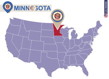
Minnesota State on USA Map. Minnesota flag and map. US States.

Colorful USA map with states, and capital cities
USA map vector illustration art on white background

Stylized blue sketch map of Minnesota

Vector Map of the U.S. state of Wisconsin

Road map of the US American State of Minnesota
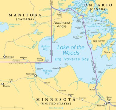
Northwest Angle, political map. An exclave of the northern Lake of the Woods County, Minnesota, forming a border between Canada and USA. Known simply as the Angle, and coextensive with Angle Township.

Nice USA map isolated on white background

Minnesota mark. Travel rubber stamp with the name and map of Minnesota, vector illustration. Can be used as insignia, logotype, label, sticker or badge of USA state.

Map of Kittson in Minnesota

Minnesota state of United States of America, USA. Simplified thick black outline map with rounded corners. Simple flat vector illustration
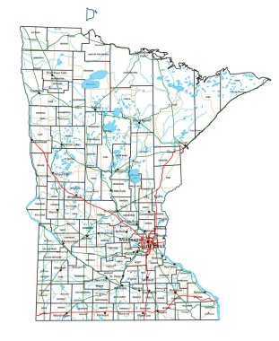
Minnesota road and highway map. Vector illustration.

An Illustrated Shape of the State of Alabama Minnesota
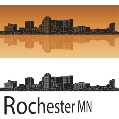
Rochester skyline in orange background in editable vector file

Minnesota State with beautiful natural views

North Dakota, ND, political map, with capital Bismarck. State in the upper Midwest subregion of the United States of America, nicknamed Peace Garden State, Roughrider State and Heaven on Earth. Vector

Minneapolis, Minnesota skyline. Detailed vector silhouette

Seal of the State of Minnesota, vintage engraved illustration. Trousset encyclopedia (1886 - 1891).

Grunge rubber stamp with name of Minnesota, Minneapolis

Stylized green sketch map of Minnesota

Isolated sketch of the state of Minnesota - Vector

The Dakotas, political map. Collective term for the U.S. states of North Dakota and South Dakota, in the Upper Midwest and North Central. Used to describe the Dakota Territory and collective heritage.
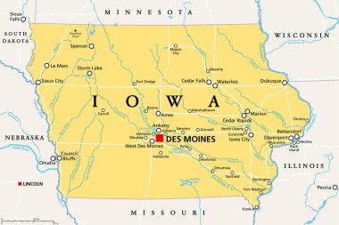
Iowa, IA, political map, with the capital Des Moines and most important cities, rivers and lakes. State in the Midwestern region of the United States of America, nicknamed The Hawkeye State. Vector.

Administrative vector map of the US Census Region Midwest
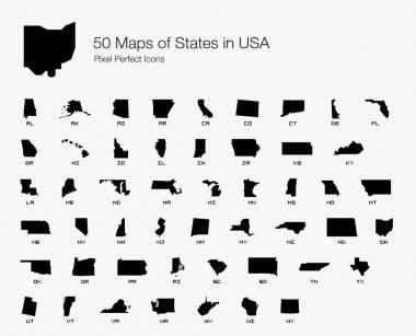
All 50 USA States Map Pixel Perfect Icons (Filled Style). Vector icons of the complete United States of America states map.

Minnesota map. Us state poster with regions. Old grunge texture. Shape of Minnesota with us state name. Superb vector illustration.

Minnesota state with blue sky background

Minnesota post office, air mail, grunge rubber stamp on white background, vector illustration
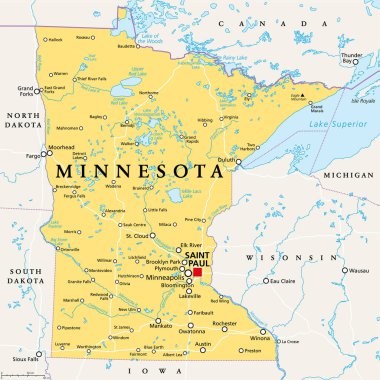
Minnesota, MN, political map, with capital Saint Paul and metropolitan area Minneapolis. State in the upper Midwestern United States. Nicknamed Land of 10,000 Lakes, North Star State and Gopher State.

Great Lakes of North America, gray political map. Lakes Superior, Michigan, Huron, Erie and Ontario. Series of large interconnected freshwater lakes, on or near the border of Canada and United States.

Colorful geometric Minnesota map- vector illustration

Minimal Minneapolis Linear City Skyline with Typographic Design

Minimal Saint Paul City Linear Skyline with Typographic Design

Vector illustration of the Welcome to Minnesota road sign

North dakota road vector map with flag
Grunge rubber stamp with name and map of Minnesota, USA

Minneapolis Minnesota USA City Skyline with Color Buildings, Blue Sky and Reflections. Vector Illustration. Business Travel and Tourism Concept with Modern Architecture. Minneapolis Cityscape with Landmarks.

Vector abstract illustration of United States city skylines
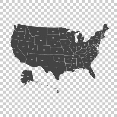
USA map with federal states. Vector illustration United states of America.

Minnesota poster in retro style. Map of the us state with regions in autumn color palette. Shape of Minnesota with us state name. Charming vector illustration.

Graphic of the North American great lakes and their neighboring states

Grunge rubber stamp or label with text Minneapolis, Minnesota written inside, vector illustration

Minneapolis city skyline silhouette - multicolor line art

Minnesota map outline - smooth simplified US state shape map vector.

USA map with borders and abbreviations for US states. Black color states with white inscriptions. Flat style vector illustration isolated on white background
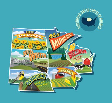
Illustrated pictorial map of Midwest United States. Includes North and South Dakota, Nebraska, Minnesota, Iowa and Wisconsin. Vector Illustration.