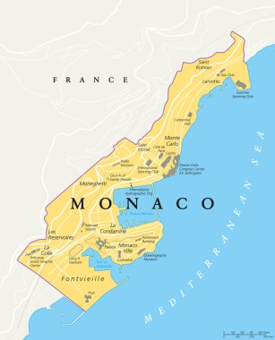
Monaco political map. City state in on the French Riviera, France, with national borders, important buildings and sights. English labeling and scaling. Illustration.

Monaco map in gray on a white background

Outline of Monaco map

High detailed flag of Monaco. National Monaco flag. Europe. 3D illustration.

Europe with highlighted Monaco map and flag

Monaco map vector illustration, scribble sketch Monaco

Monaco Highlighted on Europe Map with Flag Icon.

Flag of monaco. Flag icon. Standard colors. Standard size. Rectangular flag.

Isometric Map of Monaco. Simple 3D Map. Vector Illustration - EPS 10 Vector

Monaco flag and map set. monaco flag in official colors and proportions., map

Monaco Map Pin with National Flag on Open World Map.
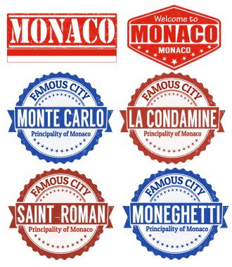
Set of grunge rubber stamps with names of Monaco cities, vector illustration
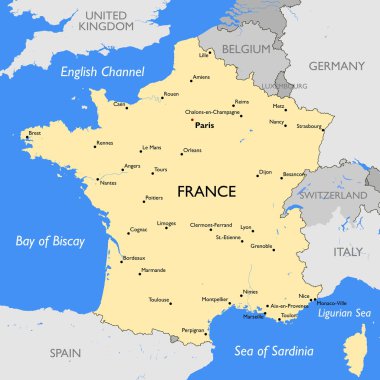
Vector detailed color France map

French Riviera, political map. Mediterranean coastline of the southeast corner of France, known as Cote dAzur (Azure Coast). Usually considered to extend from Toulon in the west to Menton in the east.

Monaco, Nice and Cannes, political map. The coastal strip of Alpes-Maritimes, a department of France, located on the French Riviera and Mediterranean Sea. With the microstate Principality of Monaco.

Southern France coastline, political map. Southernmost part of France, that border the Mediterranean Sea. Map with part of Occitania, Provence, French Riviera, Corsica, and with most important cities.
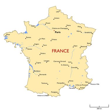
Vector detailed color France map

French Riviera, gray political map. Mediterranean coastline of the southeast corner of France, known as Cote dAzur or Azure Coast. Considered to extend from Toulon in the west to Menton in the east.

Detailed France physical map.
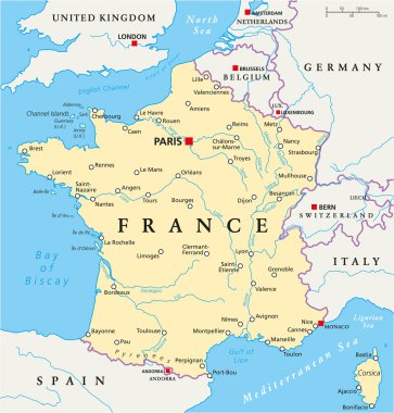
France Political Map with capital Paris, national borders, most important cities and rivers. English labeling and scaling. Illustration.

High detailed France physical map with labeling.

Piedmont region in northwest Italy, gray political map. Second largest Italian region with capital Turin bordering France, Switzerland, and regions Aosta Valley, Lombardy, Emilia-Romagna, and Liguria.

France, political map. Regions of Metropolitan France. French Republic with capital Paris and 13 administrative regions on the mainland of Europe and their prefectures. English. Illustration. Vector.

Italy, political map, administrative divisions. Italian Republic with capital Rome, 20 regions and their capitals, international borders and neighbor countries. English labeling. Illustration. Vector.

France, metropolitan regions, gray political map. French Republic with capital Paris and administrative regions on the mainland of Europe and their prefectures. English labeling. Illustration. Vector.
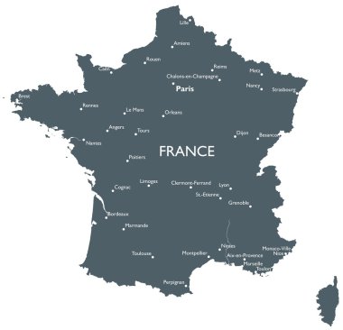
Monochrome vector France map
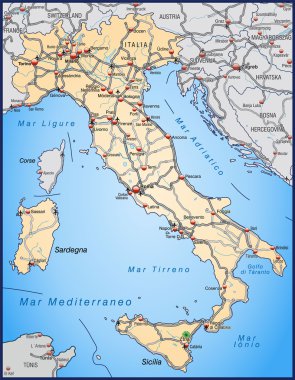
Map of Italy with highways and main cities

High detailed vector political Europe map with capitals, cities, towns, rivers and lakes.

Highly detailed physical map of Italy,in vector format,with all the relief forms,states and big cities.
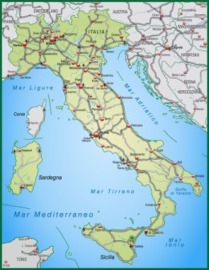
Map of Italy with highways and main cities in green
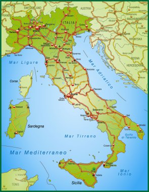
Map of Italy with highways and main cities

France political map with capital Paris, Corsica, national borders and neighbor countries. Gray illustration with English labeling and scaling on white background. Illustration.

Italy map and flag - highly detailed vector illustration

MONACO round sign. Futuristic satelite view of the world centered to MONACO. Geographical badge with map, round text and binary background. Powerful vector illustration.
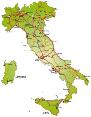
Map of Italy with highways and main cities

High detailed France physical map with labeling.

Italy map and flag - highly detailed vector illustration

Hand drawn map of Italy with the capital Rome, the Vatican and San Marino, national borders, most important cities, rivers and lakes. Vector illustration with english labeling and scale.

Monaco grand prix race track. circuit for motorsport and autosport. Vector illustration.

High detailed France physical map.

Italy political map with capital Rome, with national borders and neighbor countries. Gray illustration with English labeling and scaling on white background. Illustration.

Monaco grand prix race track for Formula 1 or F1 with flag. Detailed racetrack or national circuit for motorsport and formula1 qualification. Vector illustration.

RED FORMULA ONE RACE CAR WITH THE GRAND PRIX MONACO F1 MAP

Detailed map of Europe with cities

Road map of the French region of Provence-Alpes-Cote d Azur

Vector Europe map
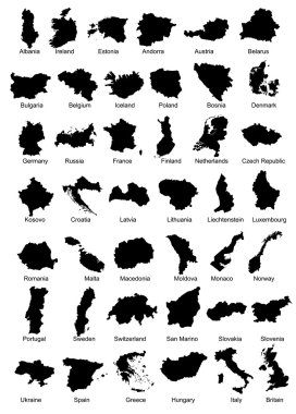
Layered vector illustration of 42 Europe Country Maps.

Detailed vector road map of french riviera

Blank outline map of Europe. Simplified vector map made of black outline on white background.

Map of Europe 1985

Monte Carlo circuit for motorsport and autosport. Monaco grand prix race track.

Vector detailed map of Europe

Administrative map of Europe

Political map of Europe. European ministates included. Flat map on white background. Colorful vector illustration.

European countries set, maps and flags, part 2

Vector illustration

Monaco grand prix race track for Formula 1 or F1. Detailed racetrack or national circuit for motorsport and formula1 qualification. Vector illustration.

Blank map of Europe. Simplified vector map in grey with white borders on white background.

Blank outline map of Europe. Simplified vector map made of black outline on white background

Maps collection countries of Europe, black contour maps of Europe. Vector set.

Blank map of Europe

Blank outline map of Europe. Simplified wireframe map of black lined borders. EPS10 vector illustration.

Europe map illustration

Black and white vector city map of Monaco with well organized separated layers.

Simplified map of Europe (vector illustration)
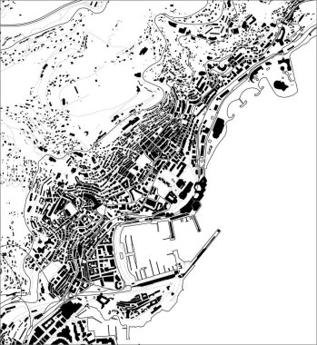
Vector map of the city of Principality of Monaco, French Riviera

Satellite map of principality of Monaco, Monte Carlo. Fontvieille, Monaco-Ville, La Condamine. Map of streets and buildings of the town center. Europe

Europe map and flags

Monaco circuit. Motorsport race track vector map.
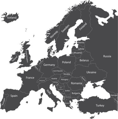
Europe political map with country names

Political map of Europe with state names - vector illustration

Map of Europe with sovereign countries, ministates and Kosovo included. Simplified vector map in black color isolated on white background

European political map set with map pointers

Vector map of tourism coasts of France

Map of Europe in gray on a white background

Outline map of Europe white background. Vector map with contour.

Outline map of Europe. Simplified wireframe map of black lined borders. Vector illustration.

Outline maps of the countries in European continent, vector illustration

White map markers with flags - Europe. Original colors
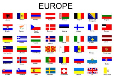
List of all European country flags

All flags of Europe. Vector Illustration. flag set

Modern europe map polygons, great design for any purposes, vector

Monaco Principate car plate, letters, numbers and symbols, vector file, illustration

Set of grand prix race track. circuit for motorsport and autosport. Vector illustration

Set of official national flags of Europe continent and other territories. Alphabetical order. Vector design illustration
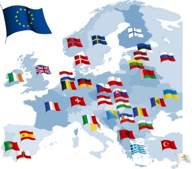
European country flags and map.

All European countries flags like pins

Set of wave buttons with European countries flags

Road and administrative map of France

Black map markers with flags - Europe. Original colors
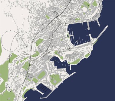
Vector map of the city of Principality of Monaco, French Riviera

Vector Europe map

"An old map" of Europe with flags of countries in the form of spots

Vector Europe map

All European countries pinned with their flags

Monaco infographics, statistical data, sights. Vector illustration

Highly detailed editable political map with separated layers. France.

Layered vector map of Monaco.

World map with magnified Monaco. Monaco flag and map.

Map monaco country icon in solid style