
Mongolia - vector map

Stylized vector Mongolia map showing big cities, capital Ulaanbaatar, administrative divisions.

Zoom on Mongolia Map and Flag. World Map

Mongolia administrative and political vector map with flag

Mongolia infographic map and flag - High Detailed Vector Illustration

Infographic for Mongolia, detailed map of Mongolia with flag. Vector Info graphic green map.

Outline of Mongolia map
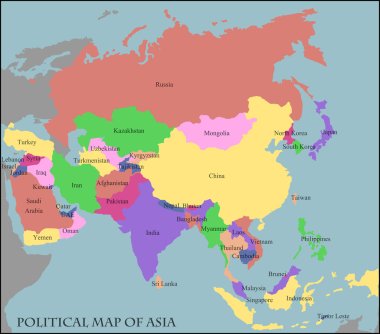
Illustration of a Political Map of Asia

Mongolia - detailed map of the country in brown colors, divided into regions. Vector illustration

Highlighted Mongolia on Global Map with 3D Flag Location Pin of Mongolia.

Mongolia vector map with infographic elements, pointer marks. Editable template with regions, cities and capital Ulaanbaatar.

Mongolia - blue map with neighboring countries and names. Vector illustration

Flag Map of Mongolia. Mongolia Flag Map

Map of administrative divisions of Mongolia

Mongolia map design. Vector low poly map of the country. Mongolia icon in geometric style. The country shape with polygnal gradient and mesh on dark background.
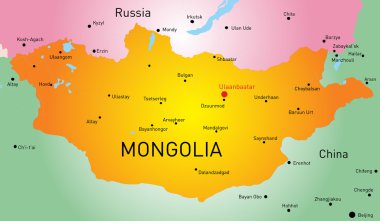
Vector map of Mongolia country

Mongolia country map polygonal with spot lights places

North Korea South Korea Japan China Russia Mongolia Map - Detailed Vector Illustration

Vector map of Mongolia with indication of Ulaanbaatar

Set of state maps of Mongolia with regions and municipalities division. Department borders, isolated vector maps on white background.

Mongolia blank detailed outline map set

Mongolia Map Pin with National Flag on Open World Map.

Mongolia flag and map set. mongolia flag in official colors and proportions., map

Isometric Map of Mongolia. Simple 3D Map. Vector Illustration - EPS 10 Vector

Mongolia Location Highlighted on Asian Map with Flag Icon.

Flag of mongolia. Flag icon. Standard colors. Standard size. Rectangular flag.

World map illustration, vector, Mongolia

Mongolia infographics, statistical data, sights. Vector illustration

Mongolia infographics, statistical data, sights. Vector illustration
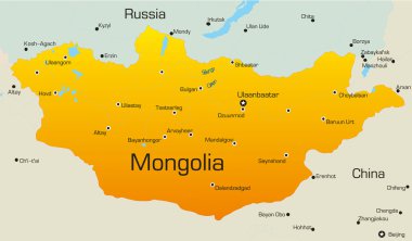
Vector map of Mongolia country

Energy industry and ecology of Mongolia vector map with power stations infographic.

Pencil hand drawn China map vector on paper illustration

Mongolia map card paper 3D natural vector

Flag Asia World Map. Travel vector Illustration.

Flags in the form of states with shadows

Asian countries set, maps and flags, Part 2
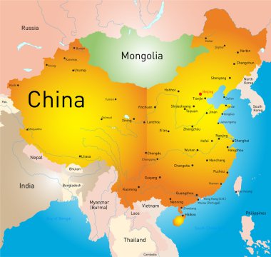
Vector map of China country

Mongolia Map - Vintage High Detailed Vector Illustration

China Political Map. Detailed vector map of China with cities, roads, railroads, rivers and lakes.

Map of administrative divisions of Mongolia

Genghis Khan's Mongol Empire in 1227 and at its greatest extent in 1279. Vector illustration.
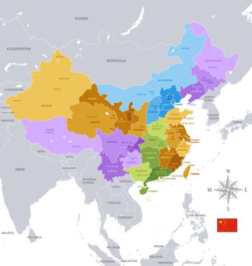
A High Detail vector Map of the People's Republic of China's Regions and major cities.

Asia political map with borders and countries. Largest and most populous continent. Gray illustration on white background. English labeling. Vector.

Vector blank map of China with provinces, regions and administrative divisions. Editable and clearly labeled layers.

Flags of the countries of the world. Flags of Asian countries. Geography, atlas, world, travel

Map of China Provinces

China map

Asia political map with capitals, national borders, rivers and lakes. Largest continent with the countries Russia, China, India, Indonesia and smaller ones. Illustration with English labeling. Vector.
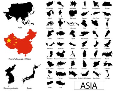
Asian countries vectors

Vector map of China provinces colored by regions with neighbouring countries and territories

Black and white map of China

Vector map of China with provinces, regions and administrative divisions. Editable and clearly labeled layers.

East Asia political map with countries and borders. Eastern subregion of the Asian continent with China, Japan, Mongolia and Indonesia. English labeling. Gray illustration on white background. Vector.

Blank political map of western, southern and eastern Asia in grey. Simple flat vector illustration.

Vector map of the People's Republic of China. Colorful sketch illustration with all regions
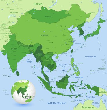
High detail map of far east Asia with a 3D Globe centered on these countries
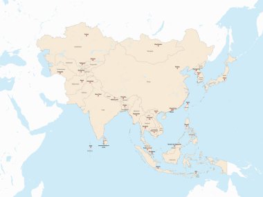
Light red detailed political map of ASIA with country and capital cities name tags using orthographic projection on white and blue background

North Korea South Korea Japan China Russia Mongolia Map - Detailed Vector Illustration

East Asia, single states, political map. All countries in different colors, with national borders, labeled with English country names. Eastern subregion of the Asian continent. Illustration. Vector.

Color map of China
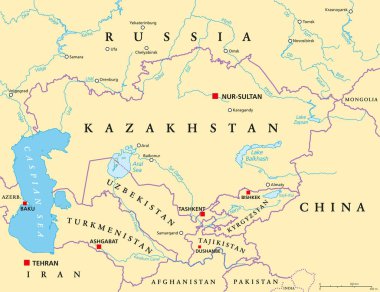
Central Asia, political map with capitals. Subregion of Asia, consisting of former Soviet republics stretching from Caspian Sea to China and Mongolia, and from Afghanistan and Iran to south of Russia.

Color map of Eastern Asia divided by the countries

America centric world map with magnified Mongolia map. Green polygonal world map.

Mongol Empire map at Genghis Khan's death in 1227 and at its greatest extent in 1279. Vector illustration.

China Map in Colors of Blue. Detailed vector map of China.

Mongolia map and flag - High Detailed Vector Illustration

China, political map, with administrative divisions. PRC, People's Republic of China, capital Beijing, provinces with capitals, borders and neighbor countries. English labeling. Illustration. Vector.

Map of administrative divisions of Mongolia

Blue pen hand drawn China map vector on paper illustration

Maps collection countries of Asia, black contour maps of Asia. Vector set.

Travel and tourism background. Vector flat illustration

Travel and tourism background. Vector flat illustration
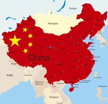
Abstract vector color map of China country coloured by national flag

Eurasia Europa Russia China India Indonesia Thailand Africa Map - Detailed Vector Illustration

Vector map of south east asian countries mixed with their national flags
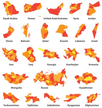
Middle East and Arabic countries maps

Mongolia network map. Abstract polygonal map design. Internet connections vector illustration.

Eurasia political map with capitals and national borders. Combined parts of the continental landmass of Europe and Asia. English labeling. Vector.

Eurasia Europa Russia China India Indonesia Thailand Map - Detailed Vector Illustration

Asia Map - Detailed Vector Illustration

Asia Map - Detailed Vector Illustration
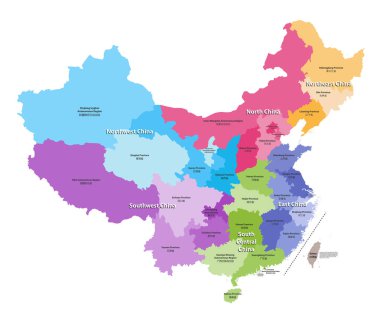
Vector map of China provinces colored by regions. Chinese names gives in parentheses

Southern Asia Map - Vintage Detailed Vector Illustration

Political map of Asia continent. Vector illustration.

Mongolia political map with capital Ulaanbaatar, national borders, important cities, rivers and lakes. Landlocked sovereign state in East Asia, bordered to China and Russia. English labeling.

Highlighted green map of BHUTAN inside light green political map of Asia using orthographic projection on light blue background

Map of Asia vector illustration, scribble sketch Asia

China Political Map Isolated on White and Map Pointers. Detailed vector map of China.

Eurasia Europa Russia China India Indonesia Thailand Map - Detailed Vector Illustration
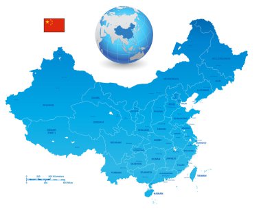
A High Detail vector Map of the People's Republic of China's colored with china flag. The set also contains a 3D Flag of China and a 3D Globe with China highlighted

Asia Map - Detailed Vector Illustration

Highlighted yellow map of CAMBODIA inside white political map of Asia using orthographic projection on dark blue background

Vector Illustration of Asia Continent in Grey color
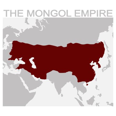
Vector map of the mongol empire for your design

Southern Asia Map - Detailed Vector Illustration

Coloured political map of Asia

Southern Asia Map - Vintage Detailed Vector Illustration

Asia Map - Vintage Detailed Vector Illustration

Eurasia Europa Russia China India Indonesia Thailand Africa Map - Detailed Vector Illustration

Mongolia infographics, statistical data, sights. Vector illustration