
Illustration of Tsunami fault types diagram

Earth structure diagram. Vector illustration of Earth internal structure with core, mantle and crust layers. Educational poster, scientific infographic, presentation template.

Map of the principal tectonic plates of the Earth. The sixteen major pieces of crust and uppermost mantle of the Earth, called the lithosphere, and consisting of oceanic and continental crust. Vector
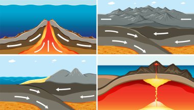
The Process of Seafloor Spreading illustration

The Process of Seafloor Spreading illustration

Illustration of japan trench diagram

Principal tectonic plates of the Earth, world map. The sixteen major pieces of crust and uppermost mantle of the Earth, called the lithosphere, and consisting of oceanic and continental crust. Vector
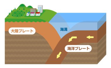
Continental crust and Oceanic crust. Sectional view vector illustration.

Illustration of a cross-section of the volcano

Diagram showing layers of the Earth lithosphere illustration
Plate tectonics word cloud concept. Collage made of words about plate tectonics. Vector illustration

Diagram showing layers of the Earth lithosphere illustration

Continental crust and Oceanic crust. Sectional view vector illustration.
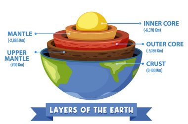
Diagram showing layers of the Earth lithosphere illustration
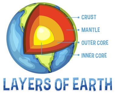
Diagram showing layers of the Earth lithosphere illustration

Metamorphism vector illustration. Labeled minerals geologic structure change process. Diagram with regional, dynamic, hydrothermal and contact forces. Tectonic volcano activity force types comparison

Mechanism of trench earthquake occurrence. Sectional view vector illustration.

Geophysics concept with earth core and section layers earth, vector illustration in flat style
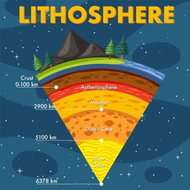
Layers of the Earth Lithosphere illustration
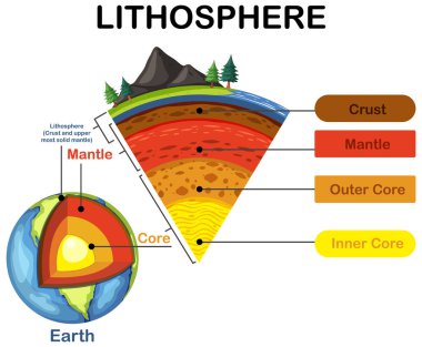
Diagram showing layers of the Earth lithosphere illustration
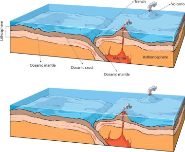
Vector illustraton of collision of two oceanic plates.

Plate boundaries diagram shows divergent, convergent, and transform faults with crust, mantle, and ocean features. Outline diagram
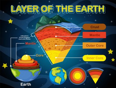
Layers of the Earth Lithosphere illustration
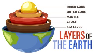
Diagram showing layers of the Earth lithosphere illustration

Layers of the Earth Lithosphere illustration

Structure of the Earth infographic. Diagram of the interior layer of Earth.

Plate boundaries vector illustration. Labeled tectonic movement comparison. Scheme with divergent, convergent and transform. Side view structure explanation with oceanic ridge, trench and mantle fault

Ridge push, slab pull or trench suction labeled scheme vector illustration. Educational geography graphic with natural earth geological process. Continental drift, volcano eruption or seismic activity

Diagram showing layers of the Earth lithosphere illustration

Vector illustration shows oceanic crust divergence

Layers of the Earth vector illustration
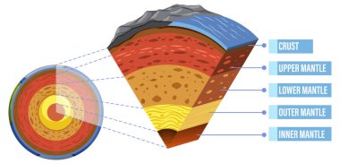
Diagram showing layers of the Earth lithosphere illustration
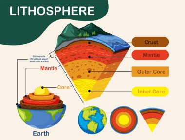
Diagram showing layers of the Earth lithosphere illustration

Set of earth globes isolated illustration
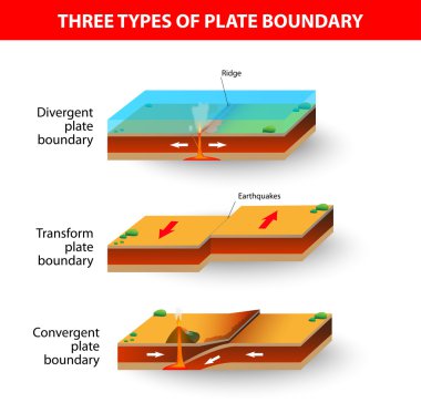
A cross section illustrating the main types of tectonic plate boundaries. convergent, divergent, or transform. Earthquakes, volcanic activity, mountain-building, and oceanic trench formation occur along these plate boundaries.

Mechanism of trench earthquake occurrence. Sectional view vector illustration.

Continental drift chronological movement, historical timeline with earth continents: Pangaea, Laurasia, Gondwana. Vector illustration world map.

Diagram showing layers of the Earth lithosphere illustration

Vestor illustratiion shows collision of oceanic and continental plates

Vector illustration of a happy orange crab with raised claws in cartoon style, suitable for marine and ocean themes, cheerful mood.
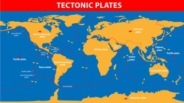
Plate tectonics. Earth's lithosphere, scientific theory.
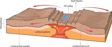
Vector illustration shows divergence of continental tectonic plates.

Vector illustration shows continental and oceanic crust.