10 FREE IMAGES of ShutterstockTry Shutterstock and Get 10 Free Images

overview map SVG, Vector And Clipart Images

() overview map SVG Vectors and Transparent background overview map ClipArts. All Download the royalty free graphic in the form of SVG, PNG, EPS, AI or PSD.

Description:

Usage ideas:

Map of the North of  Africa as an overview map in gray clipart svg vector

Map of the North of Africa as an overview map in gray

Map of the North of Africa as an overview map clipart svg vector

Map of the North of Africa as an overview map

There is a map of Finland country clipart svg vector

There is a map of Finland country

Map of the North of Africa as an overview map clipart svg vector

Map of the North of Africa as an overview map

Iceland map with flag inside and ribbon clipart svg vector

Iceland map with flag inside and ribbon

Map of thuringia with borders in blue clipart svg vector

Map of thuringia with borders in blue

Vector map of the USA highlighting New York and California with iconic landmarks. Simple design with green and pink accents clipart svg vector

Vector map of the USA highlighting New York and California with iconic landmarks. Simple design with green and pink accents

Vector illustration of Italy's map highlighting Rome and the Pantheon. Simplified design with clear labels and muted colors clipart svg vector

Vector illustration of Italy's map highlighting Rome and the Pantheon. Simplified design with clear labels and muted colors

Vector illustration of China map highlighting Beijing and the Great Wall. Simple colors and clear composition enhance visual appeal clipart svg vector

Vector illustration of China map highlighting Beijing and the Great Wall. Simple colors and clear composition enhance visual appeal

Destinations. Gps tracking map. Track navigation pin on street maps, navigate mapping locate position pin clipart svg vector

Destinations. Gps tracking map. Track navigation pin on street maps, navigate mapping locate position pin
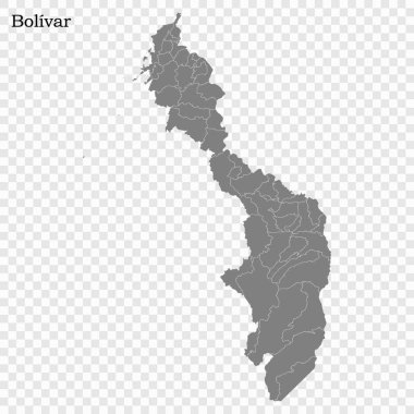
High Quality map of Bolivar is a state of Colombia, with borders of the districts clipart svg vector

High Quality map of Bolivar is a state of Colombia, with borders of the districts

A gray map of the Minas Gerais State divided into regions, Brazil clipart svg vector

A gray map of the Minas Gerais State divided into regions, Brazil

A colorful map of the Minas Gerais State divided into regions, Brazil clipart svg vector

A colorful map of the Minas Gerais State divided into regions, Brazil

Modern world map template with colorful pointer marks and statistics. Easy to use for your design or presentation. clipart svg vector

Modern world map template with colorful pointer marks and statistics. Easy to use for your design or presentation.

High Quality map of Bavaria is a state of Germany, with borders of the districts clipart svg vector

High Quality map of Bavaria is a state of Germany, with borders of the districts

High Quality map of Baja California Sur is a state of Mexico, with borders of the municipalities clipart svg vector

High Quality map of Baja California Sur is a state of Mexico, with borders of the municipalities

High Quality map of Kyoto is a prefecture of Japan with borders of the districts clipart svg vector

High Quality map of Kyoto is a prefecture of Japan with borders of the districts

Map of Andalusia autonomous community of Spain and location on Spanish map clipart svg vector

Map of Andalusia autonomous community of Spain and location on Spanish map

High Quality map of Queretaro is a state of Mexico, with borders of the municipalities clipart svg vector
High Quality map of Queretaro is a state of Mexico, with borders of the municipalities

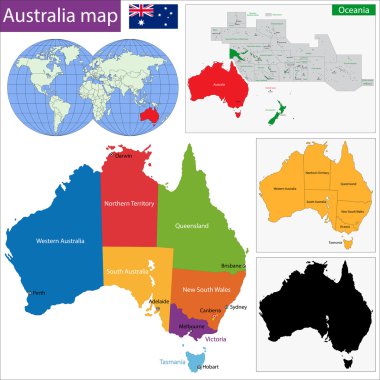
Colorful Australia map with regions and main cities clipart svg vector

Colorful Australia map with regions and main cities

View from above the map buildings. Detailed view of city from above. City top view. Abstract background. Tracking car location.. Quarter residential buildings. Cute simple design. Flat style, Vector, illustration isolated. clipart svg vector

View from above the map buildings. Detailed view of city from above. City top view. Abstract background. Tracking car location.. Quarter residential buildings. Cute simple design. Flat style, Vector, illustration isolated.

The Sao Paulo State microregions map with labels clipart svg vector

The Sao Paulo State microregions map with labels

Map of world with borders in pastel orange clipart svg vector

Map of world with borders in pastel orange

Map of Australia with borders in gray clipart svg vector

Map of Australia with borders in gray

Modern world map template with colorful pointer marks and statistics - dark version. Easy to use for your design or presentation. clipart svg vector

Modern world map template with colorful pointer marks and statistics - dark version. Easy to use for your design or presentation.
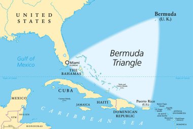
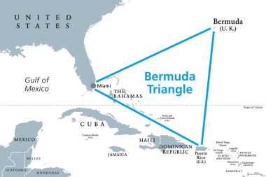
The Bermuda Triangle or Devils Triangle, political map. Region in the North Atlantic Ocean between Bermuda, Miami and Puerto Rico, where aircrafts and ships disappeared under mysterious circumstances. clipart svg vector

The Bermuda Triangle or Devils Triangle, political map. Region in the North Atlantic Ocean between Bermuda, Miami and Puerto Rico, where aircrafts and ships disappeared under mysterious circumstances.

Map of Asia with main cities in gray clipart svg vector

Map of Asia with main cities in gray

Map of the Woerthersee with the most important cities, Carinthia, Austria clipart svg vector

Map of the Woerthersee with the most important cities, Carinthia, Austria

High Quality map of Rio de Janeiro is a state of Brazil, with borders of the municipalities clipart svg vector

High Quality map of Rio de Janeiro is a state of Brazil, with borders of the municipalities

High Quality map of Jalisco is a state of Mexico, with borders of the municipalities clipart svg vector

High Quality map of Jalisco is a state of Mexico, with borders of the municipalities

Map of Lower Saxony with main cities in green clipart svg vector

Map of Lower Saxony with main cities in green

High Quality map of Minas Gerais is a state of Brazil, with borders of the municipalities clipart svg vector

High Quality map of Minas Gerais is a state of Brazil, with borders of the municipalities

High Quality map of Santa Catarina is a state of Brazil, with borders of the municipalities clipart svg vector

High Quality map of Santa Catarina is a state of Brazil, with borders of the municipalities

City top view. View from above the map buildings. Gps map. Detailed view of city from above. Decorative graphic tourist map. Quarter residential buildings. Vector, illustration. Abstract transportation background. clipart svg vector

City top view. View from above the map buildings. Gps map. Detailed view of city from above. Decorative graphic tourist map. Quarter residential buildings. Vector, illustration. Abstract transportation background.

Map of Guatemala with borders in green clipart svg vector

Map of Guatemala with borders in green

Map of Schleswig-Holstein with main cities in green clipart svg vector
Map of Schleswig-Holstein with main cities in green

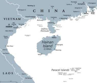
Hainan, southernmost province of China, and surrounding area, gray political map. Hainan Island, and Paracel Islands in the South China Sea, south of the Leizhou Peninsula, and east of Gulf of Tonkin. clipart svg vector

Hainan, southernmost province of China, and surrounding area, gray political map. Hainan Island, and Paracel Islands in the South China Sea, south of the Leizhou Peninsula, and east of Gulf of Tonkin.

Map of Australia with main cities in gray clipart svg vector

Map of Australia with main cities in gray

High Quality map of Tamaulipas is a state of Mexico, with borders of the municipalities clipart svg vector

High Quality map of Tamaulipas is a state of Mexico, with borders of the municipalities

Simple map of Florida state of United States and location on USA map clipart svg vector

Simple map of Florida state of United States and location on USA map

High Quality map of Buenos Aires is a province of Argentina with borders of the departments clipart svg vector

High Quality map of Buenos Aires is a province of Argentina with borders of the departments

The Pernambuco State regions map with labels on white background, Brazil clipart svg vector
The Pernambuco State regions map with labels on white background, Brazil

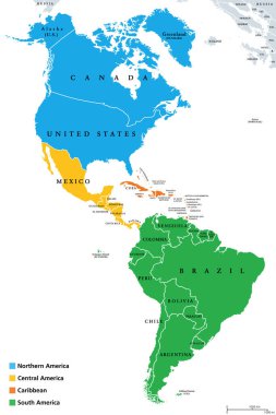
The Americas, geoscheme and political map. The North American subregion with intermediate regions Caribbean, Northern and Central America, and the subregion South America. Subdivisions for statistics. clipart svg vector

The Americas, geoscheme and political map. The North American subregion with intermediate regions Caribbean, Northern and Central America, and the subregion South America. Subdivisions for statistics.

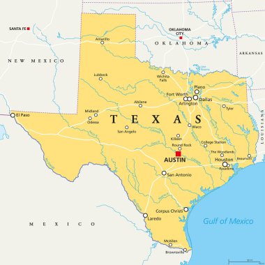
Simple map of Texas state of United States and location on USA map clipart svg vector

Simple map of Texas state of United States and location on USA map

Map of Bremen with main cities in green clipart svg vector
Map of Bremen with main cities in green

Texas, political map, with capital Austin, borders, important cities, rivers and lakes. State in the South Central region of the United States of America. English labeling. Illustration. Vector. clipart svg vector

Texas, political map, with capital Austin, borders, important cities, rivers and lakes. State in the South Central region of the United States of America. English labeling. Illustration. Vector.

3d isometric map of Guatemala City is a city of Guatemala, vector illustration clipart svg vector

3d isometric map of Guatemala City is a city of Guatemala, vector illustration

High Quality map of Cajamarca is a province of Peru, with borders of the districts clipart svg vector

High Quality map of Cajamarca is a province of Peru, with borders of the districts

High Quality map of Lima is a province of Peru, with borders of the districts clipart svg vector

High Quality map of Lima is a province of Peru, with borders of the districts

High Quality map of Antioquia is a state of Colombia, with borders of the districts clipart svg vector

High Quality map of Antioquia is a state of Colombia, with borders of the districts

High Quality map of Hidalgo is a state of Mexico, with borders of the municipalities clipart svg vector

High Quality map of Hidalgo is a state of Mexico, with borders of the municipalities

High Quality map of Goias is a state of Brazil, with borders of the municipalities clipart svg vector

High Quality map of Goias is a state of Brazil, with borders of the municipalities

A gray map of Parana State divided into regions, Brazil clipart svg vector
A gray map of Parana State divided into regions, Brazil

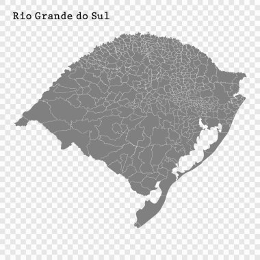
High Quality map of Rio Grande do Sul is a state of Brazil, with borders of the municipalities clipart svg vector

High Quality map of Rio Grande do Sul is a state of Brazil, with borders of the municipalities

High Quality map of Yakutia is a region of Russia with borders of the districts clipart svg vector
High Quality map of Yakutia is a region of Russia with borders of the districts

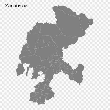
High Quality map of Zacatecas is a state of Mexico, with borders of the municipalities clipart svg vector

High Quality map of Zacatecas is a state of Mexico, with borders of the municipalities

High Quality map of Coahuila is a state of Mexico, with borders of the municipalities clipart svg vector

High Quality map of Coahuila is a state of Mexico, with borders of the municipalities

State of Idaho, subdivided into 44 counties, outline map with borders and county names. State in the Mountain West region of the United States, nicknamed The Gem State, or The Potato State. Vector clipart svg vector

State of Idaho, subdivided into 44 counties, outline map with borders and county names. State in the Mountain West region of the United States, nicknamed The Gem State, or The Potato State. Vector

High Quality map of Chiapas is a state of Mexico, with borders of the municipalities clipart svg vector

High Quality map of Chiapas is a state of Mexico, with borders of the municipalities

High Quality map of Chiapas is a state of Mexico, with borders of the municipalities clipart svg vector

High Quality map of Chiapas is a state of Mexico, with borders of the municipalities

Map of Berlin with main cities in green clipart svg vector
Map of Berlin with main cities in green

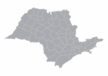
The Sao Paulo State microregions map isolated on white background clipart svg vector

The Sao Paulo State microregions map isolated on white background

Map of North Rhine-Westphalia with main cities in green clipart svg vector

Map of North Rhine-Westphalia with main cities in green

Lesser Antilles of the Caribbean, multicolored political map. Group of islands between Greater Antilles and South America. Divided into the Leeward Islands, Windward Islands, and the Leeward Antilles. clipart svg vector

Lesser Antilles of the Caribbean, multicolored political map. Group of islands between Greater Antilles and South America. Divided into the Leeward Islands, Windward Islands, and the Leeward Antilles.

Map of North America with main cities in gray clipart svg vector

Map of North America with main cities in gray

High Quality map of Sardinia is a state of Italy, with borders of the districts clipart svg vector

High Quality map of Sardinia is a state of Italy, with borders of the districts

The United States of America, gray political map. Map with the silhouettes of fifty states and postal abbreviations, and with the federal District of Columbia, as it is used for statistics. Vector. clipart svg vector

The United States of America, gray political map. Map with the silhouettes of fifty states and postal abbreviations, and with the federal District of Columbia, as it is used for statistics. Vector.

Outline Australia map with regions and main cities clipart svg vector

Outline Australia map with regions and main cities

Map of Germany with highways in pastel orange clipart svg vector
Map of Germany with highways in pastel orange

The Bermuda Triangle or Devils Triangle, gray political map. Region in North Atlantic Ocean between Bermuda, Miami and Puerto Rico where aircrafts and ships disappeared under mysterious circumstances. clipart svg vector

The Bermuda Triangle or Devils Triangle, gray political map. Region in North Atlantic Ocean between Bermuda, Miami and Puerto Rico where aircrafts and ships disappeared under mysterious circumstances.

Map of Germany with highways in pastel green clipart svg vector

Map of Germany with highways in pastel green

High Quality map of San Luis Potosi is a state of Mexico, with borders of the municipalities clipart svg vector

High Quality map of San Luis Potosi is a state of Mexico, with borders of the municipalities

Map of Campania province of Italy and location on Italian map clipart svg vector

Map of Campania province of Italy and location on Italian map

High Quality map of Los Lagos is a region of Chile, with borders of the provinces clipart svg vector
High Quality map of Los Lagos is a region of Chile, with borders of the provinces

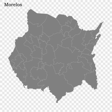
High Quality map of Morelos is a state of Mexico, with borders of the municipalities clipart svg vector

High Quality map of Morelos is a state of Mexico, with borders of the municipalities

Central America countries, colored political map. Subregion of the Americas, between Mexico and Colombia, consisting of Belize, Guatemala, Honduras, El Salvador, Nicaragua, Costa Rica and Panama. clipart svg vector

Central America countries, colored political map. Subregion of the Americas, between Mexico and Colombia, consisting of Belize, Guatemala, Honduras, El Salvador, Nicaragua, Costa Rica and Panama.

Map of world with main cities in pastel orange clipart svg vector

Map of world with main cities in pastel orange

Map of Indonesia as an overview map in pastel green clipart svg vector

Map of Indonesia as an overview map in pastel green

High Quality map of Veneto is a region of Italy clipart svg vector

High Quality map of Veneto is a region of Italy

High Quality map of Parana is a state of Brazil clipart svg vector
High Quality map of Parana is a state of Brazil

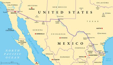
Mexico-United States border political map. International border between the countries Mexico and the USA, with states, capitals, and most important cities. Most frequently crossed border in the world. clipart svg vector

Mexico-United States border political map. International border between the countries Mexico and the USA, with states, capitals, and most important cities. Most frequently crossed border in the world.

The Sahara and the Sahel, political map. Largest hot desert in the world making up most of North Africa, and an ecoclimatic and biogeographic realm with hot semi-arid climate on the African continent. clipart svg vector

The Sahara and the Sahel, political map. Largest hot desert in the world making up most of North Africa, and an ecoclimatic and biogeographic realm with hot semi-arid climate on the African continent.

High Quality map of Espirito Santo is a state of Brazil, with borders of the municipalities clipart svg vector

High Quality map of Espirito Santo is a state of Brazil, with borders of the municipalities

Map of Bavaria with borders in gray clipart svg vector

Map of Bavaria with borders in gray

Map of Hamburg with main cities in green clipart svg vector

Map of Hamburg with main cities in green

Administrative map of the Islamic Republic of Pakistan clipart svg vector

Administrative map of the Islamic Republic of Pakistan

Map of Tanzania with main cities in pastel green clipart svg vector
Map of Tanzania with main cities in pastel green

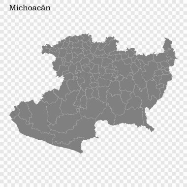
High Quality map of Michoacan is a state of Mexico, with borders of the municipalities clipart svg vector
High Quality map of Michoacan is a state of Mexico, with borders of the municipalities

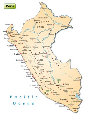
Map of Peru as an overview map in pastel orange clipart svg vector

Map of Peru as an overview map in pastel orange

High Quality map autonomous community of Spain. Galicia clipart svg vector

High Quality map autonomous community of Spain. Galicia

The world, gray general reference map. Map of the surface of the Earth with landmasses of all continents, with largest lakes, oceans and seas, in Miller cylindrical projection. Illustration. Vector. clipart svg vector

The world, gray general reference map. Map of the surface of the Earth with landmasses of all continents, with largest lakes, oceans and seas, in Miller cylindrical projection. Illustration. Vector.
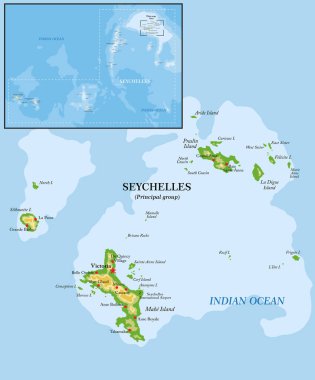
Seychelles islands highly detailed physical map clipart svg vector

Seychelles islands highly detailed physical map

South America, multi colored political map with international borders and capitals. Continent, bordered by the Pacific and Atlantic Ocean, North America and the Caribbean Sea. Isolated illustration. clipart svg vector

South America, multi colored political map with international borders and capitals. Continent, bordered by the Pacific and Atlantic Ocean, North America and the Caribbean Sea. Isolated illustration.

Shanghai Cooperation Organisation, SCO member states, political map. Eurasian political, economic and security organization. Largest regional organization in the world. Successor to the Shanghai Five. clipart svg vector

Shanghai Cooperation Organisation, SCO member states, political map. Eurasian political, economic and security organization. Largest regional organization in the world. Successor to the Shanghai Five.

Gps map navigation to own house.View from above the map buildings. Detailed view of city from above. City top view clipart svg vector

Gps map navigation to own house.View from above the map buildings. Detailed view of city from above. City top view

Map of Scandinavia with borders in gray clipart svg vector

Map of Scandinavia with borders in gray

Administrative vector map of the kingdom of thailand with flag clipart svg vector

Administrative vector map of the kingdom of thailand with flag

Vector detailed World map silhouette clipart svg vector

Vector detailed World map silhouette

High Quality map of Limburg is a province of Netherlands, with borders of the Municipalities clipart svg vector

High Quality map of Limburg is a province of Netherlands, with borders of the Municipalities

A gray map of the Rio de Janeiro State divided into regions, Brazil clipart svg vector

A gray map of the Rio de Janeiro State divided into regions, Brazil