
Phoenix, Arizona, logo design. Two in one vector arts. Big logo with vintage letters with nice colored background and one-color-version with map for every possible print production.

Phoenix USA City Map in Retro Style. Outline Map. Vector Illustration.

Phoenix City in Arizona United Stated street road map,vector outline illustration image

Illustrated map of the state of Arizona in United States with cities and landmarks. Editable vector illustration

Vector set 10 of 10 Highly detailed silhouettes of US state maps, divided into counties with names and territory nicknames
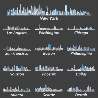
United States largest cities skylines in tints of blue color palette. Vector illustration

Vector outlines icons of United States cities skylines
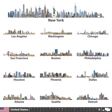
Vector illustration of largest United States city skylines. Navigation, location and travel icons; flag and map of United States of America

Vector map of United States of America with largest cities' skylines

Vector illustration of largest United States city skylines in black and white color palette. Navigation, location and travel icons; flag and map of United States of America

City map Phoenix, monochrome detailed plan, vector illustration

Travel poster, urban street plan city map Phoenix and Las Vegas, vector illustration

Vector map of the city of Phoenix, Arizona, USA

Typography composition of city names, silhouettes maps of the states of America, vector detailed posters, Division Mountain - Nevada, Utah, Arizona - set 14 of 17

Detailed vector a large color map of the USA

Arizona State on USA Map. Arizona flag and map. US States.

Canada, United States and Mexico detailed map with states names and borders. Flags and largest cities skylines outline icons of United States, Canada and Mexico

Highly detailed vector silhouettes of US state maps, Division United States into counties, political and geographic subdivisions of a states, Mountain - Nevada, Utah, Arizona - set 14 of 17
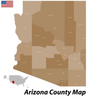
The state of Arizona with all counties and cities.

Vector a large color map of the USA

High detailed Arizona road map with labeling.
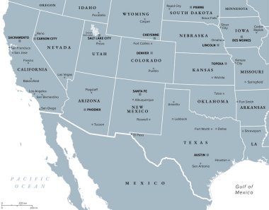
Southwest region of the United States, gray political map. States of American Southwest, simply Southwest. Geographical and cultural region, bordered by Mexico. Arizona, New Mexico, Nevada and Texas.

Vector map of the Colorado River drainage basin, United States
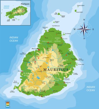
Mauritius islands physical map

Street map of the US state arizona
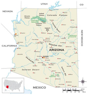
Highly detailed physical map of the US state of Arizona

Vector color map of Arizona state. Usa
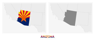
Two versions of the map of US State Arizona, with the flag of Arizona and highlighted in dark grey. Vector map.

Vector map of the city of Phoenix, Arizona, USA

Vector map of the city of Phoenix, Arizona, USA

Road map of the US American State of Arkansas
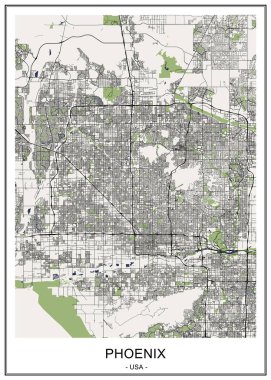
Vector map of the city of Phoenix, Arizona, USA

United States of America political map / Detailed vector a large color map of the USA

Phoenix silhouette skyline. USA - Phoenix vector city, american linear architecture, buildings. Phoenix line travel illustration, landmarks. USA flat icon, american outline design banner

Vector posters with highly detailed silhouettes of maps of the states of America, Division Mountain - Nevada, Utah, Arizona - set 14 of 17

Vector map of the city of Phoenix, Arizona, USA

The United States of America monochrome contour map with city names
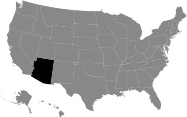
Black highlighted location map of the US Federal State of Arizona inside gray map of the United States of America

Vector illustration Arizona map with countrysides and state symbols

Blue Phoenix city area vector background map, streets and water cartography illustration. Widescreen proportion, digital flat design streetmap.

Vector map of United States of America with largest cities' skylines

Detailed vector a large map of the USA with cities
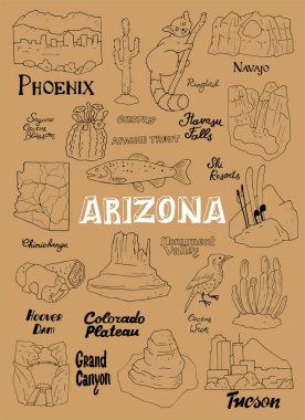
Vector illustration with Arizona's countrysides and state symbols

Map of USA with the indication of State of Arizona and Phoenix

Gray vector map of the Federal State of Arkansas, USA with white borders of its counties
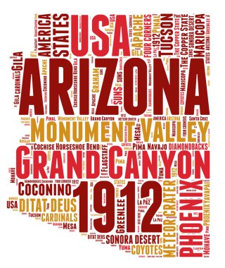
Arizona USA state map vector tag cloud illustration

USA - Arizona state infographic template
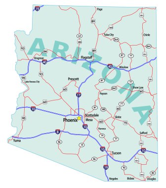
Arizona state road map with Interstates, U.S. Highways and state roads. All elements on separate layers for easy editing.
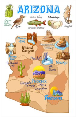
Vector illustration Arizona map with countrysides and state symbols

Arizona state detailed editable map with with cities and towns, geographic sites, roads, railways, interstates and U.S. highways. Vector EPS-10 file, trending color scheme

Arizona infographic flat hand drawn vector illustration. American state map isolated on terracotta background. Arizona travel routes, landmarks with city names lettering cartoon cliparts

Vector map of the city of Phoenix, Arizona, USA

Arizona map shape, united states of america. Flat concept icon symbol vector illustration .

Arizona map flat hand drawn vector illustration. USA state routes with cartoon landmarks and tourist attractions. Funny american travel destinations and famous places names doodle lettering
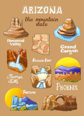
Vector illustration with Arizona's countrysides and state symbols

Arizona infographic flat hand drawn vector illustration. American state comic doodle map isolated on dark blue background. Arizona travel routes, landmarks with city names lettering cartoon cliparts

Road map of the US American State of Arizona

Arizona State map with US flag inside and Map pointer with American flag

Vector map of United States of America with largest cities' skylines outlines

USA cities names words cloud collage, concept background

Covid-19 Infographic Medical Template Presentation

Arizona map on white background vector

Arizona state with beautiful view

USA map with magnified Arizona State. Arizona flag and map.
Arizona vector map silhouette. High detailed illustration. United state of America country .

Map of Arizona state designed in illustration with the counties and the county seats

Abstract skyline Phoenix, with various landmarks, vector illustration
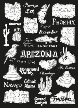
Vector illustration with Arizona's countrysides and state symbols

Vector illustration with Arizona's countrysides and state symbols

Arizona map shape, united states of america. Flat concept icon symbol vector illustration .

Arizona State map with US flag inside and ribbon

Vector posters states of the United States with a name, nickname, date admitted to the Union, Division Mountain and West South Central - Colorado, New Mexico, Texas - set 13 of 17

US letters with cities names words cloud, concept background

US letters with cities names words cloud, concept background

US letters with cities names words cloud, concept background

USA word map - city names text vector.

Maricopa County, Arizona blank outline map set

USA cities names words cloud collage, concept background

Stamp set with the name and map of Arizona, United States, vector illustration

San francisco and los angeles sign

Phoenix (Oregon) blank outline map

Minimal Phoenix city map silhouette vector. Clean black outline of USA city, perfect for infographics, prints, and digital design projects.

US map and words cloud with larger cities

Arizona state with beautiful view

Phoenix (New York) blank outline map

Arizona road and highway map. Vector illustration.

Arizona state with beautiful view
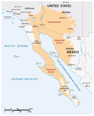
Vector map of the Sonoran Desert, Mexico, United States

Arizona state with beautiful view

Arizona state united states of america

Phoenix city map, Arizona USA, black and white poster

Arizona State car license plate pattern, letters, numbers and symbols, vector illustration, USA, Un ited States of America

Usa City Skyline Silhouette set vector, America Big city Skyline silhouette vector

County map of the US American state of Arzona

Vacoas-Phoenix city (Republic of Mauritius) map vector illustration, scribble sketch Vacoas Phoenix, Villes Jumelles map