Downloadable vector pack of 12 Solid Filled-style icons themed around Region. Simple, clean, and easy to use.

Greenland map isolated. Isometric map of Greenland detailed vector illustration. 3D country concept for infographic. Located between the Arctic and Atlantic Oceans. Vector design illustration

Italy map in gray on a black background 3d

Map of United States of America, USA, black thick outline highlighted with neighbor countries.

Israel vector map with Israelian and Palestinian flag

The Cordoba Province dark silhouette map isolated on white background, Argentina

Map of Asia with highlighted South Korea map, gray map of South Korea with neighboring countries

Map of Myanmar green highlighted with neighbor countries.

Political map of Russia and surrounding countries. Highlighted by pink. Vector illustration.

Israel vector map with the Gaza strip highlighted.

Central America Region. Map of countries in central part of America. Vector illustration.

Map of China green highlighted with neighbor countries.

Vector illustration of a map of Europe with highlighted Hungary and Hungarian flag isolated on a white background

Member states of the British Commonwealth pink highlighted in the world map. Vector illustration.

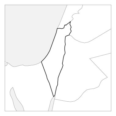
Map of Israel black thick outline highlighted with neighbor countries.

South Europe Region. Map of countries in southern Europe around Mediterranean Sea. Vector illustration.

Bahamas blue marked in the map of Caribbean. Vector illustration.

Azerbaijan blue marked in political map of South Asia and Middle East. Simple flat vector map..

Australia and Oceania Region. Map of countries in South Pacific Ocean. Vector illustration.

Southeast Asia Region. Map of countries in southeastern Asia. Vector illustration.

Saharanpur Division Highlighted in Uttar Pradesh State Map of India

This pack includes 20 clean vector icons in Solid Filled style, built around the Region theme.

Tunisia Location Highlighted on African Map with Flag Icon.

Vatican City Highlighted on Europe Map with Flag Icon.

Panama Location Highlighted on American Map with Flag Icon.

Guatemala Location Highlighted on American Map with Flag Icon.

Austria Highlighted on Europe Map with Flag Icon.

Malawi Location Highlighted on African Map with Flag Icon.

Liberia Location Highlighted on African Map with Flag Icon.

North Macedonia Highlighted on Europe Map with Flag Icon.

Montenegro Highlighted on Europe Map with Flag Icon.

Mauritius Location Highlighted on Map with Flag Icon.

Singapore Location Highlighted on Asian Map with Flag Icon.

China Location Highlighted on Asian Map with Flag Icon.

Maldives Location Highlighted on Asian Map with Flag Icon.

Tajikistan Location Highlighted on Asian Map with Flag Icon.

Palau Location Highlighted on Oceania Map with Flag Icon.

Micronesia Location Highlighted on Oceania Map with Flag Icon.

Bareilly District Highlighted in Uttar Pradesh State Map of India

Hamirpur District Highlighted in Uttar Pradesh State Map of India

Sonbhadra dist Highlighted in Uttar Pradesh State Map of India

Basti Division Highlighted in Uttar Pradesh State Map of India

Slovenia map highlighted in Slovenia flag colors, gray map with neighboring countries.

Vector illustration of a map of Europe with highlighted Finland and Finnish flag isolated on a white background

Member states of the British Commonwealth orange highlighted in the world map. Vector illustration.

South Asia Region. Map of countries in southern Asia. Vector illustration.

Valle del Cauca map, Colombia, Americas. Filled and outline map designs. Vector illustration

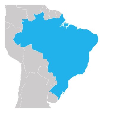
Map of Brazil green highlighted with neighbor countries.

Bahamas blue marked in the map of Caribbean. Vector illustration.

Manipur, map of India with state borders

Prayagraj District Highlighted in Uttar Pradesh State Map of India

West Flanders, Belgium. Administrative map with labels.

Canary Islands, outline map isolated on white background, Spain

Senegal Location Highlighted on African Map with Flag Icon.

Egypt Location Highlighted on African Map with Flag Icon.

Swaziland Location Highlighted on African Map with Flag Icon.

Sierra Leone Location Highlighted on African Map with Flag Icon.

Samoa Location Highlighted on Oceania Map with Flag Icon.

Malaysia Location Highlighted on Asian Map with Flag Icon.

South Korea Location Highlighted on Asian Map with Flag Icon.

Brunei Location Highlighted on Asian Map with Flag Icon.

Japan Location Highlighted on Asian Map with Flag Icon.

Qatar Location Highlighted on Asian Map with Flag Icon.

Vanuatu Location Highlighted on Oceania Map with Flag Icon.

Cape Verde Location Highlighted on Map with Flag Icon.

Costa Rica Location Highlighted on American Map with Flag Icon.

Switzerland Highlighted on Europe Map with Flag Icon.

Belgium Highlighted on Europe Map with Flag Icon.

Cyprus Highlighted on Europe Map with Flag Icon.

Spain, total solar eclipse, August 12, 2026, path of totality, map with cities. Moon fully obscuring the sun, crossing from west to east through northern half of Spain, including the Balearic Islands.

Firozabad District Highlighted in Uttar Pradesh State Map of India

Gautam Buddh Nagar (Noida) District Highlighted in Uttar Pradesh State Map of India

Kanpur Dehat District Highlighted in Uttar Pradesh State Map of India

Amroha District Highlighted in Uttar Pradesh State Map of India

Amethi District Highlighted in Uttar Pradesh State Map of India

Bareilly Division Highlighted in Uttar Pradesh State Map of India

Azamgarh Division Highlighted in Uttar Pradesh State Map of India

Agra Division Highlighted in Uttar Pradesh State Map of India

Lucknow Division Highlighted in Uttar Pradesh State Map of India

Kanpur Division Highlighted in Uttar Pradesh State Map of India

Pratapgarh District Highlighted in Uttar Pradesh State Map of India

Lucknow District Highlighted in Uttar Pradesh State Map of India

Two versions of the map of US State Indiana, with the flag of Indiana and highlighted in dark grey. Vector map.

Caribbean Region. Map of countries in Caribbean Sea in Central America. Vector illustration.

South Asia Region. Map of countries in southern Asia. Vector illustration.

Central Asia Region. Map of countries in central part of Asia. Vector illustration.

Central Asia Map with country names. Tourist and travel landmarks, vector illustration.

Israel vector map with the Gaza strip highlighted.

Map of Central Asia region with blue highlighted Kazakhstan, Kyrgyzstan, Tajikistan, Turkmenistan and Uzbekistan. Flat grey map with country white borders.

Central Asia Region. Map of countries in central part of Asia. Vector illustration.

Israel vector map with the Gaza strip highlighted.

Jhabua District Map Highlighted on Madhya Pradesh State Map

North Europe Region. Map of countries of Scandinavia. Vector illustration.

Thailand vs Cambodia conflict map

Total solar eclipses 2020 to 2029, map of the seven paths of totality worldwide, in which the moon passes between earth and sun, completely obscuring the sun, and casting a lunar shadow on the earth.

Vector illustration highlighting Dubai's Burj Khalifa on a simplified UAE map with clear labels and vibrant colors

Balearic Islands, outline map isolated on white background, Spain

Netherlands Highlighted on Europe Map with Flag Icon.

Romania Highlighted on Europe Map with Flag Icon.

Moldova Highlighted on Europe Map with Flag Icon.