Kannauj District Highlighted in Uttar Pradesh State Map of India

Shravasti District Highlighted in Uttar Pradesh State Map of India

Brazil Map With Separate States in Brazil Flag Color Theme Editable Vector

Prayagraj District Highlighted in Uttar Pradesh State Map of India

Vector map with Nandurbar district highlighted in Maharashtra, India

Vintage USA Map with Regions Borders and Major Cities Positions

A vector gray line map of the Punjab State of India.

Bareilly District Highlighted in Uttar Pradesh State Map of India

Hamirpur District Highlighted in Uttar Pradesh State Map of India

Sonbhadra dist Highlighted in Uttar Pradesh State Map of India

Vector illustration of USA map with American flag, bold colors, clean lines, patriotic theme.

Firozabad District Highlighted in Uttar Pradesh State Map of India

Gautam Buddh Nagar (Noida) District Highlighted in Uttar Pradesh State Map of India

Kanpur Dehat District Highlighted in Uttar Pradesh State Map of India

Amroha District Highlighted in Uttar Pradesh State Map of India

Amethi District Highlighted in Uttar Pradesh State Map of India

Pratapgarh District Highlighted in Uttar Pradesh State Map of India

Lucknow District Highlighted in Uttar Pradesh State Map of India

Sitapur Highlighted in Uttar Pradesh State Map of India

Auraiya District Highlighted in Uttar Pradesh State Map of India

Deoria District Highlighted in Uttar Pradesh State Map of India

Chitrakoot District Highlighted in Uttar Pradesh State Map of India

Lakhimpur Kheri District Highlighted in Uttar Pradesh State Map of India

Kushinagar District Highlighted in Uttar Pradesh State Map of India

Baghpat District Highlighted in Uttar Pradesh State Map of India

Bijnor District Highlighted in Uttar Pradesh State Map of India

Banda District Highlighted in Uttar Pradesh State Map of India

Bulandshahr District Highlighted in Uttar Pradesh State Map of India

Etawah District Highlighted in Uttar Pradesh State Map of India

Mathura District Highlighted in Uttar Pradesh State Map of India

Shahjahanpur District Highlighted in Uttar Pradesh State Map of India

Ghaziabad District Highlighted in Uttar Pradesh State Map of India

Gonda District Highlighted in Uttar Pradesh State Map of India

Kasganj (Kanshiram Nagar) District Highlighted in Uttar Pradesh State Map of India

Agra District Highlighted in Uttar Pradesh State Map of India

Mau District Highlighted in Uttar Pradesh State Map of India

Meerut District Highlighted in Uttar Pradesh State Map of India

Mahoba District Highlighted in Uttar Pradesh State Map of India

Ambedkar Nagar District Highlighted in Uttar Pradesh State Map of India

Jhansi District Highlighted in Uttar Pradesh State Map of India

Jaunpur District Highlighted in Uttar Pradesh State Map of India

Mirzapur District Highlighted in Uttar Pradesh State Map of India

Azamgarh District Highlighted in Uttar Pradesh State Map of India

Chandauli District Highlighted in Uttar Pradesh State Map of India

Basti District Highlighted in Uttar Pradesh State Map of India

Barabanki District Highlighted in Uttar Pradesh State Map of India

Balrampur District Highlighted in Uttar Pradesh State Map of India

Bhadohi (Sant Ravidas Nagar) district Highlighted in Uttar Pradesh State Map of India

Uttar Pradesh state map with red color

Sambhal District Highlighted in Uttar Pradesh State Map of India

Aligarh District Highlighted in Uttar Pradesh State Map of India

You said:pundicheryChatGPT said:Could you please clarify what you'd like to know or do with "Puducherry"? For example, are you: Looking for information about the Union Territory of Puducherry? Wanting keywords or tags for a stock image of Puducherry?

Kannauj District Highlighted in Uttar Pradesh State Map of India

Jalaun District Highlighted in Uttar Pradesh State Map of India

Pilibhit District Highlighted in Uttar Pradesh State Map of India

Rae Bareli District Highlighted in Uttar Pradesh State Map of India

Sambhal (Bhimnagar) District Highlighted in Uttar Pradesh State Map of India

Shamli District Highlighted in Uttar Pradesh State Map of India

Moradabad District Highlighted in Uttar Pradesh State Map of India

Sant Kabir Nagar District Highlighted in Uttar Pradesh State Map of India

Saharanpur District Highlighted in Uttar Pradesh State Map of India

Mainpuri District Highlighted in Uttar Pradesh State Map of India

Lalitpur District Highlighted in Uttar Pradesh State Map of India

Bahraich District Highlighted in Uttar Pradesh State Map of India

Budaun District Highlighted in Uttar Pradesh State Map of India

Gorakhpur District Highlighted in Uttar Pradesh State Map of India

Rampur District Highlighted in Uttar Pradesh State Map of India

Ayodhya District Highlighted in Uttar Pradesh State Map of India

Ballia District Highlighted in Uttar Pradesh State Map of India

Farrukhabad District Highlighted in Uttar Pradesh State Map of India

Hathras (Mahamaya Nagar) District Highlighted in Uttar Pradesh State Map of India

Kaushambi District Highlighted in Uttar Pradesh State Map of India

Muzaffarnagar District Highlighted in Uttar Pradesh State Map of India

Jaunpur District Highlighted in Uttar Pradesh State Map of India

Jhansi District Highlighted in Uttar Pradesh State Map of India

Etah District Highlighted in Uttar Pradesh State Map of India

Siddharthnagar Highlighted in Uttar Pradesh State Map of India

Fatehpur District Highlighted in Uttar Pradesh State Map of India

Hapur (Panchsheel Nagar) District Highlighted in Uttar Pradesh State Map of India

Hardoi District Highlighted in Uttar Pradesh State Map of India

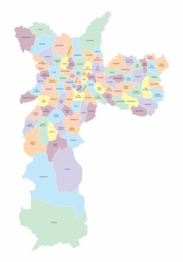
The Sao Paulo city colorful map divided into districts with labels, Brazil

The Sao Paulo city colorful map divided into districts and regions with labels, Brazil

The Sao Paulo city colorful map divided into districts and regions with labels, Brazil. Center, North, South, West and East Zones.

Comfort zone word cloud concept. Vector illustration

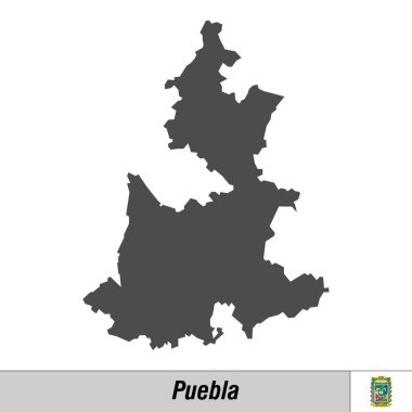
High quality map with flag state of Mexico - Puebla

This vector map of the German Free State of Saxony includes 5 editable layers for each of the 4 administrative levels (municipalities, municipalities associations, districts, and state) and the background

Australia, political map, with the capital Canberra, administrative states and territories. The Commonwealth of Australia, a sovereign country and continent. Illustration on white background. Vector.

California state counties map with boundaries and names. Eps file contains separate layers

Black map of Florida on white background

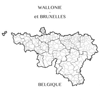
This vector map of the Belgian Regions of Wallonia and Brussels capital includes 5 editable layers for each of the 4 administrative levels (municipalities, districts, provinces, and regions) and the background

The Sao Paulo city gray map divided into districts with labels, Brazil

Maryland state blank outline map

Alberta blank outline map

New York state county map. Eps file contains separate layers with county name, boundaries and layer with counties.

High quality map with flag state of Mexico - San Luis Potosi

San Luis Potosi state blank outline map

UndefinedTrinidad and Tobago high detailed vector representation of country silhouette in solid black on white background. For educational, decorative, or informational use showcasing the national

Missouri state blank outline map

High quality map with flag state of Mexico - Chiapas

Australia, gray political map, with capital Canberra, internal administrative boundaries, and most important cities. Officially the Commonwealth of Australia, a sovereign country. Illustration. Vector