
Urban city map of Tokyo. Vector illustration, Tokyo map art poster. Street map image with roads, metropolitan city area view.

Tokyo map. Detailed map of Tokyo city administrative area. Cityscape panorama. Royalty free vector illustration. Linear outline map with highways, streets, rivers. Tourist decorative street map.

Tokyo map

Tokyo map. Detailed vector map of Tokyo city administrative area. Cityscape poster metropolitan aria view. Dark land with white streets, roads and avenues. White background.
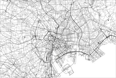
Vector map of the city of Tokyo, Kanto, Island Honshu, Japan

Tokyo Japan City Map in Black and White Color. Hand Drawn. Vector Illustration.

Tokyo map city

Tokyo prefecture blank detailed outline map set

Flat design elements. vector illustration

Cute cartoon japan element -welcome on upper left in Japanese words and japan below in Japanese words
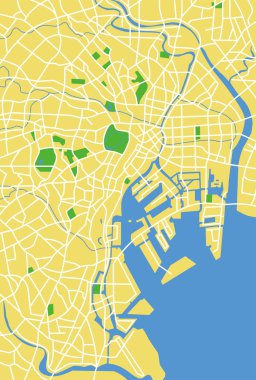
Vector map of tokyo.

Japan on world map
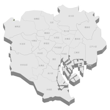
Tokyo map city

Mobile gps navigation service flat illustration. Hand-holding mobile phone with map application ( Tokyo city sightseeing )
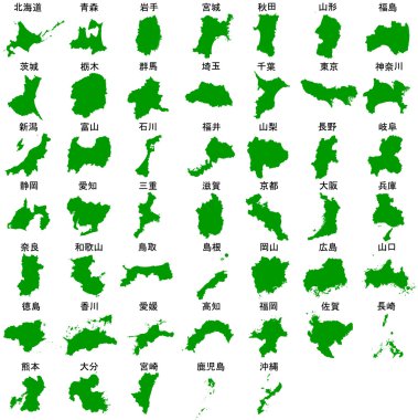
Map Japan prefectures green

Mobile gps navigation service flat illustration. Hand-holding mobile phone with map application ( Tokyo city sightseeing )

Mobile gps navigation service flat illustration. Hand-holding mobile phone with map application ( Tokyo city sightseeing )

Mobile gps navigation service flat illustration. Hand-holding mobile phone with map application ( Tokyo city sightseeing )

Tokyo map landscape

Mobile gps navigation service flat illustration. Hand-holding mobile phone with map application ( Tokyo city sightseeing )

Hand-holding mobile phone with map application ( Tokyo city ) flat illustration

Mobile gps navigation service flat illustration. Hand-holding mobile phone with map application ( Tokyo city sightseeing )

Tokyo Map Silhouette Prefecture Frame Icon

Tokyo prefecture blank outline map set

Shizuoka, Tochigi, Tokushima, Tokyo, Tottori outline maps

Tokyo prefecture blank contour map
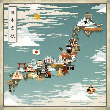
Beautiful Japan travel map - Japan travel in Japanese on upper left

Japan skyline silhouette. Vector illustration

Map of Japan vector illustration, design. Icons with Japanese landmarks, sun, gate, temple. Explore Japan concept image

Tokyo city silhouette skyline. Japan - Tokyo city vector city, japanese linear architecture, buildings. Tokyo city line travel illustration, landmarks. Japan flat icon, japanese outline design banner

Vector illustration of japanese city skylines in grey scales color palette with location, navigation and travel icons; flag and map of Japan
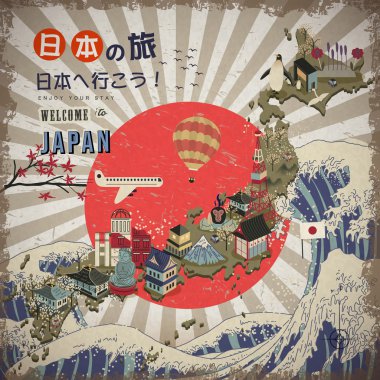
Lovely Japan travel map - Go to Japan and Japan travel in Japanese words on upper left

Japanese map with largest Japan city skylines. Navigation, location and travel icons.

Japan infographics, statistical data, sights. Vector illustration

Beautiful Japan travel map - Japan travel in Japanese on upper left
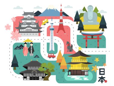
Adorable Japan walking map - Japan country name in Japanese words

Japan travel map in flat illustration.

Tokyo on map, top view of colorful travel essentials on table

Tokyo. I Love That City. Vector Illustration with country flag.

Lovely Japan walking map - Japan travel and Go to Japan in Japanese words on lower right

Line drawing and coloring frame of Japan map. Illustration background material set
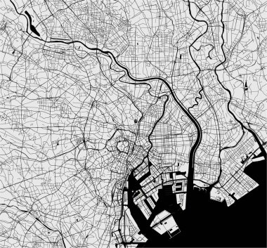
Vector map of the city of Tokyo, Kanto, Island Honshu, Japan

Vector silhouette design of Japan country map
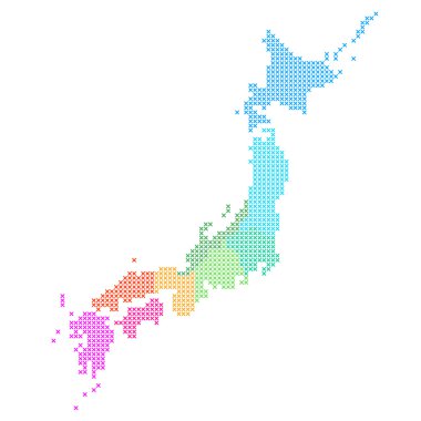
Map of Japan
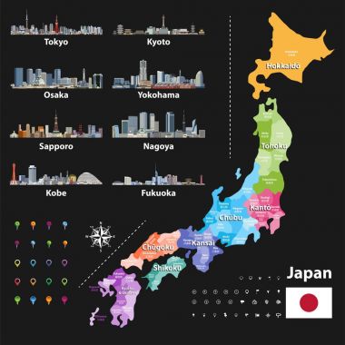
Vector illustration of Japanese flag and prefectures map colored by regions. Largest city skylines, navigation, location, and travel icons

Japan map and flag - highly detailed vector illustration
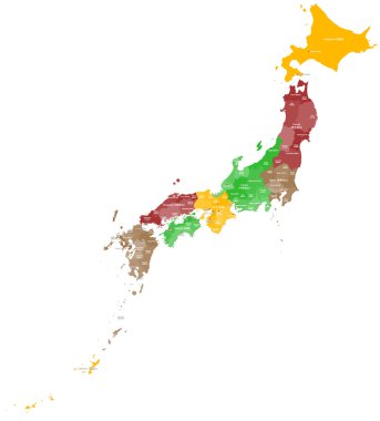
A large and detailed map of Japan with all regions, counties, islands and main cities.
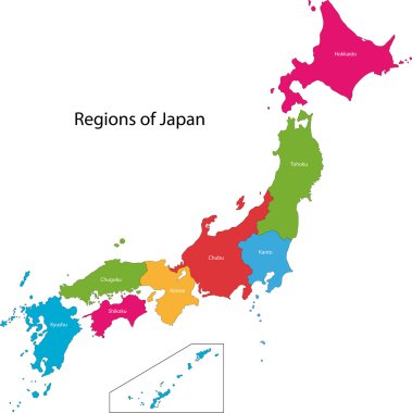
Color map of the provinces of Japan

Political map of Korean and Japanese region, South Korea, North Korea and Japan. Black outline map with black labeling on white background. Vector illustration.

Map of Japan. White color. Vector illustration.

World map with zoom on Japan. Map in loupe. Vector illustration in flat style

Vector map of asian island state japan

Japan - highly detailed black and white map. Vector illustration

Japan map. Color map of the provinces of Japan. Japan administrative map. Regions and prefectures.

Colorful political map of Japan divided into regions by color. Simple flat vector map with labels.

Japan map with prefecture name list divided into 8 areas.

Map of Japan coloring 47 prefectures in 8 areas

Blank political map of Japan. Administrative divisions - prefectures. Simple black outline vector map.

Outline of Japan map

Red silhouette of Japan on white background. Detailed map of Japanese islands. Vector illustration

Detailed vector map of Japan and capital city Tokyo

Japan blank detailed outline map set

3d verctor map of cities and roads in Asia. Countries and their neighbors.

Blank map of Japan. Map Prefectures of Japan. High detailed gray vector map State of Japan on transparent background for your web site design, app, UI. Asia. EPS10.

Political map of Japan. Administrative divisions - regions. Simple flat blank vector map

Map sets of Japan

Japan - highly detailed blue map. Vector illustration

Japan political map. Main islands Honshu, Hokkaido, Kyushu, Shikoku and Okinawa. East Asian island country in the North Pacific bordered by Sea of Japan and Okhotsk, and East China and Philippine Sea.

High detailed Japan physical map with labeling.

Japan map and flag - highly detailed vector illustration
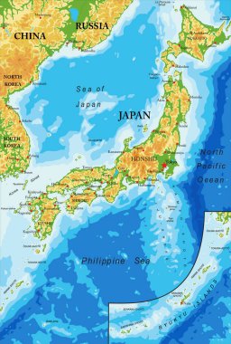
Japan highly detailed physical map,in vector format,with all the relief forms,regions and big cities.

Political map of Korean and Japanese region, South Korea, North Korea and Japan. Turquoise blue map with white labeling on white background. Vector illustration.

Japan map. Color map of the provinces of Japan. Japan administrative map. Regions and prefectures.

Vector map of the East Asian island nation of Japan

Political map of Japan, North Korea and South Korea with the capitals Tokyo, Pyongyang and Seoul, with national borders, some important cities, with rivers and lakes. Vector illustration with english labeling and scale.

Colorful Japan political map with clearly labeled, separated layers. Vector illustration.

Detailed map of the Japan with cities

Hand with Japan Map With Seismic Epicenter. Help Japan

Japan map with flag isolated vector eps10

Japan map vector illustration

Japan, an island country in East Asia, political map, with capital Tokyo and the main islands Honshu, Hokkaido, Kyushu, Shikoku and Okinawa. Archipelago of 14,125 islands in the North Pacific Ocean.

High detailed Japan physical map with labeling.

Japan map and flag - highly detailed vector illustration

Japan prefectures (japanese names gives in parentheses) vector map colored be regions with neighbouring countries and territories

The detailed map of the Japan with regions or states and cities, capitals

Blue map of Japan with indication of Tokyo
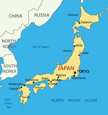
Japan - vector map

Regional map of Japan

Vector map of Japan with cities and roads on separate layers. Tokyo, Kyoto, Osaka

Japan map

Japan map in line style. Vector illustration on white background.

Japan country map icon vector illustration graphic design

Japan map icon vector illustration symbol design

Japan map vector illustration

Colorful political map of Japan. Administrative divisions - regions. Simple flat vector map with labels.
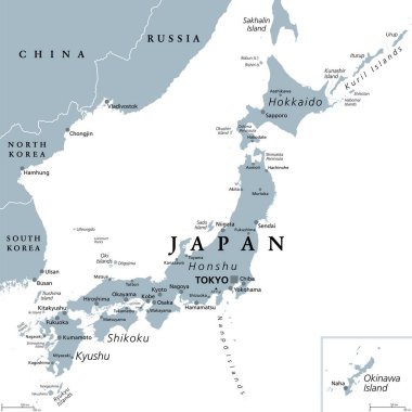
Japan, gray political map. The main islands Honshu, Hokkaido, Kyushu, Shikoku and Okinawa. East Asian island country in the North Pacific Ocean, archipelago of 14,125 islands and part of Ring of Fire.

Japan landmark and travel map. Flat design elements and icons. vector illustration

Political map of Japan with regions and their capitals

Vector Japan Pictogram isolated on white background

Japan map and flag - highly detailed vector illustration