
Mapping and analyzing spatial data of physical environments.

City map Houston, monochrome detailed plan, vector illustration

Los Angeles Vector Map, Artprint. Black Landmass, White Water and Roads.

Athens Vector Map, Artprint. Black Landmass, White Water and Roads.

Melbourne Vector Map, Artprint. Black Landmass, White Water and Roads.
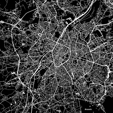
Brussels Vector Map, Artprint. Black Landmass, White Water and Roads.

City map Krakow, monochrome detailed plan, vector illustration

Budapest Vector Map, Artprint. Black Landmass, White Water and Roads.

City map Phoenix, monochrome detailed plan, vector illustration

Detailed borough map of Manhattan New York city, monochrome vector poster or postcard city street plan aerial view

Valencia Vector Map, Artprint. Black Landmass, White Water and Roads.

Sydney Vector Map, Artprint. Black Landmass, White Water and Roads.

Malaga Vector Map, Artprint. Black Landmass, White Water and Roads.

Travel poster, urban street plan city map Boston and Philadelphia, vector illustration

Travel poster, urban street plan city map Kuala Lumpur and Singapore, vector illustration

Travel poster, urban street plan city map Belfast and Edinburgh, vector illustration

Color detailed road map, urban street plan city Amsterdam and Rotterdam with colorful neighborhoods and districts, Travel vector poster

Travel poster, urban street plan city map Sofia and Bucharest, vector illustration

Color detailed road map, urban street plan city Barcelona and Madrid with colorful neighborhoods and districts, Travel vector poster

Map of the city with streets and houses. View from above. Vector illustration.

Detailed borough map of Manhattan New York city, vector poster or postcard for city road and park plan

Travel poster, urban street plan city map Naples and Palermo, vector illustration

City Park. View from above. Vector illustration.

Travel poster, urban street plan city map London and Birmingham, vector illustration
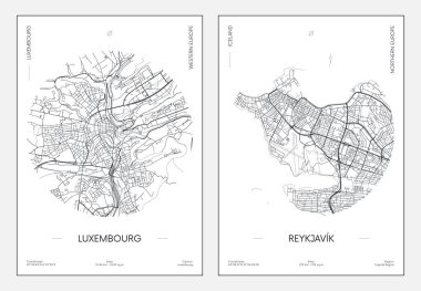
Travel poster, urban street plan city map Luxembourg and Reykjavik, vector illustration

Travel poster, urban street plan city map Belgrade and Bratislava, vector illustration

City Map Destination Route Illustration

Black location map of Viennese Mariahilf district inside gray map of Vienna, Austria

Digitally generated Map of urban infrastructure vector

Digitally generated Map application on smartphone

Digitally generated Map application on smartphone

Digitally generated Map application on smartphone

Vector illustration of Digitally generated taxi application on smartphone
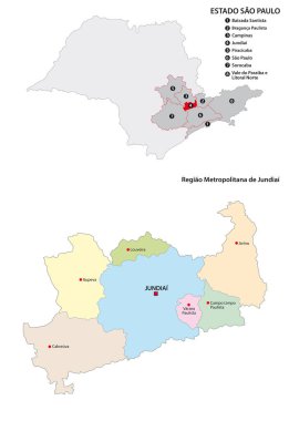
Metropolitan Region of Jundiai administrative vector map, Brazil

Administrative, political and road map of the Colombian city of Cali

Administrative road map of the metropolitan area of atlanta georgia

Vector illustration of Digitally generated taxi application on smartphone

Vector map of the Indonesian megacity (urban area) Jabodetabek

Sydney metropolitan administrative and political vector map.

Self-driving car with wireless signals, location pin, robot AI system, and smart home. Ideal for transportation, smart technology, IoT, AI connectivity automation innovation. Simple flat metaphor
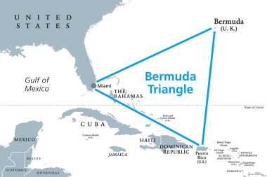
The Bermuda Triangle or Devils Triangle, gray political map. Region in North Atlantic Ocean between Bermuda, Miami and Puerto Rico where aircrafts and ships disappeared under mysterious circumstances.

City navigation map. Flat plan of streets parks and river with top view, simple cartoon city map. Vector illustration downtown pattern with beautiful mapping image town squares, square

Administrative and political map of the Indonesian city of Medan

Metropolitan Region of Baixada Santista administrative vector map, Brazil

Map of the main roads of the French railway network
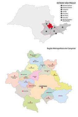
Metropolitan Region of Campinas administrative vector map

Digitally generated Map of urban infrastructure vector
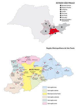
Sao Paulo metropolitan area administrative vector map

Travel poster, urban street plan city map Florence and Milan, vector illustration

Vector illustration of Digitally generated Map application interface

Colorful Istanbul administrative and political vector map .

Map of a top view from the rooftops, city streets, trees and highways

Map of a top view from the rooftops, city streets, trees and highways
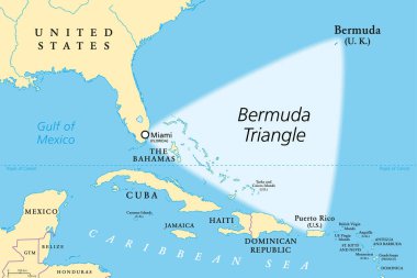
The Bermuda Triangle or Devils Triangle, political map. Region in the North Atlantic Ocean between Bermuda, Miami and Puerto Rico, where aircrafts and ships disappeared under mysterious circumstances.

Travel poster, urban street plan city map Phoenix and Las Vegas, vector illustration

Detailed borough map of Manhattan New York city, color vector city street plan, printable travel poster or postcard

Digitally generated Map of urban infrastructure vector

Travel poster, urban street plan city map Prague and Vienna, vector illustration

Vector map of London Underground,Overground,DLR, and Crossrail

Travel poster, urban street plan city map Montreal and Ottawa, vector illustration

Colorful Jakarta administrative and political map with coat of arms.

Vector map of the Peruvian region of Lima

Administrative and political map of the mexican state of sonora in spanish language

Map of city top view design flat. Map suburban settlement with private houses, narrow roads with cars and natural park design flat. Cars drive on sleeping residential district. Vector illustration

Green big city. Vector illustration

Map of a top view from the rooftops, city streets, trees and highways

Administrative, political and roadmap of the Ukrainian capital Kiev

Vector map of the Israeli Sea of Galilee

Map of a top view from the rooftops, city streets, trees and highways

Map of the city to the train station and the train. View from above. Vector illustration.

Color detailed road map, urban street plan city Rome and Florence with colorful neighborhoods and districts, Travel vector poster

Administrative map of the Florianopolis metropolitan area in the Brazilian state of Santa Catarina
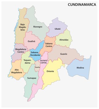
Administrative and political vector map of the Colombian Department of Cundinamarca
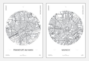
Travel poster, urban street plan city map Frankfurt am Main and Munich, vector illustration

Map of a top view from the rooftops, city streets, trees and highways

Travel poster, urban street plan city map Dubai and Doha, vector illustration

Color detailed road map, urban street plan city London and Birmingham with colorful neighborhoods and districts, Travel vector poster

Hong Kong Special Administrative Region of the People s Republic of China road vector map

Vector map of the Indonesian megacity (urban area) Jabodetabek

Map of a top view from the rooftops, city streets, trees and highways

City Map Main Roads Intersection Illustration

Travel poster, urban street plan city map Athens and Istanbul, vector illustration

Miami and Miami Beach Vector Map, Artprint. Black Landmass, White Water and Roads.

Skyscrapers, urban high-rise home. Set of objects for urban design.

Thin line flat design of street map of small town, city district location with small buildings and green trees, village road mapping. Modern vector illustration concept, isolated on white background.

City. View from above. Vector illustration.

Repair of the pipeline under the road. View from above. Vector illustration.

Crossroads in the town. Flow of people. View from above. Vector illustration.

Steel truss girder element set. Wireframe low poly mesh. Vector illustration

Mexico City administrative map divided in boroughs with labels

Map of the city with the harbor. View from above. Vector illustration.

Set of Isometric Buildings, buildings and transport.

Seamless pattern. City landscape. View from above. Vector illustration.

Infographics with isometric houses and urban landscape

Sacramento, California, Vector Map, Artprint. Black Landmass, White Water and Roads.

Skyscrapers, urban high-rise home. Set of objects for urban design.

Antwerp Vector Map, Artprint. Black Landmass, White Water and Roads.

Skyscrapers, urban high-rise home. Set of objects for urban design.

A vector gray line map of the Punjab State of India.
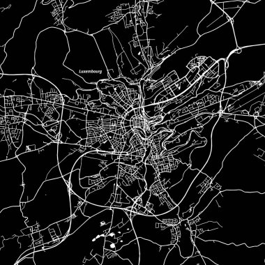
Luxembourg Vector Map, Artprint. Black Landmass, White Water and Roads.