
New Haven (Vermont) blank outline map

New Haven (West Virginia) blank outline map
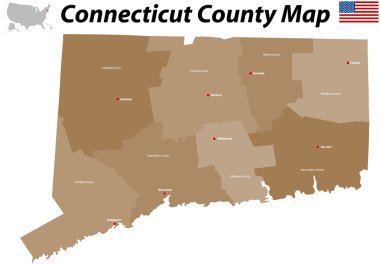
A large, detailed map of the State of Connecticut with all counties and big cities.

Highly detailed physical map of the US state of Connecticut

Connecticut State on USA Map. Connecticut flag and map. US States.

Empty vector map of Shreveport, Louisiana, USA, printable road map created in classic web colors for infographic backgrounds.
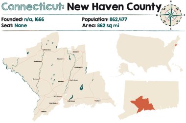
Large and detailed map of New Haven county in Connecticut, USA.
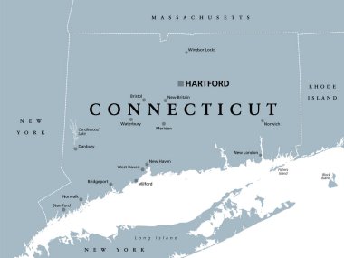
Connecticut, political map with capital Hartford. State of Connecticut, CT, southernmost state in New England region of northeastern United States of America. Gray illustration, over white. Vector.

USA map with magnified Connecticut State. Connecticut flag and map.

New Haven (Washington) blank outline map
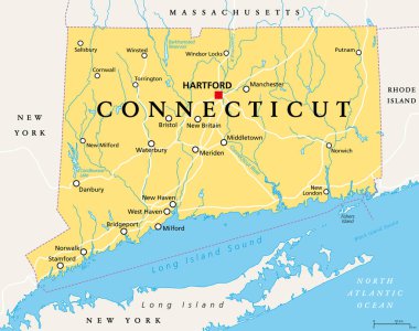
Connecticut, political map with capital Hartford. State of Connecticut, CT, the southernmost state in the New England region of the northeastern United States of America. English. Illustration. Vector

Vector green map pointer with port icon

A large and detailed map of the State of Connecticut with all counties and county seats.

Vector green map pointer with port icon

North Haven (New York) blank outline map