
This pack includes 20 clean vector icons in Solid Filled style, built around the Region theme.

Flag of South Moravian Region is an administrative unit of the Czech Republic. Vector illustration

Administrative professional day background banner or poster design template. observed every year in April. Holiday concept. Use to any Template, card, poster, placard, template.

Administrative professional day background banner or poster design template. observed every year in April. Holiday concept. Use to any Template, card, poster, placard, template.

Administrative professional day background banner or poster design template. observed every year in April. Holiday concept. Use to any Template, card, poster, placard, template.

Administrative professional day background banner or poster design template. observed every year in April. Holiday concept. Use to any Template, card, poster, placard, template.

Administrative professional day background banner or poster design template. observed every year in April. Holiday concept. Use to any Template, card, poster, placard, template.
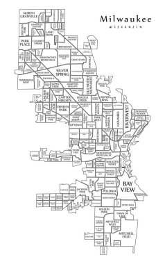
Modern City Map - Milwaukee Wisconsin city of the USA with neighborhoods and titles outline map

Modern City Map - Louisville Kentucky city of the USA with neighborhoods and titles outline map

Modern City Map - Tampa Florida city of the USA with neighborhoods and titles outline map

USA administrative map. Color puzzle

Omaha map. Detailed vector map of Omaha city administrative area. Cityscape poster metropolitan aria view. Dark land with white streets, roads and avenues. White background.
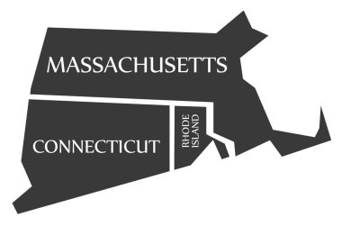
Massachusetts - Connecticut - Rhode Island Map labelled black illustration
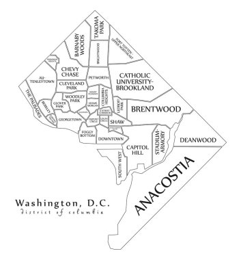
Modern City Map - Washington DC city of the USA with neighborhoods and titles outline map

Set of icons of all counties and county seats of the State of Alabama.
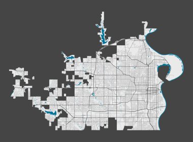
Omaha map. Detailed map of Omaha city administrative area. Cityscape panorama. Royalty free vector illustration. Outline map with highways, streets, rivers. Tourist decorative street map.

Birmingham map. Detailed map of Birmingham city administrative area. Cityscape panorama. Royalty free vector illustration. Outline map with highways, streets, rivers. Tourist decorative street map.

Modern City Map - Detroit Michigan city of the USA with districts and titles outline map

Administrative map United States with latitude and longitude

Modern Map - San Francisco city of the USA
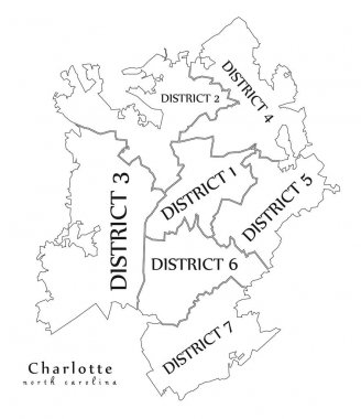
Modern City Map - Charlotte North Carolina city of the USA with boroughs and titles outline map
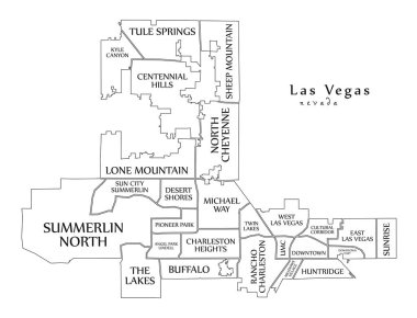
Modern City Map - Las Vegas Nevada city of the USA with neighborhoods and titles outline map
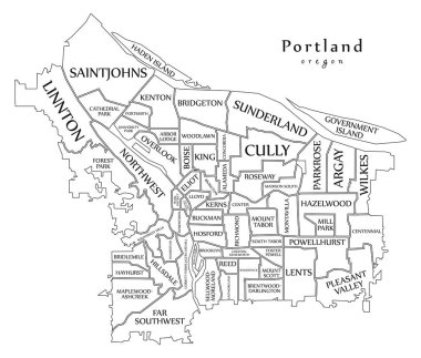
Modern City Map - Portland Oregon city of the USA with neighborhoods and titles outline map
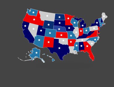
Creative Abstract Isolated Division of USA Map Illustration

Washington DC USA federal state map with Coronavirus warning illustration
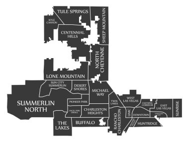
Las Vegas Nevada city map USA labelled black illustration

Modern City Map - Philadelphia city of the USA with boroughs and titles outline map

Texas administrative and political vector map with flag

Mississippi state detailed editable map with cities and towns, geographic sites, roads, railways, interstates and U.S. highways. Vector EPS-10 file, trending color scheme

Greater London ENGLAND UK region map with Coronavirus warning illustration

USA Map with modern round shapes
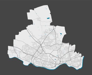
Newcastle upon Tyne map. Detailed map of Newcastle upon Tyne city administrative area. Cityscape panorama. Royalty free vector illustration. Outline map with highways, streets, rivers.

Nottingham map. Detailed map of Nottingham city administrative area. Cityscape panorama. Royalty free vector illustration. Outline map with highways, streets, rivers. Tourist decorative street map.

Collection of isolated vector buildings

Modern City Map - Fresno California city of the USA with neighborhoods and titles outline map

Greece maps with markers

Isometric political map of North America. Colorful land with country name labels on white background. 3D vector illustration
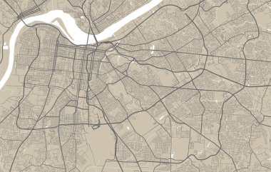
Detailed map of Memphis city administrative area. Royalty free vector illustration. Cityscape panorama. Decorative graphic tourist map of Memphis territory.
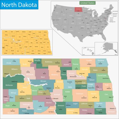
Map of North Dakota state designed in illustration with the counties and the county seats

Philadelphia city map USA labelled black illustration

Sacramento map. Detailed map of Sacramento city administrative area. Cityscape panorama. Royalty free vector illustration. Outline map with highways, streets, rivers. Tourist decorative street map.

Flag of South Bend, Indiana, USA. Vector Format.

Baja california vector color map

Modern City Map - Lexington-Fayette Kentucky city of the USA with neighborhoods and titles outline

Leicester map. Detailed vector map of Leicester city administrative area. Cityscape poster metropolitan aria view. Dark land with white streets, roads and avenues. White background.

Israel political map of administrative divisions - districts, Gaza Strip and Judea and Samaria Area. 3D isometric blank vector map in shades of grey.
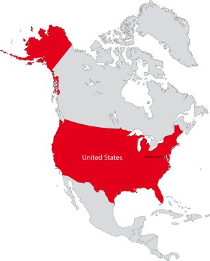
Location of the United States of America on the north America continent

Highly detailed vector silhouettes of US state maps, Division United States into counties, political and geographic subdivisions of a states, New England - Connecticut, Massachusetts, Rhode Island - set 2 of 17

Falkland Islands (British Overseas Territory, United Kingdom) map vector illustration, scribble sketch Islas Malvinas (East and West Falkland) map

Colorful New York City administrative and political vector map, united states

Set of the political Australia maps, markers and symbols for infographic

Montana state outline administrative and political map in black and white

Public institutional buildings, commercial houses, government city estate, town line icons. Editable strokes. Flat design vector illustration symbol concept. Linear signs isolated on white background

Vector flag of Durham city, North Carolina, USA.

Set of the political Sweden maps, markers and symbols for infographic

China maps with markers

Buckingham Palace, London residence and administrative headquarters of the reigning monarch of the United Kingdom

Boston Massachusetts city map USA labelled black illustration

Set of the political Slovakia maps, markers and symbols for infographic

Estonia maps with markers

Modern City Map - Boston Massachusetts city of the USA with boroughs and titles outline map

Modern Map - Alabama county map with labels USA silhouette illustration

Silhouette map of the city of Baltimore in Maryland
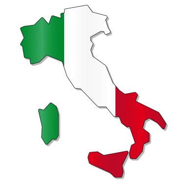
Italy flag map

Louisiana state. USA administrative map.

Charlotte North Carolina city map USA labelled black illustration

Dallas Texas city map with Coronavirus warning

Vector map of the city of Birmingham, Wolverhampton, English Midlands, United Kingdom, England

Japan. All the countries of Asia.

North East England Map grey 3D vector

Set of the political Switzerland maps, markers and symbols for infographic

Vector collection high detailed isolated city halls, landmarks, cathedrals, temples, churches, palaces and other skyline architectural elements

Texas USA federal state map with Coronavirus warning illustration

Houston Texas city map with Coronavirus warning

Michigan state. USA administrative map.

The detailed map of the United Kingdom with regions or states and cities, capitals. Actual current relevant UK, Great Britain administrative devision.

Seattle city map silhouette in Washington

Set of the political Germany maps, markers and symbols for infographic

Seamless pattern United Arab Emirates. Desert and camels and palm trees and skyscrapers. UAE Attractions. Vector background.

Minnesota state. USA administrative map.

Isometric political map of North America. Colorful land with country name labels on white background. 3D vector illustration

Florida USA federal state map with Coronavirus warning illustration

Northern America vector map silhouette illustration isolated on white background. United states of America, Canada, Mexico, Cuba, Bahamas, Caribbean sea territory.

Detailed map of Nottingham city administrative area. Royalty free vector illustration. Cityscape panorama. Decorative graphic tourist map of Nottingham territory.

United Arab Emirates (UAE) map. Outline vector country map with main cities and data table.

Hawaii state. USA administrative map.

Set of the political Finland maps, markers and symbols for infographic

Detailed map of Omaha city administrative area. Royalty free vector illustration. Cityscape panorama. Decorative graphic tourist map of Omaha territory.
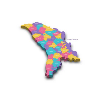
Moldova political map of administrative divisions - districts, municipalities and two autonomous territorial units - Gaugazia and Left Bank of the Dniester. Colorful 3D vector map with dropped shadow

Mexico is a federal republic located in North America.

Set of the political Egypt maps, markers and symbols for infographic

Map of Wyoming state designed in illustration with the counties and the county seats

Black Location Map of Emirate of Fujairah within Grey Map of United Arab Emirates

Pastel Colored Labeled Flat Provinces Map of the Asian Country of United Arab Emirates

Boston Massachusetts Map with neighborhoods and modern round shapes
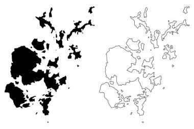
Orkney Islands (United Kingdom, Scotland, Local government in Scotland) map vector illustration, scribble sketch Orkney (Northern Isles) map

Wyoming state outline administrative and political map in black and white

Minnesota state. USA administrative map.

Hawaii state. USA administrative map. North America puzzle.

Map of Iowa state designed in illustration with the counties and the county seats