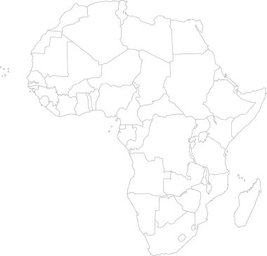
Africa map with countries
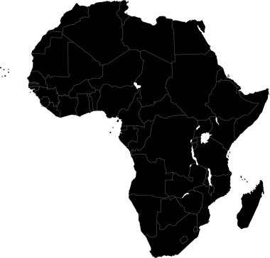
Africa map with countries

Blank detailed contour maps of Algeria - vector version

Black map of Algeria

Black abstract outline of Algeria map
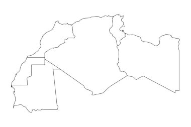
Map of Maghreb countries - Northwest Africa states. Vector illustration.

Detailed africa line map

Africa map. High detailed political map of african continent with country, capital, ocean and sea names labeling.

Vector illustration of black silhouette Africa. Vector Africa map.

Black abstract map of Africa

Vector Illustration of Africa Continent in Greyscale color

Vector illustration of Africa black outline map with countries. Vector Africa map.

Map of Algeria. Vector illustration
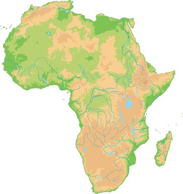
High detailed Africa physical map.

Low Poly map of Algeria. Algeria geometric polygonal, mosaic style map.

Africa map with countries and capital cities
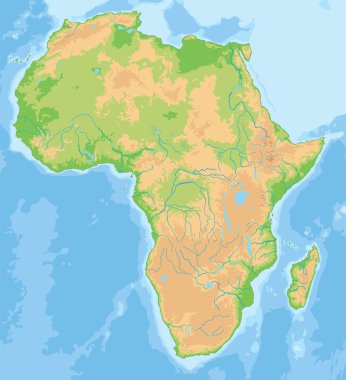
High detailed Africa physical map.

Highly detailed political map of Northern Africa and the Middle East

Old vintage map of Northern Africa and the Middle East
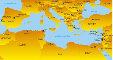
Vector color map of Mediterranean region countries
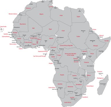
Africa map with countries and capital cities

Africa - Highly detailed editable political map with separated layers.
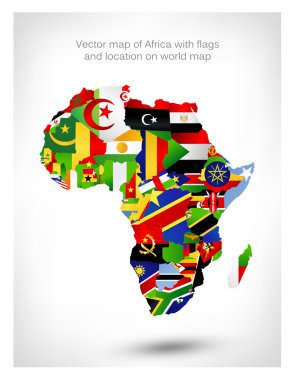
Vector map of Africa with flags and location on world map. Vector illustration.

Highly detailed physical map of Africa,in vector format,with all the relief forms,countries and big cities.
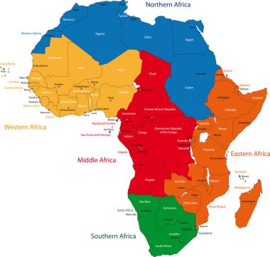
Colorful regions of Africa with countries and capital cities

Africa - Highly detailed editable political map with separated layers.

Highly detailed physical map of Africa,in vector format,with all the relief forms,countries and big cities.
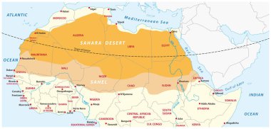
Vector map of the Sahara desert and Sahel zone

New administrative and political map of the twelve regions of the Kingdom of Morocco 2015

Africa old vintage political map with separated layers.
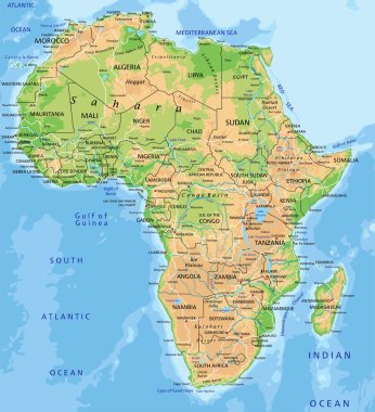
High detailed Africa physical map with labeling.

Mauritania vector road map with flag

Map of morocco. High detailed vector map - morocco.
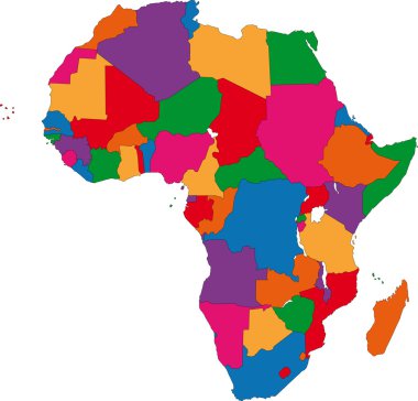
Colorful Africa map with countries

North Africa Region. Map of countries in northern Africa. Vector illustration.
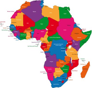
Colorful Africa map with countries and capital cities

Highly detailed set of vector flag maps of all the Africa countries.

Vector map of Mediterranean region countries

Detailed africa map with separated countries

Map of the Iberian Peninsula

Africa - Highly detailed editable political map with separated layers.

Libya map. Country poster with colored regions. Old grunge texture. Vector illustration of Libya with country name.
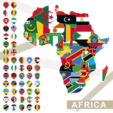
Africa map with flags, Africa map colored in with their flag. Vector Illustration.

Vector map of the Italian national highway system

Detailed map poster of Algiers city administrative area. Skyline panorama. Decorative graphic tourist map of Algiers territory. Royalty free vector illustration.

OPEC, Organization of the Petroleum Exporting Countries. World map with black highlighted member states since 2017. Vector illustration.

Africa. Highly detailed and editable simple political map. The map includes only separated layers of continet states and capitals names, without water resources and islands.

Retro color map of Northern Africa and the Middle East

Abstract Africa map of glowing radial dots. Vector illustration, eps 10
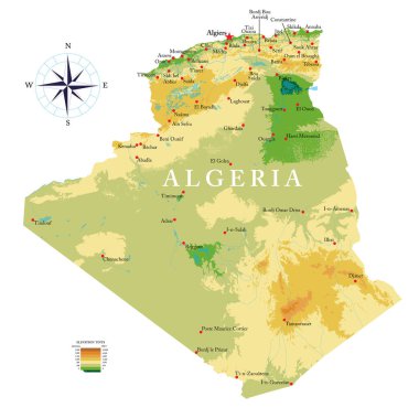
Highly detailed physical map of Algeria in vector format,with all the relief forms,regions and big cities.

African country set with map pointers

Highly detailed political map of Africa isolated on white and flat map pointers with separated layers.

Map of Algeria. Vector illustration. World map

Africa old retro map with separated layers.

Highly Detailed Africa political map

Northern africa administrative map with flags

Africa highly detailed map and navigation icons. Vector illustration.

North africa - vector maps of territories

Africa highly detailed map and colored map pointers. Vector illustration.

Abstract polygonal geometric design map of Africa painted into state flags colors.

Southern Africa map. High detailed political map of southern african region with country, capital, ocean and sea names labeling.

Colorful Africa map

Vector illustration country nation national culture

Vector illustration country nation national culture

Grey map of Algeria
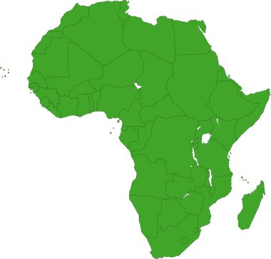
Africa map with countries

Vector map of map of Algeria with high details

Map of gibraltar. High detailed vector map - gibraltar.

Silhouette maps of the countries of the Arab League

Africa contoured map with highlighted Senegal. Senegal map and flag on Africa map. Vector Illustration.

Africa contoured map with highlighted Benin. Benin map and flag on Africa map. Vector Illustration.

Africa contoured map with highlighted Guinea. Guinea map and flag on Africa map. Vector Illustration.

Colorful Africa map with countries

Abstract Africa map of radial dots. Vector illustration, eps 10

Highly detailed vector map of Libya with administrative regions, main cities and roads.

Africa contoured map with highlighted Sierra Leone. Sierra Leone map and flag on Africa map. Vector Illustration.

African country set with map pointers

Africa map icon for your design, concept Illustration.

Africa contoured map with highlighted Nigeria. Nigeria map and flag on Africa map. Vector Illustration.

Map of Middle East with borders of countries

Blur background with silhouette of Africa. Blur Africa. Africa. Africa map. Blur. Blur background. Silhouette of Africa. Yellow Africa. Silhouette Africa. Blur Africa sunset. African map. African sun.

Africa contoured map with highlighted Mauritania. Mauritania map and flag on Africa map. Vector Illustration.

Africa contoured map with highlighted Libya. Libya map and flag on Africa map. Vector Illustration.

Orange abstract map of Africa

Country shape outlined and filled with the flag of Algeria

Detailed illustration of a ballotbox in front of a map of Algeria, eps10 vector

African country set with map pointers

African country set with map pointers

Map of Algeria - vector illustration

Blue abstract map of Africa

A Retro Gaming Controller with the flag of Algeria

Vector illustrated flags on letter A

Africa Simple line vector button. Thin line illustration icon. White outline symbol on grey background

Algeria map flag and text illustration, on world map

A Country Shape Illustration of Algeria

Flag of Algeria - vector illustration

Algeria silhouette map. Isolated vector template image of North African country in simple style

Algeria map vector illustration, Algeria map silhouette, Algeria country Landscape, Black and white Algeria map

Detailed africa map with separated countries

A minimalist and clean graphic representation of the country of Algeria, presented as an outline with a subtle three-dimensional effect and cast shadow. The transparent PNG background ensures