Description:
This Baltic Nations SVG vector file illustrates the iconic elements and cultural symbols of the Baltic states: Estonia, Latvia, and Lithuania. Presented in a scalable SVG format, this clipart is designed for versatility and high-quality reproduction in various sizes. The design includes key landmarks and motifs representative of each nation, making it ideal for both personal and commercial use. The clean lines and distinct shapes allow for easy integration into digital projects or printed materials. This graphic is suitable for use in educational resources, marketing materials, and creative artworks.
Usage ideas:
The Baltic Nations SVG vector can be utilized in a variety of commercial and educational contexts. For instance, educators can incorporate this design into lesson plans about European history or geography, enhancing classroom presentations. Businesses can use the vector in promotional materials for travel agencies or cultural events, showcasing the unique characteristics of the Baltic region. This clipart can also be adapted for social media graphics, website banners, or merchandise such as T-shirts and posters, making it a dynamic addition to creative projects.

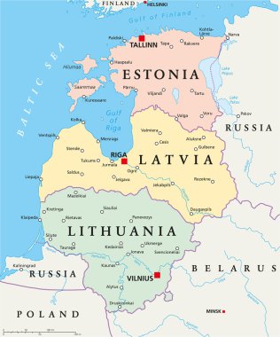
Baltic single states political map, known as Baltics, Baltic nations or states. Estonia, Latvia and Lithuania in different colors and with national borders. English labeling, illustration over white.

Baltic States Political Map. Estonia, Latvia and Lithuania with capitals Tallinn, Riga and Vilnius. With national borders, important cities, rivers and lakes. English labeling and scaling.

Baltic countries political map, also known as Baltics, Baltic nations or states. Estonia, Latvia and Lithuania with national borders. Gray illustration with English labeling and scaling over white.

Flags: Poland, Lithuania, Latvia, Estonia - vector image.

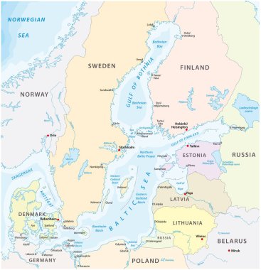
Baltic Sea area countries political map with national borders. Nations and states of Scandinavia. English labeling and scaling. Gray illustration on white background.

Baltic countries political map. Baltic states area with capitals, national borders, important cities, rivers and lakes. English labeling and scaling.

Map of the railroad tracks in the three Baltic states

Nordic Council organization flag, vector illustration

Map of the baltic sea the marginal sea of the atlantic ocean

Colorful baltic states administrative and political vector map

Character from Lithuania dressed in the traditional way Vector Illustration. Kids of the World Collection.