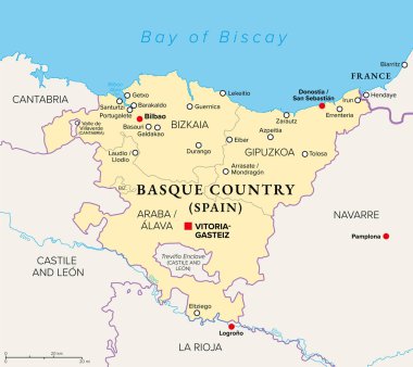
Basque Country, Euskadi, political map with capital Vitoria-Gasteiz and largest city Bilboa. The Basque Autonomous Community in northern Spain includes the provinces Araba, Bizkaia and Gipuzkoa.
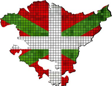
Basque map with flag inside, Vector map of the autonomous community of Basque, Basque flag and map, Abstract Mosaic Grunge Basque Flag
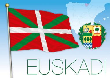
Basque country flag, coat of arms and map, vector file, illustration
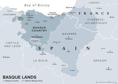
Basque Lands, gray political map. Basque Country, autonomous community in Spain with capital Vitoria-Gasteiz in dark gray, and historic Basque area in Spain and France in dark and lighter gray colors.
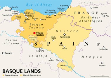
Basque Lands, political map. Basque Country, an autonomous community in Spain, with capital Vitoria-Gasteiz, in orange color. The historic Basque area in Spain and France, in orange and yellow color.
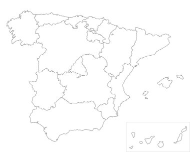
Map of Spain
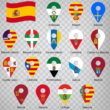
Seventeen flags of the Autonomous Community of Spain - alphabetical order with name. Set of 2d geolocation signs like flags lands of Spain. Seventeen geolocation signs for your design, logo. EPS10.

Map of Spain
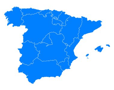
Accurate map of Spain

Map of Spain
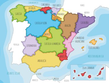
Vector illustrated map of Spain with regions and territories and administrative divisions, and neighbouring countries. Editable and clearly labeled layers.

Accurate map of Spain

Blue map of Spain

Spain map (colored by autonomous communities) with administrative divisions
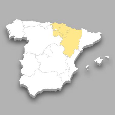
North East region location within Spain 3d isometric map

Map of Spain

Map of Spain

Spain, autonomous communities, gray political map. First-level administrative divisions with limited autonomy to 17 autonomous communities and the two cities Ceuta and Melilla. Illustration. Vector
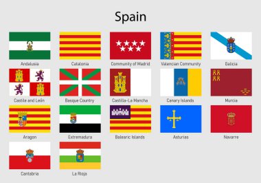
Set Flags of the communities of Spain, All Spanish regions flag collection

The Basque Country region map divided in provinces, Spain
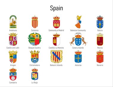
Coat of arms of the communities of Spain, All Spanish regions emblem collection

Satellite map of Bilbao, it is a city in northern Spain, the largest city in the province of Biscay and in the Basque Country. Map of streets and buildings of the town center. Europe

Vector map of Spain and provinces GRAY

Vector map of the city of Vitoria-Gasteiz, Spain

Vector map of the city of Vitoria-Gasteiz, Spain

Vector illustrated blank map of Spain with regions and territories and administrative divisions, and neighbouring countries. Editable and clearly labeled layers.

Map of Spain
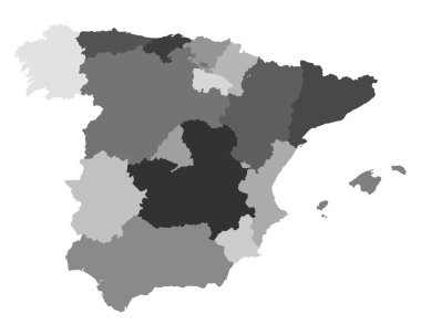
Map of Spain

Vector map of the city of Vitoria-Gasteiz, Spain

Vector map of the city of Vitoria-Gasteiz, Spain

Map of the Basque Country or Euskadi with the provinces of Guipzcoa, Donostia, Vizcaya and Bilbao. Basque Country map silhouette in green

Map of Spain

Map of Spain

Map of Spain

European country Spain and autonomies in details

European country Spain and autonomies in details

Map of Spain

Map of Spain

Map of Spain

Map of Spain

Map and flag of Spain

Accurate map of Spain

European country Spain and autonomies in details

Bilbao, Basque Country silhouette skyline. Spain - Bilbao, Basque Country vector city, spanish linear architecture, buildings. Bilbao, Basque Country line travel illustration, landmarks. Spain flat

Map of Spain

European country Spain and autonomies in details

Accurate map of Spain

Accurate map of Spain

European country Spain and autonomies in details

European country Spain and autonomies in details

Flag of Basque Vector

Grunge Basque country flag, Basque country flag with shadow on isolated background, vector illustration

Basque Country blank detailed outline map set - Spanish version

Spain political map of administrative divisions - autonomous communities and autonomous cities of Ceuta and Melilla. Grey blank vector editable map EPS.

Basque Country, Canary Islands, Cantabria, Castile and Leon, Castilla-La Mancha outline maps

Basque Country outline map isolated on white background, Spain

Basque Country of Spain map symbol shape, travel web flat vector illustration .
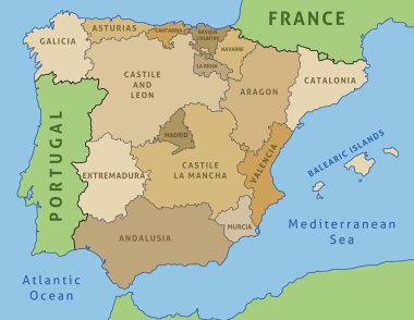
Map of Spain. Outline illustration country map autonomous communities.
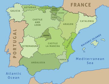
Map of Spain. Outline illustration country map autonomous communities.
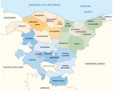
Basque country administrative and political vector map in basque language

Pink political map of Spain. Administrative divisions - autonomous communities. Simple flat vector map with labels.
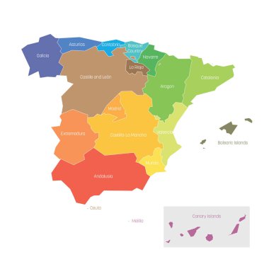
Political divisions of Spain. Map of regional country administrative divisions. Colorful vector illustration.

Spain administrative and political vector map with flags

Vector map of the city of Bilbao, Basque Country, Spain

The detailed map of the Spain with regions

Detailed vector map of Spain with administrative divisions into autonomous communities and islands, vector illustration with the location of the country in Europe

Bilbao metropolitan area administrative and political vector map

Blue political map of Spain. Administrative divisions - autonomous communities. Simple flat vector map with labels.
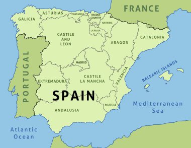
Map of Spain. Outline illustration country map autonomous communities.

Spain regional flag and map, autonomous community of Spain, vector file, illustration

Map of Spain in black with white flash

Blue map of Spain and the islands, with administrative divisions into autonomous communities and islands, vector illustration on a white background

Vector map of the city of Bilbao, Basque Country, Spain

Illustration of Map of Spain

Administrative division of the Kingdom of Spain

The detailed map of the Spain with regions or states and cities, capitals

Illustration of Map of Spain in black

Spain, Coat of arms of Kingdom of Spain with flag & monogram, vector file, illustration

Administrative division of the Kingdom of Spain

Map of Basque Country is a state Spain with flag. Vector Illustration

Dogs by country of origin. Spanish dog breeds. Shepherds, hunting, herding, toy, working and service dogs set. Vector illustration

Map pointer with Basque Country flag, autonomous community of Spain. Vector illustration.