
Vilnius retro vintage lamppost pointer. Vilnius Capital Lithuania tourism travel.
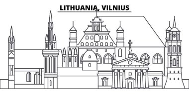
Lithuania, Vilnius line skyline vector illustration. Lithuania, Vilnius linear cityscape with famous landmarks, city sights, vector design landscape.
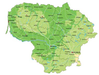
Highly detailed Lithuania physical map with labeling.
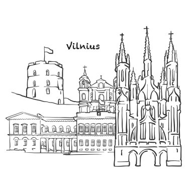
Famous buildings of Vilnius, Lithuania Composition. Hand-drawn black and white vector illustration. Grouped and movable objects.
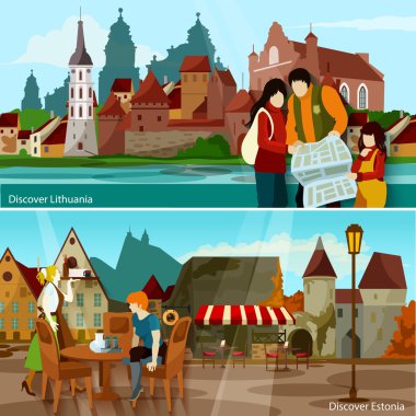
European Cityscapes Flat Concept. Europe And Sights Horizontal Compositions. European Cities Vector Illustration. European Countries Isolated Set. Discover Lithuania And Estonia Design Symbols.

Architecture of old town, hand drawn sketch, vector illustration
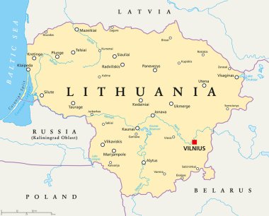
Lithuania political map with capital Vilnius, national borders, important cities, rivers and lakes. English labeling and scaling. Illustration.

Lithuania road and national park map
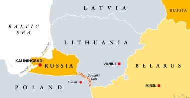
Suwalki Gap, political map. Also known as the Suwalki Corridor, the border starting from the Russian exclave Kaliningrad Oblast to Belarus, between Lithuania and Poland, near the Polish town Suwalki.

Vector Scandinavian and Baltic countries map with flags and cities skylines: Copenhagen, Stockholm, Oslo, Reykjavik, Helsinki, Riga, Tallinn, Vilnius.

Poland administrative and political vector map

Baltic States and Kaliningrad Oblast, gray political map. From Finland to Estonia, Latvia and Lithuania to Poland, and from the Russian exclave Kaliningrad, to Belarus and the European Part of Russia.

The detailed map of Lithuania with regions or states and cities, capital. Administrative division

Flag of Lithuania with Coat of Arms. Vector Format

Vector illustration for Lithuania independence day

High detailed vector political Europe map with capitals, cities, towns, rivers and lakes.
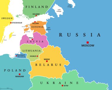
Baltic States, colored countries, political map. From Finland to Estonia, Latvia and Lithuania to Poland, and from the Russian exclave Kaliningrad Oblast, to Belarus and the European Part of Russia.

Map of the Baltic state of Latvia

Latvia road and National Park map
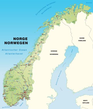
Map of Norway with highways capital cities and neighboring countries

Europe Political Map and Roads. Detailed vector illustration of Europe Map.

Baltic Sea Area Map - Vintage Detailed Vector Illustration
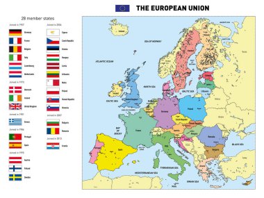
Vector highly detailed political map of The European Union with flags and capitals. All elements are separated in editable layers clearly labeled.

Hand drawn artistic postcard with Famous Catholic church and Old town in Vilnius, Lithuania, Europe

Vilnius line art landscape

Detailed map of Europe with cities

Baltic Sea Area Map - Vintage Detailed Vector Illustration
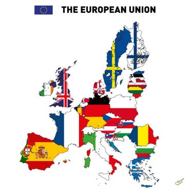
Vector highly detailed political map of The European Union with flags and capitals. All elements are separated in editable layers clearly labeled.

Lithuania, Vilnius cityscape line vector. Travel flat city landmark, oultine illustration, line world icons

Lithuania architecture vector city skyline, black cityscape with landmarks, isolated sights on background
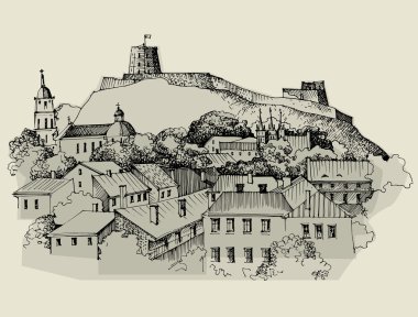
Architecture of old town, hand drawn sketch, vector illustration

Lithuania vector set. Isolated.

Vilnius Lithuania Famous Buildings, Monochrome Outlined Travel Landmarks, Scalable Vector Illustration
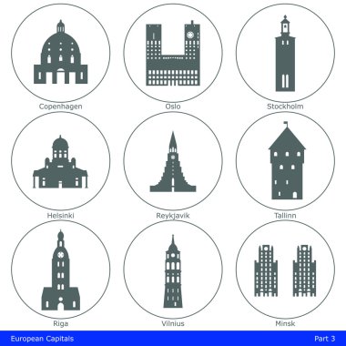
European capitals symbolized by their main landmark building

Vilnius Lithuania Panorama Sketch, Monochrome Urban Cityscape Vector Artprint
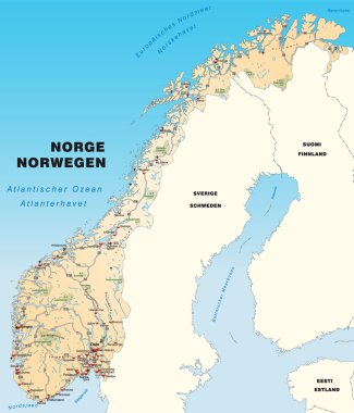
Map of Norway with highways capital cities and neighboring countries

Colorful Vilnius drawing on wooden background

Vector file, illustration of lithuania flag, europe

Latvia political map with capital Riga, national borders, important cities, rivers and lakes. English labeling and scaling. Illustration.

Baltic Sea Area Map - Vintage Detailed Vector Illustration

Architecture of old town, hand drawn sketch, vector illustratio

Lithuania, Vilnius city skyline isolated vector illustration. Lithuania, Vilnius travel cityscape with landmarks

Republic of Lithuania - vector map

Architecture of old town, hand drawn sketch, vector illustration

Vilnius, Lithuania famous Travel Sketch. Lineart drawing by hand. Greeting card design, vector illustration

The detailed map of Lithuania with regions or states and cities, capital. Administrative division

Vilnius City (Republic of Lithuania) map vector illustration, scribble sketch City of Vilnius map

Architecture of old town, hand drawn sketch, vector illustration

Vector set of Baltic and Scandinavian countries' cities skylines: Copenhagen, Stockholm, Oslo, Reykjavik, Helsinki, Riga, Tallinn, Vilnius.

Vilnius, capital of Lithuania and its largest city

Vector Europe map

Latvia administrative and political vector map with flag

Coat of arms of Vilnius is the capital of Lithuania. Vector illustration

Hand drawn artistic postcard with Famous Catholic church and Old town in Vilnius, Lithuania, Europe

Detailed vector map of Lithuania and capital city Vilnius

Architecture of old town, hand drawn sketch, vector illustration

Travel VILNIUS GEDIMINAS Poster Template.

One continuous line drawing of Vilnius city skyline, Lithuania. Beautiful landmark. World landscape tourism travel vacation wall decor poster print. Stylish single line draw design vector illustration

Contour detailed Europe political map with cities

Lithuania city skyline isolated vector illustration. Lithuania travel cityscape with landmarks

Vilnius, Lithuania, Greeting Card, hand drawn image, famous european capital, vintage style, vector Illustration

Architecture of old town, hand drawn sketch, vector illustration

World flags of Lebanon, Lesotho, Liberia, Libya, Liechtenstein, Lithuania, Luxembourg an Macau, with capitals, geographic coordinates and coat of arms, vector art illustration

Contour of Lithuania in grey and in flag colors

Vilnius, Lithuania, Colorful Artmap, Vector Map, Local Urban Travel Landmark. Infographic Design Template

Baltic Sea Area Map - Detailed Vector Illustration

VILNIUS GEDIMINAS Monument. World Travel Natural illustration Background in Line Style

Flags of the European Union and Ukraine, as well as EU member states. Flat minimum trend.

Black grunge rubber stamp with the name of Vilnius city, the capital of Lithuania

Vector maps and flags of Europe countries with administrative divisions (regions borders)

Baltic Sea Area Map - Detailed Info Graphic Vector Illustration

Scandinavian and Baltic regions countries political detailed map. Vector illustration

Vector color map of Belarus country

Vector map of Lithuania | Outline detailed map with city names

Architecture of old town, hand drawn sketch, vector illustration

Architecture of old town, hand drawn sketch, vector illustration

Lithuania map with shadow effect

Coat of arms of Telsiai is a city in Lithuania. It is the capital of Telsiai County and Samogitia region. Vector illustration

Vector map Lithuania. Isolated vector Illustration. Black on White background. EPS 10 Illustration.

Lithuania vector map with infographic elements, pointer marks. Editable template with regions, cities and capital Vilnius.

Abstact background with cityscape of European capitol

Lithuania map with borders, cities, capital and administrative divisions. Infographic vector map. Editable layers clearly labeled.

Stamp or label with text Vilnius, Lithuania inside, vector illustration

Eurozone word cloud concept. Vector illustration

Set of grunge rubber stamps with names of Lithuania cities, vector illustration

Lithuania on the globe. Earth centered at the location of the Republic of Lithuania. Map of Lithuania. Includes layer with capital cities.

Eurozone word cloud concept. Vector illustration
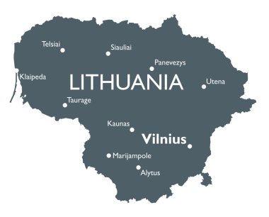
Monochrome vector Lithuania map

Lithuania world map with a pixel diamond texture. World geography.

Map of Lithuania. Vector illustration

Vilnius Lithuania Map in Retro Style. Vector Illustration. Outline Map.

A stylish and vibrant graffiti design spells out Lithuania against a stark black backdrop, capturing attention with its bold and unique lettering.

Lithuania - detailed map with administrative divisions country. Vector illustration

A stylish and vibrant graffiti design spells out Lithuania against a stark black backdrop, capturing attention with its bold and unique lettering.

Vector map of Northern Europe with the most important cities and bodies of water

Kaliningrad and vicinity, gray political map. Kaliningrad Oblast, exclave and westernmost federal subject of Russia on Baltic Sea, between Lithuania and Poland. With strategic choke point Suwalki Gap.

Lithuania flag in a hexagon frame.

Flat style Vilnius Vector Icon

Lithuania National Flag and Country Map in Flat Style Featuring European Travel and Geography Symbol

Map of the Polish Podlaskie Voivodeship