
Mayo-Kebbi Est, Mayo-Kebbi Ouest, Moyen-Chari, Ouaddai, Salamat outline maps

Ennedi Est, Ennedi Ouest, Guera, Hadjer-Lamis outline maps

Niger highly detailed physical map
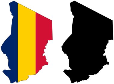
Layered editable vector illustration country map of Chad,which contains two versions, colorful country flag version and black silhouette version.

Africa contoured map with highlighted Burkina Faso. Burkina Faso map and flag on Africa map. Vector Illustration.

African continent and all countries of Africa. Vector illustration

Central Africa administrative map with flags
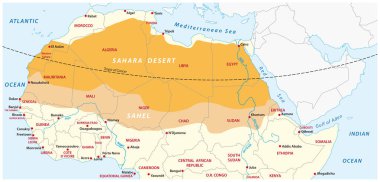
Vector map of the Sahara desert and Sahel zone

Highly detailed set of vector flag maps of all the Africa countries.

Vector illustration of Africa black outline map with countries. Vector Africa map.
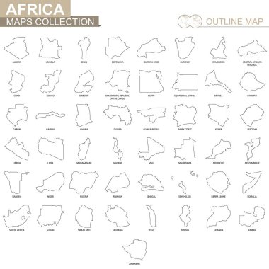
Outline maps of African countries collection, black lined vector map.

Vector administrative and political map of the Federal Republic of Nigeria
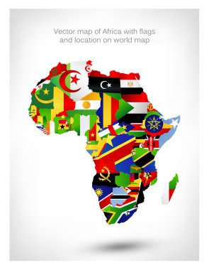
Vector map of Africa with flags and location on world map. Vector illustration.

Flag of Central African Republic - vector illustration

Africa contoured map with highlighted South Africa. South Africa map and flag on Africa map. Vector Illustration.
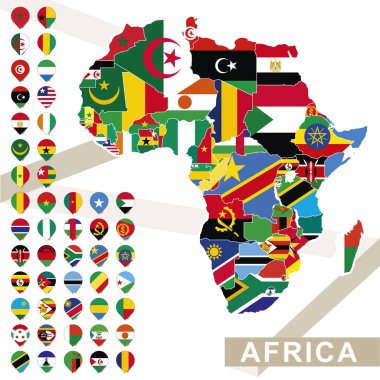
Africa map with flags, Africa map colored in with their flag. Vector Illustration.

Satellite map of N'Djamena, Chad, city streets. Street map, city center. Africa

Chad vector map with infographic elements, pointer marks. Editable template with regions, cities and capital N'Djamena.

African country set with map pointers

African continent and all countries of Africa. Vector illustration
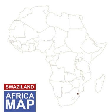
Africa contoured map with highlighted Swaziland. Swaziland map and flag on Africa map. Vector Illustration.

Africa contoured map with highlighted Ivory Coast. Ivory Coast map and flag on Africa map. Vector Illustration.

Africa contoured map with highlighted Niger. Niger map and flag on Africa map. Vector Illustration.

Vector road map of the West African state of Nigeria

Abstract polygonal geometric design map of Africa painted into state flags colors.

Africa contoured map with highlighted Kenya. Kenya map and flag on Africa map. Vector Illustration.

High detailed Africa road map with labeling - Black. (clearly labeled on separated layers)

Africa contoured map with highlighted Senegal. Senegal map and flag on Africa map. Vector Illustration.

Africa contoured map with highlighted Lesotho. Lesotho map and flag on Africa map. Vector Illustration.

Africa contoured map with highlighted Equatorial Guinea. Equatorial Guinea map and flag on Africa map. Vector Illustration.

Africa contoured map with highlighted Benin. Benin map and flag on Africa map. Vector Illustration.

Africa contoured map with highlighted Guinea. Guinea map and flag on Africa map. Vector Illustration.

Africa contoured map with highlighted Cameroon. Cameroon map and flag on Africa map. Vector Illustration.

Highly detailed vector map of Libya with administrative regions, main cities and roads.

Africa contoured map with highlighted Sierra Leone. Sierra Leone map and flag on Africa map. Vector Illustration.

Africa contoured map with highlighted Malawi. Malawi map and flag on Africa map. Vector Illustration.

Africa contoured map with highlighted Djibouti. Djibouti map and flag on Africa map. Vector Illustration.

Africa contoured map with highlighted Namibia. Namibia map and flag on Africa map. Vector Illustration.
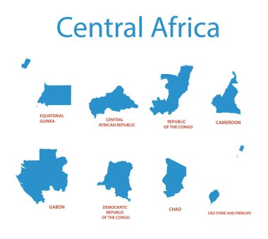
Central Africa - vector maps of territories

African country set with map pointers

Africa contoured map with highlighted Gabon. Gabon map and flag on Africa map. Vector Illustration.

Africa contoured map with highlighted Uganda. Uganda map and flag on Africa map. Vector Illustration.

Africa contoured map with highlighted Nigeria. Nigeria map and flag on Africa map. Vector Illustration.

Africa contoured map with highlighted Mauritania. Mauritania map and flag on Africa map. Vector Illustration.

Africa contoured map with highlighted Chad. Chad map and flag on Africa map. Vector Illustration.
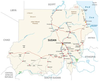
Republic of the Sudan road vector map

Vector road map of Federal Republic of Nigeria

Map of Central African Republic with flag - vector illustration

African country set with map pointers

Map of Central African Republic - vector illustration

African country set with map pointers

Doodle Map of Central African Republic - vector illustration

An Illustrated Country Shape of Chad

Detailed Chad Map Collection with Outline, Silhouette, Regions, and Flag Overlay Variations

Kanem, Lac, Logone Occidental, Logone Oriental, Mandoul outline maps

Sila, Tandjile, Tibesti, Ville de N Djamena, Wadi Fira outline maps

Barh el Ghazel, Batha, Borkou, Chari-Baguirmi outline maps

Chad Country Flag hand drawing illustration vector based drawing

Chad flag shape vector illustration on white background

Faroe Islands Map Silhouette with National Flag Design

Chad map vector illustration on white background

Chad Map Silhouette with National Flag Design