Description:
This SVG clipart features a detailed map of Coahuila, showcasing the state's geographic boundaries and major landmarks. Rendered in a scalable vector format, it allows for easy resizing without loss of quality. The design is clear and easy to interpret, making it suitable for various applications. It is particularly useful for educational materials or design projects that require geographic representation. The vector format ensures compatibility with various software, such as Adobe Illustrator and CorelDRAW. The simplicity of the design makes it ideal for layering and customization. The map is provided in a monochrome style that can be easily adapted to suit specific color palettes. Perfect for both digital and print usage, this clipart serves multiple design purposes.
Usage ideas:
The Coahuila map SVG can be effectively utilized in a variety of contexts, including educational presentations on geography or state studies. Teachers can incorporate it into classroom materials or handouts for students learning about different regions. Additionally, businesses might find this clipart valuable for creating marketing materials that highlight regional services or products. Graphic designers can use the map as part of travel brochures or websites focusing on tourism in Coahuila. Nonprofit organizations can leverage it in reports or grants that discuss community development in the area. Moreover, use it in app design where geographic context is required, ensuring a professional and informative interface.

High Quality map of Coahuila is a state of Mexico, with borders of the municipalities

Coahuila (United Mexican States, Mexico, federal republic) map vector illustration, scribble sketch Free and Sovereign State of Coahuila de Zaragoza map

Coahuila blank outline map set

Coahuila state blank contour map

Coahuila state blank outline map set

Sacramento municipality (Free and Sovereign State of Coahuila de Zaragoza, Mexico, United Mexican States) map vector illustration, scribble sketch Sacramento map
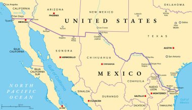
Mexico-United States border political map. International border between the countries Mexico and the USA, with states, capitals, and most important cities. Most frequently crossed border in the world.

Vector blank map of Mexico with regions or states and administrative divisions, and neighbouring countries. Editable and clearly labeled layers.
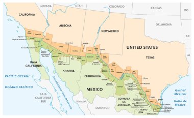
Vector map of the border districts in the United States and Mexico along the border

Vector blank map of Mexico with regions or or states and administrative divisions. Editable and clearly labeled layers.

Vector map of Mexico with regions or or states and administrative divisions. Editable and clearly labeled layers.

Vector map of Mexico with regions or states and administrative divisions, and neighbouring countries. Editable and clearly labeled layers.

A gray map of Mexico divided into provinces
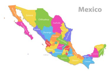
Mexico map, new political detailed map, separate individual states, with state names, isolated on white background 3D vector

Location of Coahuila on map Mexico. 3d location sign of Coahuila. Quality map with provinces of Mexico for your design. EPS10.
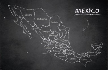
Mexico map, new political detailed map, separate individual states, with state names, card blackboard school chalkboard vector
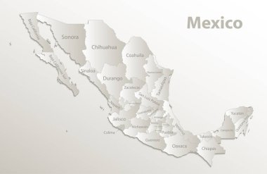
Mexico map, new political detailed map, separate individual states, with state names, card paper 3D natural vector
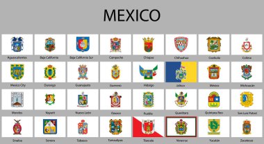
All Flags of regions of Mexico. Vector illustraion

Vector blank map of Mexico with regions or or states and administrative divisions. Editable and clearly labeled layers.
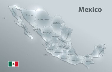
Mexico map flag, new political detailed map, separate individual states, with state names, glass card 3D state names, isolated on white background 3D vector

High Quality map of Coahuila is a state of Mexico, with borders of the municipalities

Coahuila Mexico Map black inverted silhouette

Coahuila state blank vector outline map set

Coahuila region location within Mexico 3d isometric map

Saltillo City (United Mexican States, Mexico, Coahuila State) map vector illustration, scribble sketch City of Saltillo map