
Corsica map vector illustration, scribble sketch Corsica
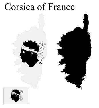
Set of maps of Corsica of France. Flag on the map. Silhouette of the card. Vector illustration

High detailed France physical map.

Silhouettes of country France and the regions

Detailed France physical map.
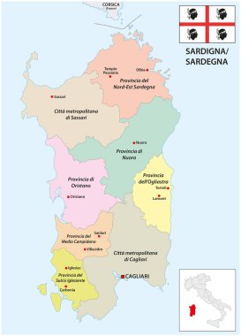
New administrative map of the Italian Mediterranean island of Sardinia, 2021

Map of Elba Island and the Tuscan Archipelago, Italy

Silhouettes of country France and new regions since 2016

High detailed France physical map with labeling.

Italy map, black and white detailed outline regions of the country. Vector illustration

High detailed France road map with labeling.

France - Highly detailed editable political map with labeling.

Silhouettes of european country France and new regions

Editable colorful vector map of Italy. Vector map of Italy isolated on background. High detailed. Autonomous communities of Italy. Administrative divisions of Italy, separated provinces. outline map.

Colorful France political map with clearly labeled, separated layers. Vector illustration.

Blank map France. Departments of France map. High detailed blue vector map of France on white background for your web site design, logo, app, UI. Stock vector. EPS10.

High detailed France physical map with labeling.
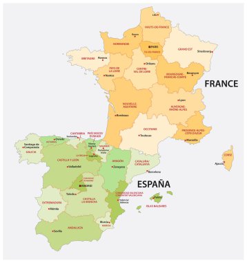
Administrative and political vector map of spain and france in the respective national language.

Silhouettes of european country France and new regions

France with regions. Vector illustration.

France - Highly detailed editable political map with labeling.

The detailed map of the France with regions or states and cities, capital, national flag

Silhouettes of country France and new regions since 2016

Blank map France. Departments of France map. High detailed gray vector map of France on transparent background for your web site design, logo, app, UI. Stock vector. EPS10.

France map icon for your design, concept Illustration.

Corse blank outline map

Corsica icon. Island map on dark background. Stylish Corsica map with island name. Vector illustration.

The detailed map of the France with regions or states

Vector hand drawn stylized map of France. Travel illustration with rivers names. Hand drawn lettering. Europe map element

France map icon. Isolated on white background. From blue icon set.

Vector illustration of the flag of Corsica with black contours on a white background

Map art vector background nation

Vector map of France with shadow isolated on white projected in UTM geographic coordinate system.
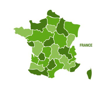
Vector illustration of a green France map

European country france and all regions in details

Highly detailed editable political map with separated layers. France.

The Corsica dark silhouette map isolated on white background, France

Corsica map outline - smooth simplified island shape map vector.

Vector map France. Isolated vector Illustration. Black on White background. EPS 10 Illustration.

Color map of france with pins on main cities. simple flat style trend modern logo graphic design isolated on green background. concept of abstract french outline mapping like infographics element

Map of Italy for your design, concept Illustration.

3D map of Corsica (French Republic islands) - white, purple, green, brown, yellow, blue and gold - vector illustration

Map of France isolated on blue background. European country. Vector template for website, design, cover, infographics. Graph illustration.

Map of France vector

High detailed France physical map.

Dot map of France. Vector eps10

Vector Map of France with Administrative borders, City and Region Names and international bordering countries in soft colors palette

Vector hand drawn stylized map of France. Travel illustration with french regions, cities names. Hand drawn lettering. Europe map element

France map. Golden France logo. Creative France logo design

Vector hand drawn stylized map of France. Travel illustration with water and neighboring countries. Geography illustrations

France is mainly divided into 18 administrative regions, 13 regions in metropolitan France and five located overseas

The detailed map of the France with regions or states and cities, capital

Silhouettes of country France and new regions since 2016

Corsica map blackboard school chalkboard vector

Crete Island outline map isolated on white background, Greece

Blue Map of France icon isolated on white background. Vector.
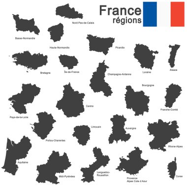
Silhouettes of country France and the regions

Silhouettes of country France and new regions since 2016

Blank contour maps of France - vector version

France map with corsica

Vector hand drawn stylized map of France. Travel illustration with french regions, cities and rivers names. Hand drawn lettering. Europe map element

Silhouettes of country France and the regions

Silhouettes of european country France and new regions

Black Map of France icon isolated on yellow background. Silver rectangle button. Vector.

Silhouettes of country France and new regions since 2016

Black simplified flat silhouette map of France. Vector country shape.

Silhouettes of country France and the regions

Vector contour Map of Corsica with name. Map of Corsica is isolated on a white background. Simple flat dotted geographic map template.

Corsica map vector illustration, scribble sketch Corsica

French Republic map outline and official flag icon isolated on white background. vector France political map illustration. European State geographic banner template. Corsica island vector

Map of France with administrative division and cities

Corsica map island card paper 3D natural vector

French Republic map and official flag icon. vector France political map logotype. European State geographic banner template. Republique Franaise

France map separate region names individual card blackboard chalkboard vector

Silhouettes of european country France and new regions

Silhouettes of european country France and new regions

European country france and all regions in details

France map icon set. France map signs - outline, solid and French national flag. Vector illustration.