
Blank map of Denmark in gray. Map of administrative divisions of Denmark. High detailed vector map Kingdom of Denmark on transparent background for your web site design, logo, app, UI. EPS10.
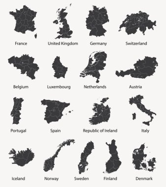
Vector set of european maps with region borders

Denmark vintage map and flag - vector illustration

Denmark Map - Detailed Vector Illustration
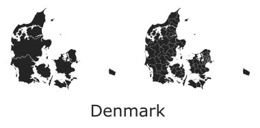
Denmark vector maps with administrative regions, municipalities, departments, borders

Denmark map - high details vector illustration

High detailed colored political map of Europe with countries' regions. Vector
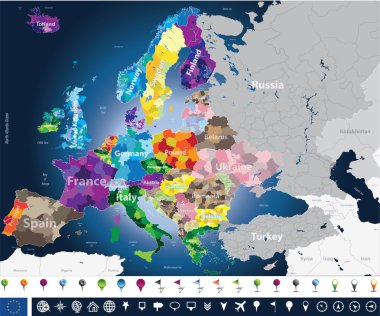
High detailed Europe map with coutries names and region borders

Vector map of Denmark with regions
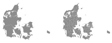
Two detailed vector maps of Danish administrative regions and areas in grey color

Denmark outline map vector with administrative borders, regions, municipalities, departments in black white colors

Denmark map and flag - vector illustration

Denmark map and flag - vector illustration

Map of Denmark - high details vector illustration

Denmark map and flag with Copenhagen city skyline. Vector illustration

Baltic Sea Area Map - Vintage Detailed Vector Illustration

Denmark Map - Detailed Vector Illustration

Denmark region map: grey outline on white background. Detailed map of Denmark regions. Vector illustration.

Arctic Map - Vintage Detailed Vector Illustration

Denmark Map - Vintage Detailed Vector Illustration

Europe map - highly detailed vector illustration.

Arctic Map - Vintage Detailed Vector Illustration

Arctic Map - Detailed Vector Illustration

Europe vector map infographic template

Map of Europe - Highly Detailed Vector illustration

Europe Map - Detailed Vector Illustration

Baltic Sea Area Map - Vintage Detailed Vector Illustration

Map of Europe - Highly Detailed Vector illustration

Europe map - highly detailed vector illustration.

Europe Map - Vintage Detailed Vector Illustration

Europe Map - Vintage Detailed Vector Illustration

Europe map - highly detailed vector illustration. Image contains land contours, country and land names, city names, water object names, navigation icons.

Europe Map - Detailed Vector Illustration

Europe map - highly detailed vector illustration Image contains next layers: - land contours - country and land names - city names - water object names

Greenland region map: grey outline on white background. Detailed map of Greenland regions. Vector illustration.

Europe map - highly detailed vector illustration Image contains next layers: - land contours - country and land names - city names - water object names - navigation icons

Arctic Map - Vintage Detailed Vector Illustration

Europe map - highly detailed vector illustration Image contains next layers: - land contours - country and land names - city names - water object names - navigation icons

Arctic Map - Detailed Vector Illustration

Europe map - highly detailed vector illustration Image contains next layers: - land contours - country and land names - city names - water object names - navigation icons

Europe Map - Color Detailed Vector Illustration

Europe Map - Vintage Detailed Vector Illustration

Europe Map - Detailed Vector Illustration

Europe Map - Vintage Detailed Vector Illustration

Arctic Map - Vintage Detailed Vector Illustration

Arctic Map - Detailed Vector Illustration

Eurasia Europa Russia China India Indonesia Thailand Africa Map - Detailed Vector Illustration

Europe Map - Vintage Detailed Vector Illustration

Europe Map - Vintage Detailed Vector Illustration

Eurasia Europa Russia China India Indonesia Thailand Map - Detailed Vector Illustration

Eurasia Europa Russia China India Indonesia Thailand Map - Detailed Vector Illustration

Eurasia Europa Russia China India Indonesia Thailand Africa Map - Detailed Vector Illustration

Eurasia Europa Russia China India Indonesia Thailand Map - Detailed Vector Illustration

Eurasia Europa Russia China India Indonesia Thailand Map - Detailed Vector Illustration

Eurasia Europa Russia China India Indonesia Thailand Africa Map - Detailed Vector Illustration

Eurasia Europa Russia China India Indonesia Thailand Map - Detailed Vector Illustration

Eurasia Europa Russia China India Indonesia Thailand Map - Detailed Vector Illustration

Eurasia Europa Russia China India Indonesia Thailand Map - Detailed Vector Illustration

Eurasia Europa Russia China India Indonesia Thailand Map - Vintage Detailed Vector Illustration

Eurasia Europa Russia China India Indonesia Thailand Map - Detailed Vector Illustration

Eurasia Europa Russia China India Indonesia Thailand Africa Map - Detailed Vector Illustration
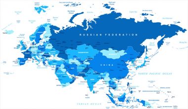
Eurasia Europa Russia China India Indonesia Map - Detailed Vector Illustration
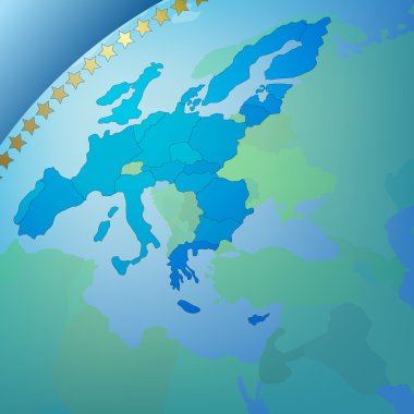
Abstract business blue background with europe map

Europe map - highly detailed vector illustration.

Eurasia Europa Russia China India Indonesia Thailand Map - Detailed Vector Illustration

Road and administrative map of Denmark

High detailed vector map - Denmark

Arctic Map - Detailed Info Graphic Vector Illustration

Arctic Map - Detailed Info Graphic Vector Illustration

Arctic Map - Vintage Detailed Vector Illustration

Vector illustration of Europe map.

Abstract background with europe map and compass

Denmark Map with states and modern round shapes

Baltic Sea Area Map - Vintage Detailed Vector Illustration

Arctic Map - Detailed Vector Illustration

Europe map - highly detailed vector illustration Image contains next layers: - land contours - country and land names - city names - water object names - navigation icons

Arctic Map - Detailed Info Graphic Vector Illustration

Europe map - highly detailed vector illustration Image contains next layers: - land contours - country and land names - city names - water object names - navigation icons

Europe vector high detailed political map with regions borders

Administrative and political vector outline map of the Kingdom of Denmark

Detailed, vector, blue map of Denmark with administrative divisions into regions country

Arctic Map - Detailed Vector Illustration
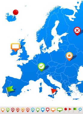
Vector illustration of Europe map and navigation icons

Arctic Map - Detailed Vector Illustration

Baltic Sea Area Map - Detailed Vector Illustration

Baltic Sea Area Map - Detailed Info Graphic Vector Illustration
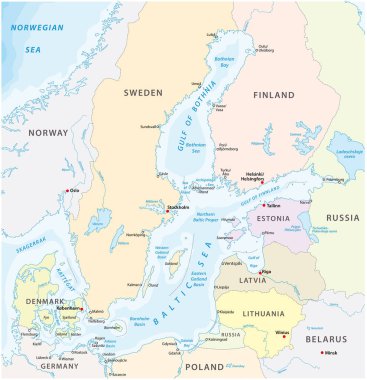
Map of the baltic sea the marginal sea of the atlantic ocean

Vector map infographic templates pack

Vector map infographic templates bundle.

Vector map infographic templates bundle

Denmark political map of administrative divisions - regions. Grey blank vector editable map EPS.

Hovedstaden, Midtjylland, Nordjylland, Sjealland, Syddanmark outline maps

Detailed Faroe Islands Map Collection with Outline, Silhouette, Regions, and Flag Overlay Variations

Denmark regional borders map. Black silhouette of Denmark with visible administrative borders vector illustration. Federal state territory division sign. Geographic and political boundary symbol.

Detailed Denmark Map Collection with Outline, Silhouette, Regions, and Flag Overlay Variations