East Java blank outline map set

3d isometric map of East Java is a province of Indonesia, vector illustration

Jawa Barat, Jawa Tengah, Jawa Timur, Kalimantan Barat outline maps

South East Asia political map. Black outline on white background. Simple flat vector illustration.

Abstract black outline of Bali map- vector illustration

South East Asia political map. Black outline on white background with black country name labels. Simple flat vector illustration.

Indonesia country vector color map

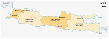
Simple administrative and political vector map of indonesian island java

Administrative and political vector map of Indonesia's districts on the island Borneo/ Kalimantan

Candi borobudur temple in Java island Indonesia vector line art thin outline

Vector road map of island Borneo, Kalimantan

Map of the Lesser Sunda Islands in the Malay Archipelago

Vector road map of Iseland Borneo / Kalimantan

Isolated polygon illustration of Indonesia, geography, infographics, travel, and location-based design projects.

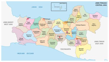
Jawa Tengah, Central Java administrative and political vector map, Indonesia

Indonesia detailed East Java map shape, Flat web graphic concept icon symbol vector illustration .

Abstract background illustration featuring a subtle map of Indonesia, combined with the colors of the Indonesian flag in a modern and elegant style. Perfect for presentations, posters, or design projects with a national theme.