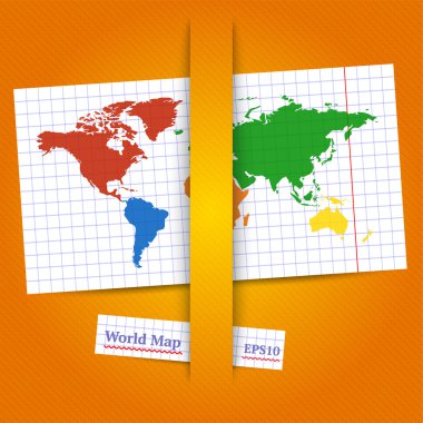
Colorful vector World map. Eps10

Set of navigation tools. Vector illustration

Set of the globe icons

Vector Globe Icon

Bold Vector Line Icon.

Bold vector line icon.

Vector Chalk School Geographical Globe on Dark Green Background

Simple illustration of America continent and Atlantic Ocean on geographical globe in comic style

Trade bold line icons.

Financial flat colored icon.

Business flat colored Icon.

Set of seo and marketing line icons.

Internet flat colored icon.

Financial flat colored icon.

Vector globe icons isolated on white
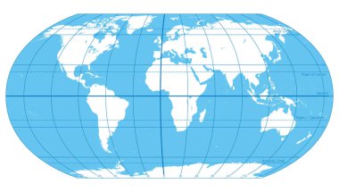
The World, important circles of latitudes and longitudes, blue colored political map. Equator, Greenwich meridian, Arctic and Antarctic Circle, Tropic of Cancer and Capricorn. Illustration. Vector.

Globe Icon. Editable Bold Outline With Color Fill Design. Vector Illustration.

Simple vector world map flat icon. Stock vector illustration isolated

Geography school earth globe web icon. vector illustration

China marked by blue in grey World political map. Vector illustration.

Vector Geographical Globe
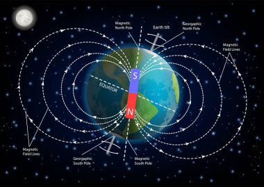
Earth magnetic field or geomagnetic field diagram. Vector illustration of planet Earth surrounded by magnetic field created by rotation of Earth on its axis. Educational poster, infographic template.

World Map - Highly Detailed Vector Map of the World. Ideally for the Print Posters

World Map - Highly Detailed Vector Map of the World. Ideally for the Print Posters

World map vector flat design illustration isolated on white background.

World map with magnifying on North Korea. Blue earth globe with North Korea flag pin. Zoom on North Korea map. Vector Illustration

High quality Outlined vector map of the world with only straight lines

World map with countries names.High detailed Vector world map complete with all countries names in blue background drawing by illustration

World Map - Highly Detailed Vector Map of the World. Ideally for the Print Posters

Political world map on white background, with every state labeled and selectable. Colored by continents. Versatile file, turn on an off visibility and color of each country in one click

World Map - Highly Detailed Vector Map of the World. Ideally for the Print Posters

World Map - Highly Detailed Vector Map of the World. Ideally for the Print Posters

World Map - Highly Detailed Vector Map of the World. Ideally for the Print Posters

World map, political, in high details. Vector illustration. All elements are separated in editable layers clearly labeled.

Blue vector world map complete with all countries and capital cities names.

Detailed world map with pinned enlarged map of Turkey and neighboring countries. Turkey flag and map.

Blank vector world map with sovereign countries and larger dependent territories. Every state is a group of objects in dark grey color with white borders. South Sudan included.

World Map Background With Country Name

World Map - Highly Detailed Vector Map of the World. Ideally for the Print Posters

World Map. Highly detailed map of the world with detailed borders of all countries in blue colors. Vector illustration

World Map - Highly Detailed Vector Map of the World. Ideally for the Print Posters

Globe Map in Light Grey Color with USA Marked Red. Vector Illustration

Map of the World - Highly Detailed Vector illustration

Decorative banner with flat Earth in space with sun and moon. Old Vision of Planet and solar system. Alternative theory of flat earth. Hand-drawn vector illustration in cartoon style.

Vector Colorful World Map with all continents in different colors and Earth globe with matching colors.

Map of Asia vector illustration, scribble sketch Asia

Political world map Van der Grinten projection

World Map - Highly Detailed Vector Map of the World. Ideally for the Print Posters

Terrestrial globe on white background. Vector illustration

Color circle global america map geography vector illustration

Compass icon

World Map silhouette Black color White line drawn vector design

Grey political World map with country borders and white state name labels. Hand drawn simplified vector illustration.

World Map - Highly Detailed Vector Map of the World. Ideally for the Print Posters

Red Flat Vector Map of South America on White Background
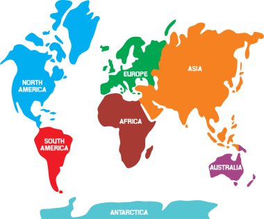
World map with continents

Highly detailed political world map with a 3D globes and navigation icons

Simple stylized world map silhouette in minimal style, vector illustration

Hand drawn World map. Isolated world map. Vector illustration

Planet Earth vector illustration from four sides. World Globe circular sequence with political map . Countries silhouettes on planet surface. Global world concept. Isolated on white background.

The Globe - World Map with continents and countries. Illustration of the earth - geographic pole, magnetic pole & axial Tilt of the Earth. Earth Temperature, Earth rotation on a white background.

World Map - Highly Detailed Vector Map of the World. Ideally for the Print Posters

Theory of flat earth. Flat Earth in space with sun and moon vs spherical earth. Vector illustration. isolated on white background.

World Map - Highly Detailed Vector Map of the World. Ideally for the Print Posters

Detailed world map with borders of states. Isolated world map on white background. Vector illustration

World Map - Highly Detailed Vector Map of the World. Ideally for the Print Posters

World Map - Highly Detailed Vector Map of the World. Ideally for the Print Posters

Climate zones map scheme. Vector illustration with equatorial, tropical, polar, subtropical, subequatorial subpolar temperate zones

Earth day. Vector background with the image of planet Earth in the form of fantastic flower

World Map - Highly Detailed Vector Map of the World. Ideally for the Print Posters

Doodle circle global america map geography vector illustration

World map and globes - highly detailed vector illustration.

High Detail World map. Vector illustration

World Map - Highly Detailed Vector Map of the World. Ideally for the Print Posters

Highly detailed world map with labeling. Grayscale vector illustration

Vector political world map for your designs

World Map - Highly Detailed Vector Map of the World. Ideally for the Print Posters

High Detail World map. Vector illustration

Map and flags, this illustration may be useful as designer work

Colorful world map with continents and country 's name illustration.

Antique globe icon

World Map - Highly Detailed Vector Map of the World. Ideally for the Print Posters

Vector World Map with state name labels. Blue land with black text on white background. Hand drawn simplified illustration.

World map school supply icon

World Map and navigation icons. Flat style.

World globe on stand line icon for web, mobile and infographics. Vector dark grey icon isolated on light grey background

World Map - Highly Detailed Vector Map of the World. Ideally for the Print Posters
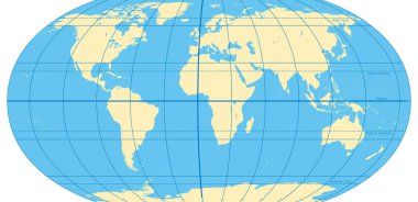
World map with most important circles of latitudes and longitudes, showing Equator, Greenwich meridian, Arctic and Antarctic Circle, Tropic of Cancer and Capricorn. English. Illustration. Vector.

Map of peace, this illustration may be useful as designer work

Vector illustration

Outline maps of the countries

Vector world map with labels of sovereign countries and larger dependent territories. Every state is a group of objects in grey color without borders. South Sudan included

Red grunge continent America logo on a white background. Vector illustration

Vector illustration

Blue vector world map complete with all countries and capital cities names.

Planet earth on a white background. Geography. Vector illustration

Map of the World and Flags - Highly Detailed Vector illustration

Colorful vector world map complete with all countries and capital cities names.

Earth's magnetic (geomagnetic) field. The magnetosphere shields the surface of the Earth from the charged particles of the solar wind and is generated by electric currents located in different parts of the Earth. Vector diagram for educational, and s
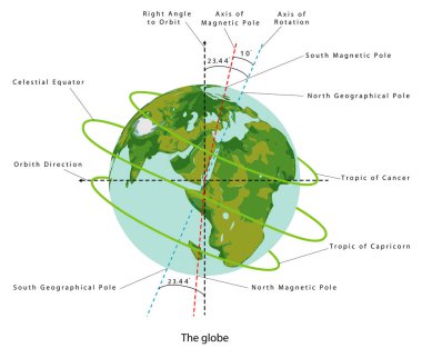
The Tilt of Earth. Axial Tilt of the Earth. Earth planet globe. Color illustration on a white background. Earth Temperature Magnetic pole, Earth rotation