Description:
The Greater Metropolitan Area SVG vector illustrates the detailed outline of a metropolitan region, showcasing its key features, boundaries, and significant landmarks. Available in SVG format, this clipart is designed for versatility in various design applications. The image presents clear lines and defined edges, making it suitable for both digital and print use. With its scalable nature, the vector can be resized without loss of quality, ensuring precision in graphic projects. This design serves as a valuable resource for urban planners, educators, and graphic designers. It encapsulates urban geography in a clean, organized style, making it easy to understand and utilize. The SVG format allows for easy integration into various design software, enhancing user experience.
Usage ideas:
This SVG clipart of the Greater Metropolitan Area can be effectively used in a range of commercial and educational applications. For instance, urban planners can incorporate this vector into presentations to illustrate city layouts or demographic data. Educators can use the image in lesson plans to teach students about urban development and geography. Additionally, graphic designers can utilize the clipart for creating posters, brochures, or maps, enhancing visual interest in marketing materials for real estate and tourism. Businesses can also leverage this vector in digital apps or websites aimed at local services or events, creating an engaging visual narrative.
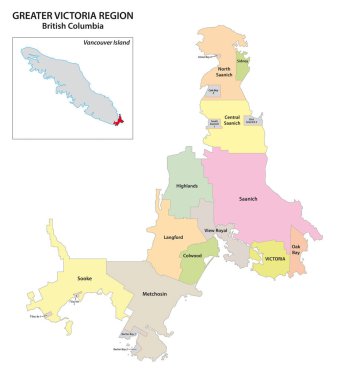
Administrative map of the greater Victoria region, Vancouver Island, British Columbia, Canada

Administrative and political map of the greater Rio de Janeiro, Brazil

Bilbao metropolitan area administrative and political vector map

Map of the greater st. louis area in illinois and missouri usa

Toronto, Ontario (Canada) street network vector map

Toronto, Ontario (Canada) street network vector map

Vector neighborhood map of the Canadian city of Toronto

Toronto, Ontario (Canada) street network vector map
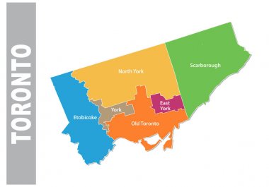
Colorful toronto administrative and political vector map

World Capital Solid vector illustration.

A map of the Sao Paulo metropolitan region with municipalities borders and labels, Brazil

Main road and administrative map of Greater Rio de Janeiro, Brazil

Map of the Golden Horseshoe metropolitan area around the western end of Lake Ontario, Ontario, Canada
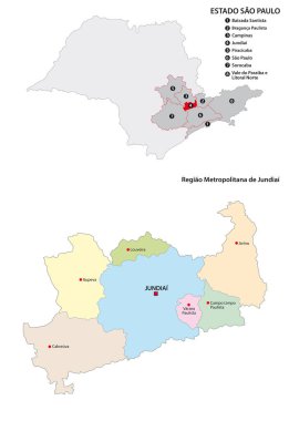
Metropolitan Region of Jundiai administrative vector map, Brazil
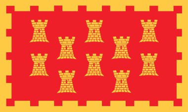
Great Manchester flag illustration isolated. North West England area, United Kingdom. British territory. Administrative division of Great Britain.

The Rio de Janeiro Metropolitan Region map with labels

Toronto, Ontario (Canada) street network vector map

The Recife metropolitan region isolated map with labels, Pernambuco State, Brazil
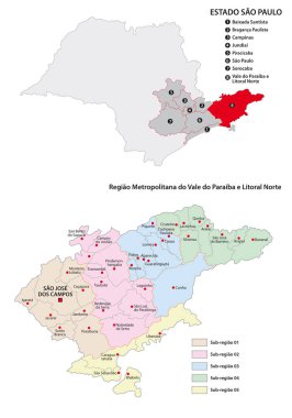
Metropolitan Region vector map
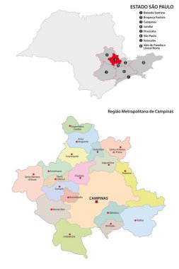
Metropolitan Region of Campinas administrative vector map

Metro Manila administrative, political and road map, Philippines
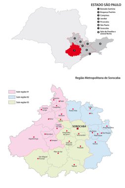
Metropolitan Region of Sorocaba administrative vector map

A map of the Sao Paulo metropolitan region with municipalities borders, Brazil

Metropolitan Region of Baixada Santista administrative vector map, Brazil
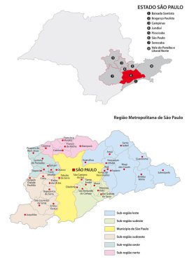
Sao Paulo metropolitan area administrative vector map

Aglomeracao Urbana de Piracicaba administrative vector map

High Quality map of Metropolitan Manila is a region of Philippines, with borders of the provinces

Urban Poznan map. Map of Poznan, Poland borders. City poster with streets and Warta River. Light stroke version on dark background.

Essex, Gateshead, Gloucestershire, Greater London outline maps