
3d map of Brazil with borders of regions

Brazil 3d map with borders of regions. Vector illustration

Brazil country silhouette. High detailed map. Solid grey vector illustration isolated on white background.
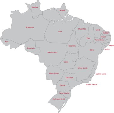
Grey Brazil map with states

Political map of Americas in grey on white background. North and South America with country labels. Simple flat vector illustration.

Map of Pernambuco in Brazil

Grey map of South America with countries borders

Map of Rio de Janeiro in Brazil

Accurate map of Brazil

Map of Sao Paulo in Brazil

Map of Rio de Janeiro in Brazil

The Minas Gerais State silhouette map and its location in Brazil
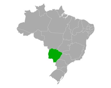
Map of Mato Grosso do Sul in Brazil

Map of Goias in Brazil

Map of Bahia in Brazil

Map of Mato Grosso do Sul in Brazil

Map of Piaui in Brazil

The grayscale map of South America isolated on white background

Map of Minas gerais in Brazil

Map of South America with indication of Argentina
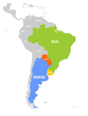
Map of MERCOSUR countires. South american trade association. Highlighted member states Brazil, Paraguay, Uruguay and Argetina. Since December 2016.

Illustration of a gray South america map on white background

Map of Para in Brazil

Sao Paulo Brazil Map black inverted silhouette

Political map of South America. Simple flat vector map with country name labels in grey.

Very simplified infographical political map of South America in grey colors. Simple geometric vector illustration.

Map of South America with indication of Peru

Map of South America with indication of Ecuador

Map of South America with indication of Brazil

Map of MERCOSUR countires. South american trade association. Orange highlighted member states Brazil, Paraguay, Uruguay and Argetina. Since December 2016.

Gray political map of Brazil. Administrative divisions - states. Simple flat vector map with labels.

Map pointers with flag and 3D effect on grey background - Brazil

Map of South America with indication of Bolivia

Vector map of Brazil with regions or states and administrative divisions. Editable and clearly labeled layers.

Territory of South America continent. White background

Grey South America map with countries and capital cities

Map of MERCOSUR countires. South american trade association. Blue highlighted member states Brazil, Paraguay, Uruguay and Argetina. Since December 2016.

Rio de Janeiro State silhouette and its location in Brazil map

Map of Goias State for social purposes. Vector demographics mosaic. Mosaic map of Goias State created of social pictograms. Demographic scheme in dark gray color tinges.

Map of Rio Grande do Sul State for demographics projects. Vector demographics collage. Composition map of Rio Grande do Sul State composed of human items. Demographic scheme in dark grey color tints.

Accurate map of Bahia

World map with highlighted member countries of BRICS - association of five major emerging national economies - Brazil, Russia, India, China and South Africa.

Map of Rio Grande do Norte

Map of Mato Grosso do Sul

World map with highlighted member countries of BRICS - association of five major emerging national economies - Brazil, Russia, India, China and South Africa.

Accurate map of Ceara

World Map - Highly Detailed Vector Map of the World. Ideally for the Print Posters

World Map - Highly Detailed Vector Map of the World. Ideally for the Print Posters

Accurate map of Goias

Map of Sao Paulo

World Map - Highly Detailed Vector Map of the World. Ideally for the Print Posters

Map of Rio Grande do Sul

Accurate map of Alagoas

Map of Minas Gerais

Map of Santa Catarina

Map of Minas Gerais

Map of Minas Gerais

Accurate map of Goias

Map of Espirito Santo

Map of Rio de Janeiro

Map of Sao Paulo

Map of Santa Catarina

Map of Rio de Janeiro

Map of Mato Grosso

Map of Sao Paulo

Brazil map with Brazil flag inside and ribbon

Accurate map of Brazil

Map of the Brazil in gray on a white background

Map of the world with indication of Brazil

Transparent - High Detailed Grey Map of Brazil. Vector eps10.

Brazil marked by blue in grey World political map. Vector illustration.

Brazil map in gray on a black background 3d

World map vector isolated on white background
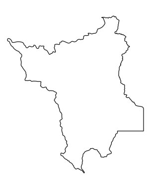
Accurate map of Roraima

Accurate map of Alagoas

Accurate map of Brazil

Vector illustration of grey Brazil map. Vector Brazil map. .

South America Detailed Physical Map with global relief, lakes and rivers. Highly detailed vector map.

Transparent - High Detailed Grey Map of South America. Vector Eps 10.

White map of South America

Map of South America with indication of Chile

Brazil map with borders, cities, capital and administrative divisions. Infographic vector map. Editable layers clearly labeled.

Accurate map of Bahia

The Sao Paulo State map and its location in Brazil

Accurate map of Paraiba

Accurate map of Paraiba

Political map of Americas in four shades of grey on white background. North and South America with country labels. Simple flat vector illustration.

Map of Mato Grosso in Brazil

Map of Rio Grande do Norte

Map of Pernambuco State collage designed with spheric dots and subtracted shape. Vector map of Pernambuco State mosaic of spheric blots in variable sizes and gray color tones.
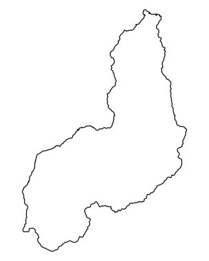
Accurate map of Piaui

Brazil map illustration vector detailed Brazil map with all states
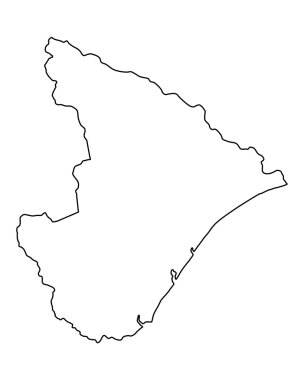
Accurate map of Sergipe

Map of Rio Grande do Sul

Gray political map of Brazil. Administrative divisions - states. Simple flat vector map with labels.

Accurate map of Maranhao

Accurate map of Rondonia

Accurate map of Alagoas

Map of South America with indication of Colombia

High quality map of Brazil with borders of the regions on white backgroun