Gujarat India Map black inverted silhouette

Gandhinagar District Highlighted on Gujarat State Map, India

Morbi District Highlighted on Gujarat State Map, India

Gujarat blank detailed outline map set

Daman and Diu, Delhi, Goa, Gujarat outline maps

Easy to edit vector illustration of Physical Map of India with different state

Outline map of the Republic India with the borders of the states and Union Territories, includes the new state Telangana

India country detailed editable map with regions cities and towns, roads and railways, geographic sites. Vector EPS-10 file

Easy to edit vector illustration of Nuclear Plant Map Of India

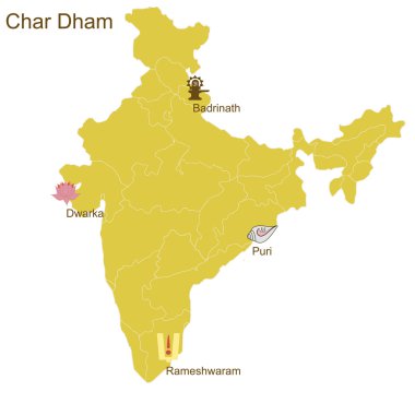
Char Dham, four most important Hindu pilgrimage places - Badrinath in North, Puri in East, Rameshwaram in South and Dwarka in West - on the map of India

Mosaic Gujarat State map of heart hearts in red color isolated on a white background. Regular red heart pattern in shape of Gujarat State map. Abstract design for Valentine illustrations.