
Azores islands hyghly detailed physical map
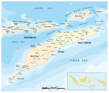
Map of Timor Island, East Timor and Indonesia
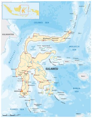
Vector road map of the Greater Sunda Island Sulawesi, Indonesia
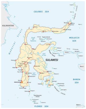
Vector roads map of indonesian island sulawesi
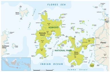
Detailed map of Komodo National Park, East Nusa Tenggara, Indonesia
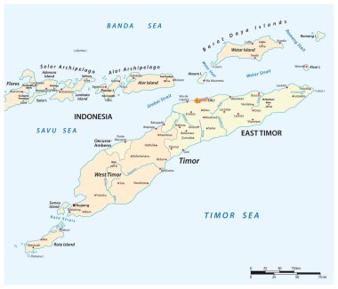
Map of Timor Island, East Timor and Indonesia
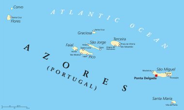
Azores Political Map with administrative capital Ponta Delgada. Autonomous region of Portugal composed of nine volcanic islands. English labeling and scaling.
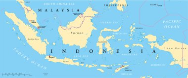
Political map of Malaysia and Indonesia with capitals Kuala Lumpur and Jakarta, with national borders and lakes. Vector illustration with English labeling and scaling.

Azores islands, Portugal, detailed editable map with cities and towns, roads and railways. Vector EPS-10 file

Administrative vector map of the Portuguese archipelago Azores in the Atlantic Ocean, Portugal

Map of the Lesser Sunda Islands in the Malay Archipelago

Vector map of the portuguese archipelago Azores in the Atlantic ocean with flag, Portugal

Map of indonesian island sulawesi

Lombok island map illustration hand drawn isolated vector

Lombok island map illustration hand drawn outline vector

Lombok island map illustration hand drawn isolated vector

Lombok island map illustration hand drawn outline vector

Lombok island map illustration hand drawn outline vector
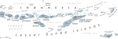
Lesser Sunda Islands, Indonesia, gray political map. Nusa Tenggara Islands, archipelago in Southeast Asia. Part of volcanic Sunda Arc. Bali, Lombok, Sumbawa, Sumba, Flores, Timor and smaller islands.

Lombok island map illustration hand drawn isolated vector